

Bobcat Trail.
Bobcat Trail is a 0.1-mile connector within the Paul Smith's VIC trail network, short enough to link two larger routes in a matter of minutes. At this length, it's more functional junction than destination—a quick transition between points rather than a hike in its own right. Useful for loop-building or cutting distance on longer outings through the VIC system.
- Leg-stretcherShort and nearly flat — an hour or less
- Peak foliage window — color starts up high and works down the valleys through mid-October.
Seasonal pattern for this trail · tops out ~1,713 ft · live closures appear above
- Nordic (groomed)Ski
- PaulSmithVICNetwork
Read the line before you walk it.
What the trailhead is doing today.
Where the hike begins.
What the route itself carries.
Summits reached, waters touched, and the lean-tos along the way — read it like a cue sheet, mile posts ascending.
Guides, outfitters & shuttles.
If you’re already out here.
Saranac Lake.
The corner of the Park this trail calls home — its hamlets, waters, lodging, and the rest of its field record.
Read the Region→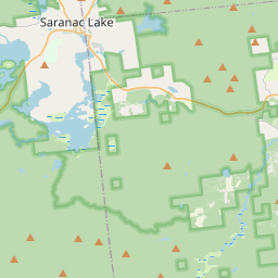
Make a weekend of it.
Closest editorial picks for a meal, a scoop, a pint, a bed, and a sight worth your time.
Eat.
4- Hohmeyer's Adirondack Alps Restaurant5.4 mi
A family-owned restaurant in the Adirondacks offering seasonal, 100-mile-focused fusion cuisine, a 1920s Speakeasy, and a hidden Beer and Wine Cellar.
- Our Plates10.0 mi
Our Plates offers Caribbean and Southern-inspired cuisine for pickup at 7 Broadway. Enjoy dishes like Empanadas Locas, Dominican Chimi Burgers, Bistec Encebollado, and Tres Leches cake.
- Red Fox10.0 mi
The Red Fox Restaurant is a longtime Saranac Lake landmark known for its Steak, Seafood, and Italian dishes, offered in a spacious Adirondack-style setting.
- China Jade10.0 mi
A long-running Chinese restaurant on Saranac Lake's Main Street, doing classic American-Chinese standards for dine-in and takeout, Tuesday through Saturday.
Sip.
4- Saranac Juice9.4 mi
Cold-pressed juices, cleanses, protein elixirs, and nut mylks from Saranac River Ranch in Bloomingdale, made from organic produce grown on the farm or sourced from local Adirondack growers.
- Nori's Village Market9.9 mi
Nori's Village Market and Riverside Cafe offers a market with organic and local produce, bulk foods, coffee, and teas, alongside a cafe serving natural, vegetarian, vegan, gluten-free, and local meat options.
- Origin Coffee10.0 mi
Origin Coffee Co is a specialty coffee shop with locations in Lake Placid and Saranac Lake serving a chef-driven breakfast and lunch menu.
- Blue Moon10.0 mi
Blue Moon Café in Saranac Lake offers dine-in, pick-up, and curbside delivery services. Guests can enjoy weekly specials, restaurant menus, baked goods, coffee, grocery items, and adult beverages.
Sweet.
4- Mark Twain Maple Works9.6 mi
Mark Twain Maple Works produces New York State maple syrup on the shore of Saranac Lake in the Adirondack Park. They have been making syrup since 2013, expanding their operation and offering various grades.
- Mountain Mist Custard10.9 mi
A summer fixture on the shore of Lake Flower in Saranac Lake, with picnic tables and a dock you can tie a boat to. Frozen custard and soft serve with weekly-rotating flavors, shakes, and sundaes.
- Donnelly's Soft Ice Cream12.7 mi
A fourth-generation Saranac Lake institution on a former dairy farm, serving exactly one rotating soft-serve flavor each day — twisted with vanilla on the same 1953 machine. Cash only; check the daily flavor. Memorial Day to Labor Day.
- Emma's Lake Placid Creamery17.5 mi
A 1950s-themed creamery in the heart of walkable Lake Placid, famous for its Maple Creme soft serve alongside 16 hard flavors, gelato, sorbet, and old-fashioned malts. The reliable apres-hike treat.
Drink.
4- The 1892 Bar & Grille5.3 mi
The 1892 Bar & Grille is a locally owned rustic bar and restaurant in Lake Clear, NY, offering homemade food. Recently under new ownership, it brings fresh energy and an updated menu to its patrons.
- Hex and Hop Brewing8.7 mi
Hex and Hop Brewing is a craft brewery and meadery in Bloomingdale, New York, making full-flavored, locally sourced beer and mead. They prioritize community and craft, using fresh, local ingredients.
- Bitters & Bones9.8 mi
Saranac Lake's only downtown brewery, restaurant, and bar, Bitters & Bones offers craft beer brewed upstairs, fresh local cuisine for breakfast, lunch, and dinner, and craft cocktails. It features rooftop decks and unique private event spa…
- RiverTrail Beerworks9.9 mi
RiverTrail Beerworks is Saranac Lake’s only riverfront brewpub, located on the Saranac Lake River Walk and Rail Trail. It features a heated patio, firepits, two golf simulators, and serves lunch and dinner daily with house-brewed beers and…
Stay.
4- The St. Regis Suites2.7 mi
Five well-appointed suites of various sizes, between Saranac Lake and Paul Smith's College in Gabriels, NY. Renovated by Cedar Circle LLC with green building techniques. Stays from three days to three months.
- Hohmeyer's Lake Clear Lodge & Resort5.4 mi
Wooded lakefront resort featuring homey rooms & cabins, local dining, a pub & outdoor recreation.
- Ampersand Bay Resort9.5 mi
A small lakefront resort on Lower Saranac Lake with townhomes, cabins, lakeview suites, a private beach, a marina, and an on-site restaurant and wine bar. Five minutes from downtown Saranac Lake.
- Hotel Saranac9.9 mi
Hotel Saranac — 100 Main Street, Saranac Lake. 1927-era National Register property reimagined as a modern boutique within the Hilton Curio Collection.
See.
4- White Pine Camp1.8 mi
The 1907 Great Camp on Osgood Pond that served as Calvin Coolidge's Summer White House in the summer of 1926. Seasonal guided tours, and several cottages rent by the week.
- Topridge2.7 mi
The sprawling Gilded Age estate Marjorie Merriweather Post built on Upper St. Regis Lake — later New York State's, now privately held. Best seen from the St. Regis lakes.
- THE GREAT ADIRONDACK CORN MAZE4.2 mi
The Great Adirondack Corn Maze at Tucker Farms in Gabriels offers a new maze design each year, providing a fun experience of getting lost in the cornfield.
- Adirondack Carousel9.8 mi
A community-built carousel on Depot Street in Saranac Lake, with hand-carved Adirondack animals (bear, loon, deer, otter) instead of horses. Year-round, indoors, and the best rainy-day move in town for kids under 8.
Add to the record.
Free, takes thirty seconds. Yours forever.
Every page on this site gets better when readers contribute. Mark a peak you’ve climbed, drop a photo, file a field note, or flag a correction — every addition makes the next visitor’s page better.
File a report.
Trail conditions, water level, bug pressure, blowdown. The kind of detail that helps the next person plan.
Write a field note →Spot something off?
Wrong elevation, outdated access notes, a coordinate that's drifted. We'd rather hear it than miss it.
Suggest an edit →


Frequently asked.
- How long is the Bobcat Trail?The Bobcat Trail is approximately 0.05 miles (0.1 kilometers) — a short out-and-back suitable for most fitness levels.