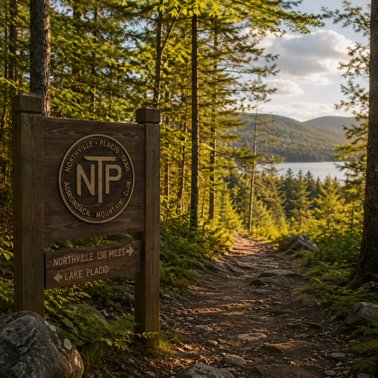
1. Why hike the NPT
The NPT is the rare long-distance trail that delivers real wilderness in long uninterrupted blocks — twenty, thirty, forty miles between road crossings — without ever leaving New York State, and without ever climbing above the conifer line.
The Adirondack Park contains some of the largest continuous tracts of designated wilderness in the eastern United States. The Northville–Lake Placid Trail threads through the heart of that wilderness — the Silver Lake Wilderness, the West Canada Lakes Wilderness, the Blue Mountain Wild Forest, and the western edge of the High Peaks Wilderness — for one hundred and thirty-four miles. It is, by most measures, the longest wilderness-immersive hike in the Northeast that doesn’t require summit weather windows or technical scrambling.
The character of the trail is consistent with the character of the Adirondacks: dense northern hardwood and spruce-fir forest, lakes everywhere, beaver dams and boggy crossings, lean-tos at regular intervals, relatively modest elevation gain compared to the Appalachian Trail through New England, and the great long quiet of a region that has been managed as forever- wild forest for a century and a half.
For most thru-hikers, the NPT is either a first long-distance trail (a manageable two-week introduction to backpacking-as-a-trip rather than backpacking-as-a- weekend) or a deliberate return — experienced AT and PCT alumni come back to the NPT for a kind of wilderness they describe as different from anything else east of the Mississippi.
This is a wilderness backpacking trip, not a hike. Eight days minimum on foot, multiple stream fords, no cell service for the majority of the corridor, real exposure to weather and water-level changes. We say so honestly because the trail is not casual. Done well — with the right preparation, the ADK guidebook, and a tested kit — it is one of the great experiences of the eastern US.
2. The trail's history
The Adirondack Mountain Club was founded in 1922 by a group of outdoorspeople, conservationists, and educators who wanted to build a hiking constituency for the Park’s forever-wild lands. The same year, the Club’s founders proposed and helped construct a long-distance trail from the village of Northville at the Park’s southern edge to Lake Placid, the hamlet that was — even then — emerging as the Park’s cultural and recreational capital.
The original route was longer than today’s, reaching ~150 miles. Over the ensuing century, sections have been rerouted (sometimes by storm damage, sometimes by reorganization of the underlying wilderness boundaries), the dam at Duck Hole was removed in 2011 with downstream rerouting consequences, and lean-tos have been added, removed, and reconfigured. The trail today is officially 134 miles (some sources cite 138 depending on which connectors are counted).
The NPT is maintained by the ADK Mountain Club’s volunteer trail crews, by NYSDEC ranger staff, and by the Lean-2 Rescue program that adopts and maintains the corridor’s lean-tos. It remains, a century after its founding, an active wilderness experience kept open by hand-tools, hand-cleared blowdowns, and the kind of institutional memory that’s rare in American outdoor recreation.
3. The interactive trail atlas
The full 134-mile route plotted by section, with every known lean-to, both termini, and the two resupply hamlets at Piseco and Long Lake. Filter the overlays in the sidebar — toggle off the lean-tos for a cleaner route view, or zoom into one section to see the shelter density. The sidebar also lists all eight sections with mileages and one-line characterizations.
- § 1Northville → Upper Benson → Whitehouse12 mi
Gentle southern start through Sacandaga foothills and old logging country. Easy first day for shake-out.
- § 2Whitehouse → West Stony Creek → Piseco16 mi
Climbs through the West Stony Creek drainage to the first major resupply at Piseco — the village on Piseco Lake.
- § 3Piseco → Spruce Lake → Cedar Lakes24 mi
The wildest stretch on the trail. Spruce Lake, the West Canada Lakes Wilderness, Cedar Lakes. Two-night minimum.
- § 4Cedar Lakes → Stephens Pond18 mi
Crosses the Cedar River and follows old roads through the central wilderness toward Stephens Pond.
- § 5Stephens Pond → Long Lake14 mi
Drops down through Lake Durant State Park toward Long Lake village — the second major resupply point.
- § 6Long Lake → Plumley's → Cold River22 mi
Follows the Long Lake shoreline north past Plumley's Landing, then climbs into the Cold River wilderness corridor.
- § 7Cold River → Duck Hole15 mi
Through the deepest stretch of Adirondack wilderness — the Cold River Lean-tos at Seward, Ouluska Pass, and the Number Four. Duck Hole at the end.
- § 8Duck Hole → Lake Placid (Averyville Road)15 mi
Final stretch — climbs out of Duck Hole through Moose Pond, Wanika Falls, and into the Averyville Road trailhead just outside Lake Placid village.
Schematic — approximate route centerline for orientation and section-level planning. NPT navigation requires the ADK Mountain Club’s official guidebook, current DEC topo maps, and a compass. Do not use this atlas as a navigational source.
4. North-to-south or south-to-north?
Most thru-hikers walk the NPT south-to-north— starting at Northville, finishing at Lake Placid. There are real reasons either way. Pick by which finish you want, what kind of food & lodging you want at the end, and the season.
Going south-to-north (Northville → Lake Placid)
- Builds toward the High Peaks. The Cold River corridor and the climb out at Wanika Falls deliver the most dramatic scenery near the end. Saves the best for last.
- Finishes in a real town. Lake Placid has hot showers, restaurants, breweries, and a hostel + lodging spectrum. Northville is a small village without the same wind-down infrastructure.
- Resupply rhythm is friendlier. First resupply at Piseco is 28 miles in (manageable starting load). Second at Long Lake is at the rough midpoint.
- Trail gets harder, then easier. The middle section (West Canada Lakes / Cedar Lakes) is the most remote. By the time you reach the High Peaks edge you've earned the views.
Going north-to-south (Lake Placid → Northville)
- Drier early, wetter late. The Cold River and Duck Hole crossings have more reliable water early in summer when snowmelt is finishing. Going north-to-south puts the wet stuff first.
- Decompression ending. Finishing at a small southern village rather than the bustle of Lake Placid suits some hikers' preferred reentry.
- Easier closer to the highway corridor. The southern end is closer to the Northway and Capital Region — quicker pickup home for downstate New Yorkers.
Either direction works. Our recommendation: south-to-north for first-time NPT thru-hikers. The build-to-Lake-Placid arc is editorial pleasure, the resupply spacing is easier, and the trail town at the end gives a real finish-line feeling.
5. The eight sections
The trail breaks naturally into eight sections at logical resupply points, road crossings, and major waypoints. Mileages below are approximate; the ADK guidebook has them to the tenth.
| § | Section | Miles | Character |
|---|---|---|---|
| 1 | Northville → Whitehouse | 12 mi | Gentle southern start through Sacandaga foothills. The southern terminus marker is in the village; the actual woods entry is at Upper Benson a few miles north. |
| 2 | Whitehouse → Piseco | 16 mi | Climbs through the West Stony Creek drainage. Ends at Piseco — the first resupply, ~28 mi in. Plan to spend a night before or after Piseco in town if pace permits. |
| 3 | Piseco → Cedar Lakes (via Spruce Lake) | 24 mi | The wildest stretch on the trail. Through the West Canada Lakes Wilderness — Spruce Lake, the West Canada Lake area, the Cedar Lakes. Two nights typical. No road access between Piseco and Long Lake (40+ miles). |
| 4 | Cedar Lakes → Stephens Pond | 18 mi | Crosses the Cedar River and follows old logging roads through the central Park. Wakely Pond and Stephens Pond lean-tos along the way. |
| 5 | Stephens Pond → Long Lake | 14 mi | Drops down toward the Long Lake village — second major resupply, real food, hot meals at Hoss's Country Corner. |
| 6 | Long Lake → Cold River | 22 mi | Up the Long Lake shoreline past Plumley's Landing, then climbs into the Cold River wilderness corridor. The character shifts here — deeper forest, fewer hikers. |
| 7 | Cold River → Duck Hole | 15 mi | The Cold River lean-tos — Seward, Ouluska Pass, Number Four — and the trail's most remote stretch. Duck Hole, where the dam was removed in 2011, marks the end. |
| 8 | Duck Hole → Lake Placid (Averyville Road) | 15 mi | Climbs out of Duck Hole through Moose Pond and Wanika Falls, then a long descent through the High Peaks foothills to the Averyville Road trailhead. Walk-in distance to Lake Placid village from there. |
6. Lean-tos & shelter strategy
The Adirondack lean-to is one of the great institutions of eastern American backpacking — a three-sided log shelter with a sloped roof, a wooden floor, and an open front facing a fire ring. They sleep six to eight on the floor. They’re free, first-come-first-served, and there are seventeen-plus along the NPT corridor.
How the system works
- First-come, first-served. No reservations on NPT lean-tos. Most thru-hikers plan for the most likely lean-to each night but always carry a tent as backup.
- Sharing is normal. If a lean-to has six floor-spots and four hikers are there, two more are expected to fit in. Bring an open mind.
- Carry a tent. Lean-tos can be full, occupied by the wrong vibe, or — rarely — out of service. A small backpacking tent is essential insurance.
- Pack out everything. Including ash from the fire ring if you've burned anything in it. The NPT has held up over a century because backpackers leave the lean-tos cleaner than they found them.
The big clusters
Several stretches of the NPT have dense lean-to clusters — convenient for thru-hikers with flexible pace. Notable ones: Spruce Lake (two lean-tos within walking distance), the Cedar Lakes (two), the Cold River corridor(Seward, Ouluska Pass, Number Four — all within a day’s walk of each other). The map above plots them all.
DEC requires bear-resistant food canisters in the Eastern High Peaks Wilderness (April through November). The northernmost ~15 miles of the NPT — from Duck Hole north — falls in this zone. Most thru-hikers carry a bear can the entire trip rather than try to receive one at a resupply. Plan accordingly.
7. Resupply — Piseco and Long Lake
Piseco (Section 2 end · ~28 mi in)
The village of Piseco on Piseco Lake is the first major resupply on a south-to-north thru-hike. A small village by any measure — general store, post office, motel and B&B options, a couple of restaurants. Sufficient for a resupply, hot meal, and an off-trail night if you want one.
- Mail-drop friendly. The Piseco P.O. holds general-delivery packages. Send yourself a resupply box from home two weeks before the trip; address to General Delivery, Piseco NY 12139.
- Shop at the General Store. Backpacker-friendly stock. Don't expect specialty items (no freeze-dried meals); do expect crackers, instant oatmeal, peanut butter, tortillas, hot dogs, and the things hungry hikers actually eat after a hot day.
- Lodging if you need it. Several small motels and B&Bs in town. A real bed and a hot shower at the 28-mile mark sets up the harder Spruce Lake stretch ahead.
Long Lake (Section 5 end · ~84 mi in)
Long Lake is the cultural heart of the NPT thru-hike — for good reason. The village sits at roughly the midpoint, the trail comes down through it, and Hoss’s Country Corner at the village center is the legendary thru-hiker outfitter + general store + ice-cream stop. Hoss’s holds mail-drop packages, sells gear and food, and the owners’ institutional NPT knowledge is part of the trail’s lore.
- Restaurants are real. Multiple sit-down restaurants in town. The Adirondack Hotel veranda has been a thru-hiker's first burger for generations.
- Take a zero day. Most thru-hikers take a rest day in Long Lake. Hot showers, real food, laundry, regroup for the second half. The trail's culture supports it.
- Mail-drop to Hoss's. Hoss's Country Corner holds packages for thru-hikers. Address to Hoss's Country Corner, Long Lake NY 12847, with your name + estimated arrival date.
8. When to hike
The NPT season runs roughly late June through early October, with shoulder windows on either side depending on the year.
Late June — early July
Snow is gone from the corridor (the NPT stays below treeline so it clears earlier than the High Peaks). Stream crossings are at their peak — wet feet guaranteed at several fords. Black fly season is at its peak Mother’s Day through late June; if you can’t start in earnest until after black flies subside, mid-July is the better window. Bring head nets.
Mid-July — late August (peak)
The classic NPT thru-hike window. Stream crossings have dropped to wadable levels. Black flies are mostly done; mosquitoes and deer flies persist but are manageable. Trail conditions are typically dry. Weather is the most predictable. Lean-tos are at their busiest — start early each morning to claim a spot.
September — early October (foliage)
The connoisseur’s NPT season. Bugs are gone. Foliage windows peak through the corridor September 25 to October 10 (varies by year and section). Crowds thin. The risk: an early cold snap or early snow can hit at higher elevations near the Cold River by late September; carry warm layers and check the forecast closer to your start date.
May is mud season; many of the wetter sections are essentially impassable. Late October to early November has nighttime temperatures below freezing — possible but cold-weather-camping skills required. After hunting season (typically mid-November in the relevant DEC units), winter conditions set in and the trail becomes an entirely different undertaking.
9. Getting to the termini
South terminus — Northville
Northville sits at the southern edge of the Adirondack Park, off Route 30, about an hour’s drive north of Saratoga Springs and Albany. The historic NPT southern terminus marker is in the village; the actual trail entry is at Upper Benson, a few miles north — most hikers either get dropped off at Upper Benson directly or walk the road miles as section one.
- Drive in. Northville is approachable from the Northway (I-87 Exit 27 then west) or via Route 30 from the south. Parking at Upper Benson trailhead.
- Shuttle services. A few small ADK-area shuttle services run point-to-point thru-hiker drop-offs. Coordinate with your finish-line ride.
- Train + ride. Amtrak Adirondack to Saratoga Springs, then car-pool / shuttle from there. ~1 hour drive Saratoga → Northville.
North terminus — Averyville Road, Lake Placid
The NPT’s northern trailhead is on Averyville Road just outside Lake Placid village — walking distance into town for celebration meal, hot shower, lodging. Lake Placid is accessible via Amtrak from NYC (to Westport, then ride ~45 minutes) or by car via I-87 Exit 30 then Route 73.
- Plan the pickup. If you're car-pooling or have someone meeting you, schedule a 24-hour window — pace varies, weather variables compound, and a finish-day rescue is no fun.
- Lodging in Lake Placid. Hostel options for thrifty thru-hikers; full hotel + lodge spectrum for the celebration end.
10. Gear for the ADK long-distance hiker
NPT gear is similar to any 8-to-14-day backpacking trip but with three Adirondack-specific considerations: it will rain, you will cross streams, and bugs are real.
Shelter
- Backpacking tent (lean-tos are insurance, not a plan)
- Sleeping pad — full-length, not 3/4 (ADK ground is uneven)
- 20°F-rated sleeping bag (down or synthetic — synthetic is more forgiving of moisture)
- Bivy or tarp as backup (some weight-conscious thru-hikers go tarp-only)
Food + water
- Bear canister (required Duck Hole north; carry full trip)
- Stove + fuel (canister + jet stove most common; alcohol stove banned in fire-restriction periods)
- Pot, lighter, spork
- Water filter (Sawyer Squeeze is the de facto NPT standard)
- Backup chlorine tablets
- 2L water capacity minimum (bladder + bottle works)
Clothing
- Synthetic baselayer top + bottom (cotton kills)
- Hiking pants — convertible OR shorts + rain pants
- Insulating layer (puffy or synthetic jacket)
- Rain jacket (Gore-Tex or equivalent — not a poncho)
- Trail-running shoes OR low-cut hikers (high boots overkill for ADK)
- Sock changes (synthetic; merino best)
- Camp shoes / sandals (for fords + camp)
- Head net (June + July essential)
- Sun hat + warm hat
Navigation + safety
- ADK Mountain Club NPT guidebook (the canonical paper companion)
- DEC topo maps (the relevant sheets for each section)
- Compass + the skill to use it
- Phone with offline maps (Gaia GPS, FarOut, AllTrails downloaded for offline)
- Headlamp + spare batteries
- Small first-aid kit + blister care
- Personal locator beacon or InReach (recommended for solos)
- Trip plan left with someone NOT on the trail
11. Section hiking the NPT
Most people who hike the NPT don’t thru-hike it. They section-hike — chunks of it spread across many years, weekend trips, vacations. This is a perfectly honorable way to know the trail and in some ways a richer way to see it.
The most accessible sections for weekenders
- Section 5 (Stephens Pond → Long Lake, 14 mi). Two-day weekend. Easy access at both ends (Lake Durant State Park to Long Lake village). Finishes with hot food.
- Section 4 (Cedar Lakes → Stephens Pond, 18 mi). Two- or three-day section. Wakely Pond and Stephens Pond lean-tos. Old-roads trail surface forgiving for newer backpackers.
- Section 6 (Long Lake → Cold River, 22 mi). Two- or three-day section. Up the Long Lake shoreline, into the Cold River wilderness. A real wilderness sample without the deep commitment of the West Canada Lakes.
- Section 8 (Duck Hole → Lake Placid, 15 mi). Most spectacular single section — climbs through the High Peaks edge with views. Two days. Finishes at the Averyville Road trailhead.
Section-hike strategy
Most section hikers work the trail in either direction over time, picking weekends or vacations when life permits. The corridor crosses public roads at a small number of points — Northville, Piseco, NY-30 (Long Lake), and Averyville Road — which constrain how sections can break apart for a car-based trip. A few section hikers use the New York State Department of Environmental Conservation’s general-use backcountry car-shuttle services or two-car relay to connect midpoint sections.
12. Permits, bear canisters & regulations
No permits required
The NPT does not require a permit. The Park’s wilderness areas are managed by NYSDEC under a first-come, first-served public-access model — no quota system, no permit fee, no advance reservation needed for the trail itself. Self-registration sign-in is expected at trailhead kiosks.
Bear canisters in the Eastern High Peaks
Bear-resistant canisters are required by DEC regulation in the Eastern High Peaks Wilderness from April through November. The northernmost stretch of the NPT — from Duck Hole north through the Averyville Road trailhead — passes through this zone. Most thru-hikers carry a canister the entire trip rather than try to swap or rent one mid-trail. Approved canisters include the Garcia, the BV500 (BearVault), and the Wild Ideas Bearikade.
Group size limits
DEC limits backcountry group size to 15 in total in most wilderness areas; in the Eastern High Peaks specifically, the limit is 8 for day hiking and 8 for camping. NPT thru-hikers (small groups or solo) are well within these limits.
Campfire rules
Campfires are permitted in lean-to and designated campsite fire rings only — not anywhere else along the trail. Some sections (typically the Cold River corridor during dry summers) see fire restrictions announced by DEC; check the current advisories before departure. Dead-and-down wood only; do not cut standing trees.
The NPT has held up for a century because backpackers leave the corridor cleaner than they found it. Pack out everything you bring in — including food scraps, gear, and waste. Bury human waste in a 6-8 inch cathole 200 feet from water. Stay on the trail through wet sections rather than widening the tread. The Adirondack wilderness is fragile in specific ways — a single mistake compounds over time.
13. Trail conditions & rerouting
The NPT is actively maintained, but it’s also a long wilderness corridor — beaver dams reroute streams, blowdowns close sections after big storms, and the dam-removal at Duck Hole in 2011 produced lasting changes that didn’t fully settle until the mid-2010s. Check current conditions before you start.
- DEC trail conditions. The Department's regional offices issue weekly trail-condition updates during the hiking season. Check dec.ny.gov for the relevant DEC region (5 for most of the NPT corridor).
- ADK Mountain Club updates. The Club's Information Center in Lake Placid (and the chapter network) tracks current corridor status. Call ahead.
- Adirondack Almanack trip reports. Independent NPT hiker accounts published periodically. Useful for current-season anecdata.
- Trail-register checks. Sign in at every trailhead register. Read the most recent entries — recent hiker notes are often the freshest condition reports available.
14. Notable side trips
Some thru-hikers take side-trip variants that add a day or two for substantial reward.
- Wakely Mountain firetower (Section 4, ~2 mi round trip). Short detour to the restored Wakely fire tower with one of the best views in the central Park. Worth the 90-minute side excursion.
- Tirrell Pond (Section 6). Quiet pond with good camping; some hikers take a half-day rest here rather than push through to the Cold River.
- Seward Range bushwhacks (Section 7). For experienced bushwhackers only — the Sewards are the western chain of the High Peaks, accessible by faint herd paths from the Cold River area. Not for casual hikers.
- Long Lake paddle option. Hikers who don't want to walk the long Long Lake shoreline section have historically arranged a paddle pickup at Plumley's Landing. ADK guides will arrange this — adds a paddling-day to the trip.
15. Frequently asked questions
Most thru-hikers complete the NPT in 8 to 14 days. Fast hikers do it in 7 with long days; section hikers spread it across many years. Plan 10-12 days for a comfortable first thru-hike.
134 miles is the most commonly cited official mileage. Some sources cite 138 depending on which connectors are counted. Either way, it's the longest wilderness-immersive trail in New York State.
No. Self-registration at trailhead kiosks is expected, but no permit is required and no fee is charged. Bear canisters ARE required for the northernmost stretch (Duck Hole north) per DEC regulation.
Two practical resupply points: Piseco (~28 miles in) and Long Lake (~84 miles in). Both have general stores, P.O. boxes for mail drops, and lodging. Hoss's Country Corner in Long Lake is the legendary thru-hiker stop.
Most thru-hikers go south-to-north (Northville → Lake Placid). It builds toward the dramatic Cold River and High Peaks finish, ends in a real town, and the resupply spacing works better. North-to-south has its own merits but is less common.
Mid-July through August is the classic window — bugs subsided, streams down to wadable levels, weather predictable. September is the connoisseur's season (foliage + no bugs) but watch for early cold snaps in the Cold River area. Avoid May (mud) and late November onward (winter conditions).
Black bears are present throughout the corridor. The Eastern High Peaks (Duck Hole north) requires a bear canister by DEC regulation; most thru-hikers carry one the entire trail. Keep a clean camp, don't leave food unsecured, and you'll be fine.
Drive: Northway I-87 Exit 27 then west to Northville (~1 hour from Saratoga). The actual trail entry is at Upper Benson a few miles north of the village. Rail: Amtrak Adirondack to Saratoga Springs, then car-pool/shuttle the last hour.
The Averyville Road trailhead is on the outskirts of Lake Placid village — walking distance into town. Drive via I-87 Exit 30 then Route 73 (~2.5 hours from Albany). Rail: Amtrak Adirondack to Westport, then 45-minute drive.
Not as a single hike. As section hikes, yes — many people day-hike individual sections (especially Section 5 between Stephens Pond and Long Lake, or Section 8 finishing at Lake Placid). The full corridor requires multi-day backpacking by definition.
Bear canister (required by DEC north of Duck Hole). Head net (June-July). Water filter is essential — you'll filter many liters per day. Lightweight tent as lean-to insurance. The ADK Mountain Club NPT guidebook is the canonical paper companion.
Yes — abundantly. The NPT crosses streams, ponds, and lakes regularly. You'll never carry more than 2L between filter stops in normal conditions. In late-summer drought years, the higher Cold River stretches can have spaced-out sources; carry a bit more there.
No, for the majority of the corridor. Brief signal near Piseco and Long Lake; nothing useful in the deep wilderness stretches. Download offline maps and carry a personal locator beacon or InReach if you're solo.
Leave your route + dates + expected finish with someone NOT on the trip. Sign in at every trailhead register. If you have an InReach or similar, check in nightly. DEC rangers will look for overdue hikers but they rely on someone reporting you missing first.
Sources & further reading
This guide is editorial — the NPT is a real wilderness backpacking trip and not a substitute for the ADK Mountain Club’s official guidebook, current DEC topo maps, or the kind of backcountry skill set that keeps backpackers safe. Plan well, hike honestly, leave no trace.


