What the 46er challenge really is.
The Adirondack 46er challenge is to summit the original list of 46 High Peaks recognized by the Adirondack Forty-Sixers. Four of those original peaks are now known to be below 4,000 feet, but they still count because the challenge is based on the historic list, not a revised one.
The smartest way to think about the challenge is not as 46 isolated hikes. It is a progression. You are developing mountain fitness, descent durability, alpine judgment, navigation skills, weather discipline, and the ability to execute long, remote days without rushing.
Most hikers take three to seven years to finish. Some do it in a single calendar year (the “single-season finish” — a real undertaking but increasingly common). A few do it in a single calendar season. None of those paths is more correct than another. What matters is finishing well, with the judgment and the experience to make the last few peaks safer than the first few.
The mistake beginners make.
Most new hikers sort the peaks by elevation and assume the highest ones are automatically the hardest. In the Adirondacks, that is often wrong. Mileage, mud, route-finding, relentless re-climbs, stream crossings, and remote herd paths often matter more than absolute elevation.
That is why peaks like Allen, Couchsachraga, the Sewards, and Cliff/Redfield often feel harder than taller peaks that have clean, well-traveled routes.
The other common mistake: starting with a peak that’s too hard. Doing Algonquin as your first 46er is technically possible but commonly ends in a slow, miserable descent that turns hikers off the entire challenge. Cascade and Porter exist for a reason. Use them.
The right way to progress.
- Build a base. on shorter, marked peaks with big reward: Cascade, Porter, Phelps, Big Slide, Wright, Giant.
- Learn how interior mileage changes pace. Tabletop, Street/Nye, Algonquin, Colden, Marcy.
- Graduate to combo and ridge days. Dial/Nippletop, Colvin/Blake, Wolfjaws/Armstrong, Gray/Skylight, Gothics.
- Move into remote or trailless terrain. Marshall, Cliff/Redfield, Santanonis, Seymour — only after long descents and route management feel comfortable.
- Save the notorious finishers for late. Allen, Couchsachraga, Sewards, full Dix Range, Basin/Saddleback/Haystack — when judgment is at its best, not just excitement.
None of this is required. The 46 doesn’t issue progression instructions. But across thousands of finished rounds, this is the pattern that consistently produces the safest, most enjoyable experiences. Hikers who skip the base often pay for it on Allen or in the Sewards.
Choosing your home base.
Where you stay determines which trailheads are reasonable, how early you can leave, and how late you can return. The High Peaks region has five distinct staging areas, each with its own access logic.
The default for first-time 46ers. Walking-distance restaurants, full lodging spectrum from hostel to luxury, gear shops, hospitals, and within 20–35 minutes of nearly every primary trailhead. The Olympic Center, Mirror Lake, and Main Street all give you a real town to come back to.
A 15-minute drive from Lake Placid puts you in Keene Valley, the historic heart of Adirondack mountaineering. Closer to the Garden trailhead (Big Slide, Brothers, Johns Brook), Roostercomb, and the AMR. Quieter than Lake Placid, fewer restaurants, but better positioned for east-side climbing.
Operated by the Adirondack Mountain Club. The most authentic and trail-immediate base in the High Peaks — you walk to most trailheads from the parking lot. Lodge rooms, cabins, the Wilderness Campground, and the Heart Lake Program Center. Family-style meals included with most stays.
The Upper Works trailhead at Tahawus is the only practical southern approach to the central High Peaks. Critical for Allen, Cliff, Redfield, Marshall, and the Santanonis. Newcomb is small, with limited lodging, but the Newcomb Lake region and the historic ghost town of Adirondac are worth seeing in their own right.
The Coreys Road trailhead off Route 30 is the launch for the Seward Range (Seward, Donaldson, Emmons) and Seymour. Tupper Lake is the closest town. Most hikers come for the Sewards specifically and stay nowhere else in the region.
| Base | Best access | Lodging price | Town infrastructure |
|---|---|---|---|
| Lake Placid | Most peaks within 35 min | $$$ | Full — restaurants, gear, hospital |
| Keene Valley | Eastern peaks, AMR, Garden | $$ | Limited — small village |
| ADK Loj | Heart Lake, MacIntyre, Marcy region | $$ (with meals) | None — true backcountry base |
| Newcomb / Tahawus | Allen, Cliff, Redfield, Marshall | $ | Minimal |
| Tupper Lake / Coreys | Seward Range, Seymour | $ | Limited — small town |
Trailheads, parking, and logistics.
High Peaks parking has become genuinely hard. Most major trailheads fill before sunrise on summer weekends. The reservation systems, shuttle programs, and alternative approaches matter as much as the climbing itself.
- The AMR (Ausable Club) reservation system:
- The Adirondack Mountain Reserve operates the parking and trail access for the eastern peaks accessed via Lake Road — Colvin, Blake, Sawteeth, Lower/Upper Wolfjaw, Armstrong, Gothics, Pyramid, Dial, Nippletop, and access to Sawteeth and Indian Head. Parking is reserved in advance through the published reservation system used by US National Parks. Reservations open about a month in advance and prime weekends fill within hours. If you don’t have an AMR reservation, you don’t park there. There is no walk-up.
- The Garden parking lot (Keene Valley):
- The trailhead for Big Slide via The Brothers, Johns Brook Lodge, and the Range from the east. About 50 spaces. Fills before dawn on summer weekends. The Marcy Field park-and-ride shuttle runs in peak season — when The Garden is full, you park at Marcy Field on Route 73 and ride in.
- Adirondack Loj at Heart Lake:
- The largest dedicated trailhead parking in the High Peaks. Capacity is real but not unlimited; weekends fill by 6:30 AM in summer. There’s a daily parking fee for non-ADK members (with a discount for members). Showers, restrooms, water, and the High Peaks Information Center are all on site.
- Cascade / Pitchoff / Owl's Head (Route 73):
- Cascade has had multiple location changes due to overuse. The current trailhead is the New Cascade trailhead (formerly known as Mount Van Hoevenberg). Park at the dedicated lot; the old roadside parking is closed. This change added some mileage but reduced trail erosion and improved safety.
- Upper Works / Tahawus (Newcomb):
- Free. No reservation. Drivable for any vehicle but the road is slow. The trailhead is the gateway to Allen, Cliff, Redfield, Marshall, and the southern approach to the interior. Cell service drops on the road in. Pit toilets only, no water.
- Coreys Road (Tupper Lake area):
- Dirt road, drivable in any vehicle, slow. Trailhead for the Seward Range and Seymour. Parking is informal but adequate. Plan for very early starts.
Trail closures, parking changes, regulatory updates, and conditions advisories change frequently. The single best pre-trip habit is checking the NYSDEC Backcountry Information page and the ADK High Peaks Conditions Report the night before and the morning of every hike.
Gear: what you actually need.
A 46er round doesn’t require expensive gear. It does require correct gear. The wrong shoes will end your day faster than poor fitness. The wrong rain layer will turn a manageable summit storm into a survival situation. Here’s what genuinely matters.
The non-negotiables
Whatever you carry, these are the items that should be in your pack on every High Peaks hike, every season:
- A real rain shell:
- Hardshell, waterproof, with a hood. Not a "water-resistant" softshell. ADK weather changes fast and rain at 4,000 feet is colder than rain in town.
- Insulation layer:
- A puffy or fleece, even in summer. Summit temperatures can be 25 degrees colder than the trailhead.
- Headlamp with fresh batteries:
- Long descents in fading light are common. A phone flashlight is not a substitute.
- Real food:
- 2,500–4,000 calories for a long peak. Underfueling causes more bonking than fitness ever does.
- Real water:
- 2–3 liters minimum, more for longer days. A filter for refills on interior days.
- Map and compass — and the ability to use them:
- Phones die. Apps fail. The waterproof Trails Illustrated #742 paper map covers the entire High Peaks region.
- First aid kit:
- A small one. Add blister treatment, ibuprofen, and a chemical hand warmer.
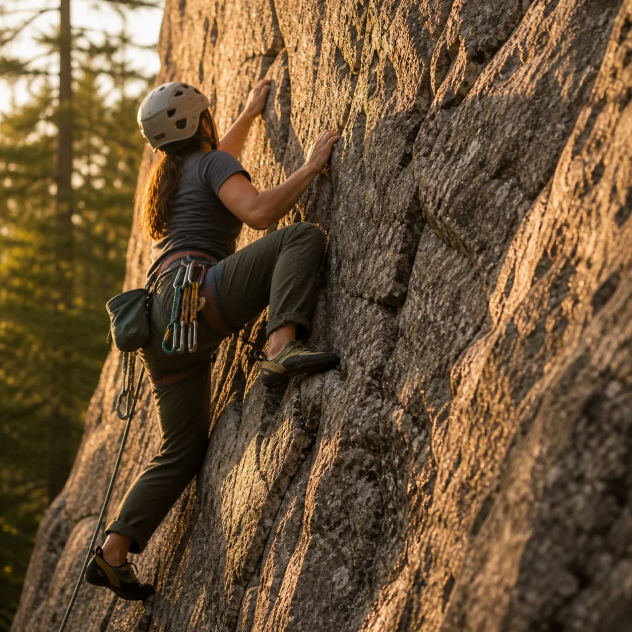
Footwear — the most consequential decision
The right shoes for the High Peaks depend on the season and the peak. Most hikers wear shoes that are too stiff and too expensive. Trail runners or low-cut hiking shoes work for the vast majority of summer 46ers. Heavy mountaineering boots are appropriate for winter and shoulder-season ice conditions, not for July on Cascade.
- Summer (June – early October):
- Trail runners or lightweight low-cut hiking shoes. Waterproof membranes are not always better; in summer, your feet are getting wet regardless and a non-breathable shoe just dries slower.
- Shoulder season (April–May, late October–November):
- Mid-cut waterproof boots with real tread. Microspikes recommended above 3,500 feet.
- Winter:
- Insulated mountaineering boots compatible with full crampons. Snowshoes required when snow is below the upper trees. Expert territory.
The pack
For a single-peak day, a 25–35 liter pack is plenty. For long combo days (Sewards, Dix Range, Santanonis), 35–45 liters gives room for more food, more water, and more layers. Frame and hipbelt matter more than capacity.
Navigation
Phone GPS apps with pre-downloaded offline maps are the standard for most hikers. They work without signal if maps are downloaded in advance. But phone batteries die fast in cold and after a long day, so a paper map is your backup, not your primary. The waterproof Trails Illustrated #742 covers the entire High Peaks region and should be in your pack on every hike.
For trailless peaks (the herd-path 46ers), download the route tracks for your specific itinerary in advance. Don’t rely on signal. The High Peaks have huge no-signal zones.
Emergency communication
Cell service in the High Peaks is patchy at best, absent at worst. For solo hikers, for trailless peaks, for shoulder season, and for any hike where you’re more than a few hours from a road, a two-way satellite communicator is genuinely a life-safety device. Press one button and a search-and-rescue call goes out via satellite from anywhere with sky visibility. Subscriptions are inexpensive. It is the single piece of gear most likely to save your life that hikers most often skip.
- Hardshell rain jacket (always)
- Insulating layer (puffy or fleece, always)
- Hat, gloves (always — even summer)
- Headlamp + spare batteries
- 2–3 liters water, more for long days
- Water filter for interior days
- 2,500–4,000 calories of food
- Paper map (Trails Illustrated #742) + compass
- Phone with offline GPS app, fully charged + battery pack
- First aid kit (small)
- Sun protection — hat, sunscreen, lip balm
- Bug protection (May–early July especially)
- Microspikes (April–May, October–November)
- Bear canister if camping in the Eastern High Peaks
- Satellite communicator — strongly recommended
- Emergency blanket / bivy
Physical & mental preparation.
High Peaks days are long. Twelve hours on your feet is normal. Sixteen-hour days happen. Fitness matters, but it’s not what most people think.
The fitness that actually matters
Not maximum heart rate. Not VO2 max. Three specific capacities determine whether you have a good day:
- Eccentric leg strength:
- The ability to descend for hours without your quads failing. Build this with downhill walking, weighted step-downs, and stair work — not just uphill cardio.
- Sustained aerobic base:
- Six to twelve hours of moving at conversational pace. Build this with long, slow distance — not interval work.
- Foot durability:
- Your feet need miles of preparation to handle the rocks, roots, and mud. Walk in your hiking shoes. Walk on uneven terrain. Build calluses where they need to form.
A simple training protocol
Six to ten weeks before your first major peak, walk three to five times per week. At least one walk per week should be 2–3 hours on hilly or trail terrain. Add a heavy backpack as you progress. The goal is not to make a peak feel easy; it is to make the descent feel manageable.
Mental preparation matters more than people admit
The hardest part of a 14-hour Sewards day is not physical. It is the moment, six hours in, when you realize you have eight more hours of moving ahead of you and you still have to climb Couchsachraga. The hikers who handle this well are not stronger; they are more patient. They have practiced moving steadily through discomfort.
Practice this on training hikes. Make yourself walk one extra mile when you’re tired. Walk in rain. Walk when your feet hurt. The reps train your mind to not panic when the day is hard. The Sewards will absolutely test this.
Good first peaks.
- Cascade / Porter:
- Best introduction to the 46ers — reasonable mileage and the reward comes quickly. Two peaks in 5–6 hours, marked the entire way, with a rocky exposed summit that feels like a real mountain.
- Phelps:
- Excellent first interior peak. You learn trail pacing without being buried by mileage. The Van Hoevenberg approach is the gateway to most other interior peaks — get to know it here.
- Big Slide:
- Beautiful next step — more climbing and more exposure. The Brothers approach gives three lesser summits as warmup with views of the Great Range. Steeper than Phelps; this is where you find out if your descent strength is real.
- Wright:
- Shorter but more alpine-feeling. Good test of how you handle open rock and weather. The summit is genuinely above treeline — your first real alpine experience.
- Giant:
- Steep and serious, but compact. Great for learning that short mileage does not mean easy. Six miles, three thousand vertical feet — it earns every inch.
The peaks that teach the most.
- Tabletop:
- A common first herd-path peak. You learn what an unmarked Adirondack trail looks like, how to follow it, and how easy it is to lose.
- Street and Nye:
- Crossings, muddy trails, and route attention. The crossing of Indian Pass Brook can be impassable in spring. The herd path teaches navigation discipline.
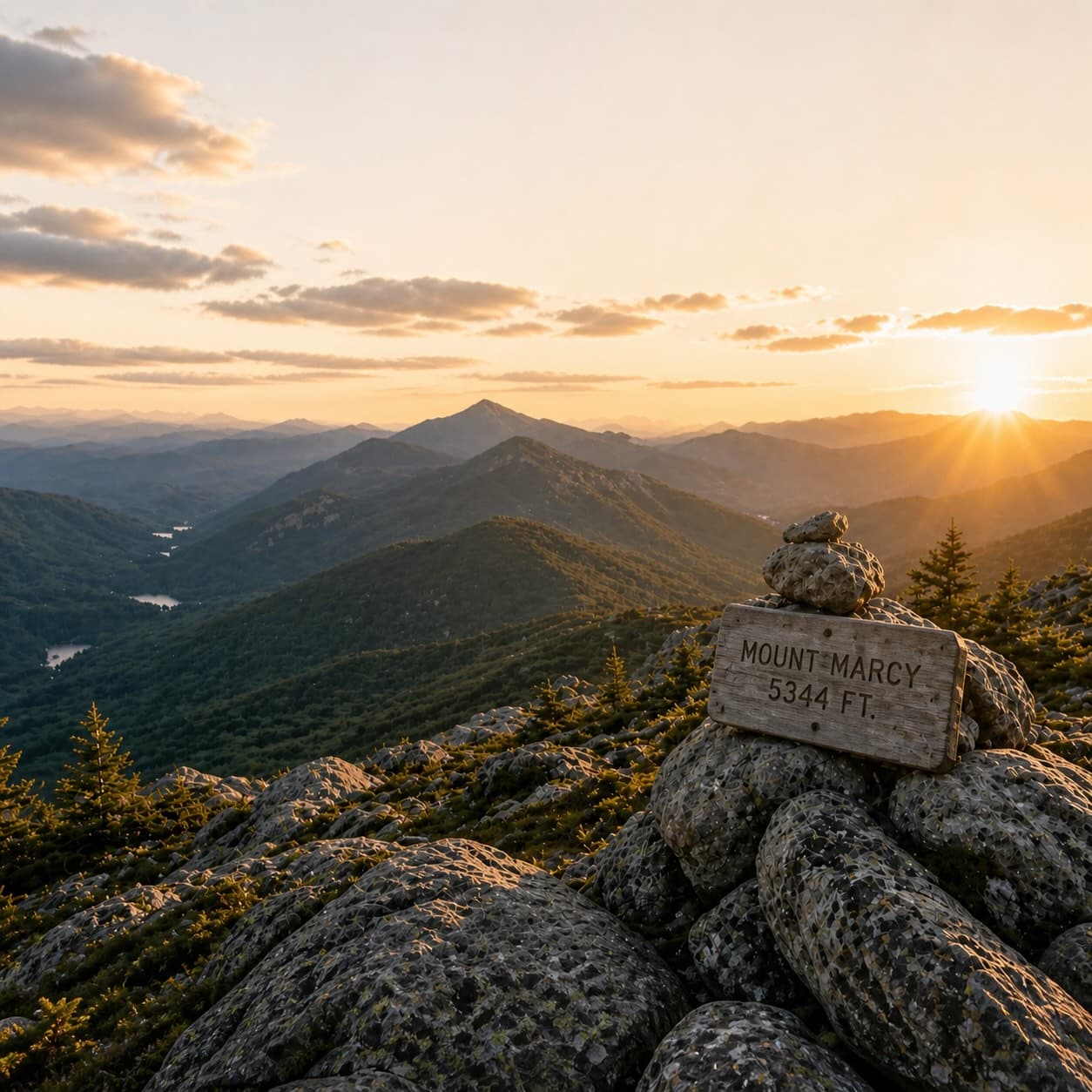
- Marcy:
- Endurance and time management. Fifteen miles, a long alpine summit ridge, weather that changes by the hour. The state's high point and the day that proves you can do real big peaks.
- Gray and Skylight:
- The long interior day and how slowly big mountain days add up. Eighteen miles to Skylight’s open summit. You learn that the real difficulty is the return — those last four miles when you’re already tired.
- Dial and Nippletop:
- Sustained ridge travel and the cost of long loops. The ridge between Dial and Nippletop teaches that “easy” terrain at hour eleven is not actually easy.
- Colvin and Blake:
- The pain of losing elevation and climbing it back. Blake is a sub-4,000-foot peak that requires a serious re-climb on the return. You don’t forget it.
- Gothics, Armstrong, and the Wolfjaws:
- Ladders, slab confidence, and Great Range-style ups and downs. This is where alpine scrambling becomes part of your skill set.
The notorious finishers.
These are not the only hard peaks, but they are the ones many hikers intentionally leave for late in the round because they combine distance, remoteness, mud, navigation, or demoralizing re-climbs:
- Allen: Long approach, red-slime descent, and an isolated feel. 18 miles round trip. The red iron-stained slabs in the upper section are genuinely dangerous when wet.
- Couchsachraga: A deep col, endless mud, and a punishing reclimb. The lowest of the 46 (3,820 feet) and somehow one of the hardest. Often saved for second-to-last.
- Seward / Donaldson / Emmons: A classic full-value range day that is long, steep, and remote. Eighteen miles, fifty-four hundred feet of gain, all on herd paths.
- Cliff / Redfield: A rough, muddy, awkward interior day. The kind of day where everything is fine except that it never seems to end.
- Haystack with Basin or Saddleback: Big effort, big exposure, and very little free elevation. The col descents and re-climbs add up.
- The full Dix Range: Huge cumulative gain and a real mountain day from start to finish. Macomb, Grace, Carson, Hough, Dix — done in one day, fifteen miles and fifty-eight hundred feet of gain.
Difficulty tiers.
This guide uses four practical tiers rather than pretending every peak can be perfectly ranked.
Common combo days.
| Combo | Why | Reality |
|---|---|---|
| Cascade + Porter | Efficient two-peak starter day | Great first combo, but still rocky and steep. |
| Street + Nye | Same approach for both peaks | Navigation and crossings can matter more than fitness. |
| Colvin + Blake | Best way to get Blake | The reclimb over Colvin on the way out is the real sting. |
| Dial + Nippletop | Natural loop | Long, sustained, and more tiring than it looks on paper. |
| Gray + Skylight | Efficient interior pairing | A long day that often feels much bigger than expected. |
| Algonquin + Iroquois | Same approach, both above treeline | Iroquois is a herd-path detour; the wind on the col can be serious. |
| Santanoni + Panther + Couchsachraga | Most common way to finish the range | Couch is usually the emotional low point. |
| Seward + Donaldson + Emmons | Standard Seward Range itinerary | One of the toughest common 46er days. |
| Macomb + Grace + Carson + Hough + Dix | Full Dix Range day | A true finish-line level outing for many hikers. |
Hiring a guide.
Hiring a licensed Adirondack guide is one of the smartest, most underused decisions in High Peaks hiking. Especially for first-timers, for trailless peaks, for winter, and for any hike where the consequences of getting it wrong are real.
When a guide is genuinely worth it
- Your first 46er:
- A guided day on Cascade or Phelps teaches pacing, navigation, and decision-making in a single day that takes months to learn alone.
- Trailless peaks:
- Allen, Cliff/Redfield, the Sewards, the Santanonis — guides know the herd paths, the river crossings, the mud routes, and the bail-out options. Hiring one for your first trailless peak is cheaper than the day you spend lost.
- Winter peaks:
- Winter hiking in the High Peaks is genuinely dangerous and a guide is often appropriate even for experienced summer hikers.
- Big combo days:
- The Dix Range, the Sewards, the Santanonis — a guide takes the navigation off your plate so you can focus on moving and managing energy.
- You're hiking solo and want backup:
- A guide is a margin of safety.
What a guide costs
Adirondack licensed guides typically charge $250–$400 per person per day, with some discount for groups. Multi-day trips run $400–$700/day. This is not cheap. It is also less than most hikers spend on gear they don’t actually need. A single guided day on a hard trailless peak can be the best money you spend on the whole 46er round.
Featured listings will be replaced with vetted Adirondack-licensed guide partners as the network is finalized.
Lodging near the High Peaks.
Where you stay is partly about price and partly about which trailheads you want to reach quickly. The best High Peaks lodging is a question of geography first, comfort second.
Best for Lake Placid–access peaks
Cascade, Porter, Phelps, Algonquin, Wright, Iroquois, Colden, Marcy, the Wolfjaws–Armstrong–Gothics range from the AMR side.
Best for ADK Loj-area peaks
Phelps, Tabletop, Marcy, Algonquin, Wright, Iroquois, Colden, Street, Nye, Marshall.
Best for Keene Valley / AMR / Garden access
Big Slide, Wolfjaws, Armstrong, Gothics, Saddleback, Basin, Haystack, Giant, Rocky Peak Ridge, Colvin/Blake, Dial/Nippletop, Sawteeth.
Venues listed are options to consider in each access cluster, not paid placements. Confirm availability and current operating details before booking.
Seasonal realities.
Spring is mud season. Higher routes can be snowy or icy long after valleys thaw, and alpine vegetation is vulnerable. The DEC and the 46ers organization actively discourage hiking the High Peaks during the worst of mud season (typically mid-April to mid-May) — both for safety and for trail erosion.
Summer is the most common 46er season, but it brings heat, thunderstorms, bugs, and crowds. Black flies are at their worst in late May and early June. Mosquitoes peak in July. Afternoon thunderstorms are routine — be off exposed summits by 1 PM in unstable weather.
Fall is spectacular but colder, darker, and more volatile than many first-timers expect. Daylight shrinks fast in October. Above 3,500 feet you can hit ice and snow as early as late September. Foliage draws crowds; trailheads fill earlier than in summer.
Winter turns every 46er into an expert objective. Snowshoes are required when snow is below the lower trees. Crampons, ice axes, and avalanche awareness are required for many peaks. Some experienced hikers find winter their favorite season; for first-timers it is genuinely dangerous.
Bear-resistant canisters are required overnight in the Eastern High Peaks Wilderness from April 1 through November 30. Rentals are available at the High Peaks Information Center at the ADK Loj. AMR/Ausable Club access requires a parking reservation in season — check NYSDEC and the Conditions Report before every trip.
Skills that matter more than people expect.
- Descending:
- Many hikers are strong uphill and fall apart on the way down. Descent is harder on knees, harder on attention, and the cause of most injuries. Practice it.
- Nutrition and hydration:
- Long Adirondack days punish under-fueling. Eat every 60–90 minutes whether you feel hungry or not. Drink before you're thirsty.
- Pacing:
- A sustainable pace beats a heroic first hour. The hikers who finish strong are the ones who go slower than they could in the first three hours.
- Feet and footwear:
- Wet rock, mud, and long descents expose bad shoe choices quickly. Break in your shoes before the trip, not on it.
- Navigation:
- Herd paths are usually followable until they suddenly are not. Know what to do when you lose the path. Don't wander; stop, mark your position, look around.
- Turnaround discipline:
- Finishing a peak is optional. Finishing the day safely is not. Set a turnaround time. Honor it. The mountain will be there next month.
Safety, emergencies, and rescue.
The High Peaks have a real search-and-rescue volume. Most rescues are not from technical accidents. They are from underestimating distance, weather, daylight, or fitness — and not having a way to call for help when things go sideways.
Before you hike: the safety basics
- Tell someone your plan:
- Trailhead, route, expected return time, when to call for help if you don't return. The single highest-leverage safety habit.
- Sign the trail register:
- At every trailhead. Search teams check these first.
- Carry a satellite communicator:
- A two-way satellite messenger with SOS function is the standard backcountry safety device. Subscription required, but it costs less per month than parking at the Loj costs per day.
- Check the conditions report:
- NYSDEC Backcountry Information and the ADK High Peaks Conditions Report. The morning of, every time.
- Know your turnaround time:
- Backed by daylight, weather, and your remaining capacity — not by ego.
What to do if you’re in trouble
If you have a satellite communicator: press the SOS button. New York State Forest Rangers will be dispatched. Stay where you are if it’s safe. Conserve warmth.
If you don’t have a satellite communicator and are in genuine emergency: dial 911. If you have any cell signal, even one bar, the call may go through. Move to higher ground or open terrain to improve signal. If you can’t call out, stay where you are if anyone knows your plan; move toward the trailhead if no one does.
For non-emergency assistance — overdue, lost, but uninjured — the NYSDEC Forest Ranger dispatch is 1-833-NYS-RANGERS (1-833-697-7264). Save it in your phone before you leave.
Common situations and what they actually require
- Off-trail / lost herd path:
- Stop. Mark your position. Look back the way you came; the path is often visible from the wrong direction. If you can't relocate the path, GPS-backtrack to your last known point. Don't push forward.
- Caught in a thunderstorm above treeline:
- Descend immediately. Get below treeline. If you can't, crouch low on packs (insulated from the ground), away from tall trees and isolated rocks, until the storm passes.
- Hypothermia symptoms:
- Uncontrollable shivering, slurred speech, poor judgment. Stop. Get insulation on. Eat sugar. Get to shelter. Don't wait for it to get worse.
- Stream crossing impassable:
- Don't force it. Adirondack streams in spring and after rain can be deceptively dangerous. Turn around. The peak isn't worth it.
- Ankle injury, can move slowly:
- Walk out if you can. Self-rescue is almost always faster than waiting for help.
- Ankle injury, can't move:
- Activate your satellite SOS or dial 911. Stay warm. Eat. Drink. Wait.
Wilderness first aid is worth taking
A two-day Wilderness First Aid (WFA) course teaches you to manage common backcountry medical situations until rescue arrives. The Adirondack Mountain Club, SOLO Schools, and NOLS Wilderness Medicine all offer courses in or near the High Peaks region. Cost is typically $200–$400. If you plan to spend years hiking the 46, take the course early.
Alpine ecology & Leave No Trace.
The alpine zone above 4,000 feet in the Adirondacks is one of the rarest ecosystems in the eastern United States. Plants growing in those summit meadows took decades to establish and can be killed by a single off-trail footstep. Stewardship is not optional.
The summit stewards
The Adirondack High Peaks Summit Steward Program stations trained naturalists at the most-visited alpine summits during peak season — Cascade, Algonquin, Marcy, Wright, Colden. They’re there to teach, not to police. If you see a steward, talk to them. They’re some of the most knowledgeable people on the mountain.
The seven Leave No Trace principles, applied to the High Peaks
- Plan ahead and prepare:
- Carry enough gear that you don't need to improvise damaging solutions.
- Travel and camp on durable surfaces:
- On alpine summits, this means staying on bare rock — never on plants, never on cushions of vegetation.
- Dispose of waste properly:
- Pack out everything, including food scraps and TP. There are no trash cans on the trail.
- Leave what you find:
- No cairns. No carved initials. No moved rocks.
- Minimize campfire impact:
- Stoves only above 4,000 feet. No fires above the lower trees.
- Respect wildlife:
- Bear canisters required overnight in the Eastern High Peaks. Don't approach, don't feed.
- Be considerate of other visitors:
- Yield to ascending hikers. Step aside for faster groups. Keep voices low at summits.
Walk on bare rock, not on plants
The single most important alpine behavior. Above 4,000 feet, look for visible rock and walk on it. Avoid the green cushions of moss campion, alpine bilberry, and Bigelow’s sedge. They look hardy. They aren’t. A single boot print can kill a plant that has been growing since before you were born.
The 46er round is a long-term relationship with these mountains. The hikers who follow you deserve to summit the same alpine zones you did.
Suggested roadmap by peak count.
| Stage | Focus | Suggested peaks |
|---|---|---|
| 0–5 | Learn the feel of Adirondack climbing | Cascade/Porter, Phelps, Big Slide, Wright, Giant |
| 6–15 | Add interior mileage and your first herd paths | Tabletop, Street/Nye, Algonquin, Esther/Whiteface, Colden, Marcy |
| 16–30 | Develop range-day confidence | Dial/Nippletop, Colvin/Blake, Gothics, Wolfjaws, Gray/Skylight, Rocky Peak Ridge |
| 31–40 | Move into rugged and remote terrain | Marshall, Cliff/Redfield, Santanonis, Seymour |
| 41–46 | Finish with intention, not luck | Allen, Sewards, Dix Range, Haystack/Basin/Saddleback, Couchsachraga |