

Whitney Road.
Whitney Road is a short 0.3-mile connector that sees use primarily as a local access route rather than a destination hike. The brief distance makes it a quick link for walkers moving between points, though it lacks the elevation gain or backcountry character of more traditional Adirondack trails. Expect a straightforward walk that takes under ten minutes at a standard pace.
- Leg-stretcherShort and nearly flat — an hour or less
- Family-friendlyShort, easy, and gentle enough for young legs
- Good for snowshoeingNon-technical grade that carries a snowshoe track
- Peak foliage window — color starts up high and works down the valleys through mid-October.
Seasonal pattern for this trail · tops out ~1,952 ft · live closures appear above
- UnpavedSurface
Read the line before you walk it.
What the trailhead is doing today.
Where the hike begins.
Curated trailheads & parking near this route.
Editorial trailhead listings within roughly 3 miles — permit info, parking capacity, and access-road conditions.
Guides, outfitters & shuttles.
If you’re already out here.
Lake Placid.
The corner of the Park this trail calls home — its hamlets, waters, lodging, and the rest of its field record.
Read the Region→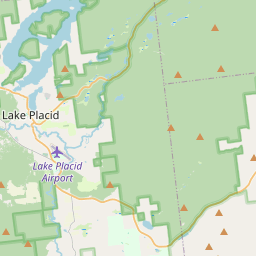
Make a weekend of it.
Closest editorial picks for a meal, a scoop, a pint, a bed, and a sight worth your time.
Eat.
4- The Cottage at Mirror Lake Inn0.8 mi
The Cottage Restaurant and Cafe is located directly on the shore of Mirror Lake, offering spectacular views of the Adirondack High Peaks. It features food and drink options sourced from the Lake Placid region and operates on a first-come,…
- the breakfast club, etc.0.8 mi
The breakfast club, etc. is a lakeside restaurant in Lake Placid, NY, serving creative breakfast and lunch items all day. It features an in-house coffee bar with handcrafted lattes and a full bar known for its 10 different Bloody Marys and…
- The Cabin Grill0.8 mi
The on-site restaurant and bar at The Grand Adirondack, a Tribute Portfolio hotel on Main Street in Lake Placid, with Great Room lobby dining, fireplace seating, and a relaxed bar register.
- Smoke Signals0.9 mi
A barbecue restaurant on Main Street in Lake Placid doing in-house smoked brisket and pulled chicken, with scratch-made sides and a full bar. Casual room, walk-ins welcome.
Sip.
4- The Coffee Bar0.9 mi
A small coffee bar on Main Street in Lake Placid with Mirror Lake and Whiteface Mountain views, pulling shots from Tug Hill Artisan Roasters beans.
- Origin Coffee0.9 mi
Origin Coffee Co. is a specialty coffee shop with locations in Lake Placid and Saranac Lake, offering a chef-driven breakfast and lunch menu served all day. It serves as a community gathering spot for locals and Adirondack travelers.
- Simply Gourmet1.6 mi
Simply Gourmet in Lake Placid offers daily breakfast and lunch with a focus on clean food, using fresh, local, and sustainable ingredients free of additives or preservatives. They also provide comprehensive catering services for various ev…
- Nori's Village Market8.5 mi
Nori's Village Market and Riverside Cafe offers a market with organic and local produce, bulk foods, coffee, and teas, alongside a cafe serving natural, vegetarian, vegan, gluten-free, and local meat options.
Sweet.
4- Ben & Jerry's1.0 mi
The Ben & Jerry's scoop shop on Lake Placid's Main Street above Mirror Lake — the Vermont brand's pints and cones in the heart of the village.
- Emma's Lake Placid Creamery1.0 mi
A 1950s-themed creamery in the heart of walkable Lake Placid, famous for its Maple Creme soft serve alongside 16 hard flavors, gelato, sorbet, and old-fashioned malts. The reliable apres-hike treat.
- Adirondack Corner Store1.6 mi
A longtime deli and general store at the corner of Route 73 in Lake Placid with an ice cream counter and subs — a locals' spot off the Main Street tourist row.
- Donnelly's Soft Ice Cream6.1 mi
A fourth-generation Saranac Lake institution on a former dairy farm, serving exactly one rotating soft-serve flavor each day — twisted with vanilla on the same 1953 machine. Cash only; check the daily flavor. Memorial Day to Labor Day.
Drink.
4- Lake Placid Pub & Brewery0.8 mi
A brewpub on Mirror Lake Drive in Lake Placid since 1996, with 12 house beers on tap including the original Ubu Ale, a downstairs Irish pub, and a deck over Mirror Lake.
- Top of the Park0.8 mi
A Lake Placid bar on Main Street offering a curated selection of wine, scotch, bourbon, craft beer, and top-shelf liquors, complemented by small plates and signature cocktails. Enjoy 'Spirits with a View' from its large deck overlooking Mi…
- Ray Brook Brewhouse5.4 mi
Ray Brook Brewhouse is a unique brewery in Ray Brook, NY, offering wild and traditional brews paired with adventurous dishes made from local and exotic ingredients.
- R.F. McDougall's Pub8.0 mi
The casual sibling of the Hungry Trout Restaurant, sharing the same Adirondack riverside property next to Whiteface. Pub food, regional beers, and the same view of the West Branch Ausable at a more relaxed price point.
Stay.
4- Lake Placid Club Resort0.7 mi
A historic resort on Morningside Drive above Lake Placid, with 45 holes of championship golf, a wedding venue with High Peaks views, lodging through the Grandview Hotel, and real-estate offerings across 900-plus acres.
- The Interlaken Inn & Restaurant0.8 mi
Victorian-style property offering plush quarters, plus an upscale restaurant & an old-school pub.
- The Haus0.8 mi
An all-suite boutique hotel on Main Street in Lake Placid with Mirror Lake or downtown views, full kitchens, living rooms in every suite, and complimentary kayaks and paddleboards in summer.
- Golden Arrow Lakeside Resort0.8 mi
Traditional lakeside resort with family suites, plus a restaurant, a lounge & a pool.
See.
4- Lake Placid Olympic Museum0.9 mi
Museum focusing on the winter Olympic games & its events, including hockey, skating & curling.
- Olympic Center1.0 mi
The hockey arena where the 1980 'Miracle on Ice' happened, now part of a larger Olympic complex with skating rinks, the Olympic Museum, training facilities, and bobsled / skeleton experiences.
- Captain Marney's Boat Rental1.1 mi
Captain Marney's Boat Rental offers boat and water sports rentals in the Lake Placid, NY area. They provide reasonably priced options for various water enthusiasts, including discounts for multi-day, multi-boat, and group rentals.
- 1980 Winter Olympic cauldron1.9 mi
The cauldron associated with the Olympic flame of the 1980 Winter Games in Lake Placid — a piece of the village's enduring Olympic legacy.
Add to the record.
Free, takes thirty seconds. Yours forever.
Every page on this site gets better when readers contribute. Mark a peak you’ve climbed, drop a photo, file a field note, or flag a correction — every addition makes the next visitor’s page better.
File a report.
Trail conditions, water level, bug pressure, blowdown. The kind of detail that helps the next person plan.
Write a field note →Spot something off?
Wrong elevation, outdated access notes, a coordinate that's drifted. We'd rather hear it than miss it.
Suggest an edit →


Frequently asked.
- How long is the Whitney Road?The Whitney Road is approximately 0.34 miles (0.6 kilometers) — a short out-and-back suitable for most fitness levels.
- How long does it take to hike the Whitney Road?Most hikers complete the Whitney Road in about 10 minutes at a steady pace with roughly 39 feet of elevation gain. Allow extra time for rest stops, photos, weather, and trail conditions.
- How difficult is the Whitney Road?Based on its length and elevation gain, the Whitney Road is an easy hike (39 ft of climbing over the route) — gentle grades suitable for most fitness levels and families. This is an estimate from route data, not an official trail rating — check current DEC advisories before heading out.