

Cedar River Trail.
The Cedar River Trail runs 2.2 miles through the western Adirondacks, offering relatively easy terrain suited to casual hikers. The route follows along the Cedar River corridor, a waterway that historically served as a logging route in the region's timber era. Best tackled with standard hiking footwear and allowing roughly an hour for the round trip.
- Family-friendlyShort, easy, and gentle enough for young legs
- Good for snowshoeingNon-technical grade that carries a snowshoe track
- Peak foliage window — color starts up high and works down the valleys through mid-October.
Seasonal pattern for this trail · tops out ~2,205 ft · live closures appear above
Read the line before you walk it.
What the trailhead is doing today.
Where the hike begins.
What the route itself carries.
Summits reached, waters touched, and the lean-tos along the way — read it like a cue sheet, mile posts ascending.
Guides, outfitters & shuttles.
If you’re already out here.
Blue Mountain Lake.
The corner of the Park this trail calls home — its hamlets, waters, lodging, and the rest of its field record.
Read the Region→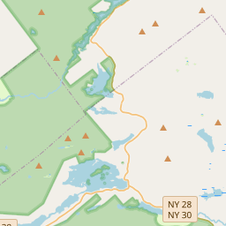
Make a weekend of it.
Closest editorial picks for a meal, a scoop, a pint, a bed, and a sight worth your time.
Eat.
4- Chef Darrell’s Mountain Diner9.1 mi
Chef Darrell’s Mountain Diner: the best Diner in Indian Lake, NY. Order directly online today for takeout or delivery. Save money, support local business!
- Tony Harper's Pizza & Clam Shack9.8 mi
Tony Harper's Pizza & Clam Shack is a family restaurant and bar with four Adirondack locations, offering homemade pizza, wings, and seafood. Guests can enjoy sports on high-def TVs, a full bar, and live music.
- McSweeney's Irish Pub10.9 mi
An Irish-style pub on Route 30 in Indian Lake serving comfort-food classics (shepherd's pie, fish and chips) seven days a week, year-round. The dependable dinner spot in town.
- Seventh Lake House14.2 mi
Rustic space with a lake view preps classic & contemporary American dishes from seasonal goods.
Sip.
4- Schoolhouse Grounds Coffee Shop9.5 mi
Seasonal coffee shop inside the 1895 schoolhouse that houses Blue Mountain Designs. Espresso, locally roasted coffee, loose-leaf tea, baked goods, avocado toast, sandwiches, and soups. May through October.
- Tamarack Cafe16.2 mi
Tamarack Cafe in downtown Inlet serves a wide variety of breakfast and lunch options, from traditional favorites and specialty bowls to creative salads, sandwiches, and burgers. The cafe also features an 18-hole mini-golf course.
- Blue Line Coffee House16.2 mi
Blue Line Coffee House offers Adirondack-inspired apparel, handcrafted mugs, and mountain-themed gifts, along with pre-packaged coffee and coffee accessories. Products are available for nationwide shipping, and local customers can order dr…
- The PERKS of Speculator16.7 mi
Speculator coffee shop and bakery at 2855 NY-30. Specialty coffee, espresso, fresh-baked bagels and pastries, plus breakfast and lunch sandwiches. Gluten-free options across the bakery case.
Sweet.
4- Northern Lights Creamery Inc.15.8 mi
An Inlet institution for 40-plus years, a short walk from Arrowhead Park on Fourth Lake — soft serve, homemade gelato, floats, flurries, and specialty sundaes.
- Speculator Creamery16.7 mi
A family-run village creamery anchoring Speculator's tiny downtown near Lake Pleasant — a genuine community summer hub. Wide-ranging soft-serve flavors, the 16oz Nor'Easter blend, and hand-dipped hard ice cream. Roughly May through September.
- Custard’s Last Stand16.9 mi
Custard's Last Stand is a historic ice cream shop in Long Lake, established in 1958, serving a variety of soft frozen custard & hard ice cream, sundaes, specialty shakes, floats, and ice cream sodas. They also offer merchandise and gift cards.
- The Park16.9 mi
Trying to find a fast food restaurant in Long Lake? Pay a visit to The Park. We offer a range of burgers, sides, ice cream, drinks and coffee options.
— 15.8 mi to the nearest scoop; save it for the ride home.
Drink.
4- Hex and Hop Tasting Room - Blue Mountain Lake9.2 mi
Hex and Hop is a craft brewery and meadery located in Bloomingdale, New York. They offer full-flavored, high-quality craft beer and mead, made with fresh, locally sourced ingredients, emphasizing community and craft.
- Indian Lake Restaurant, Tavern and Liquor Store11.0 mi
Indian Lake Restaurant, Tavern and Liquor Store offers a full bar with an extensive bottle selection and local drafts, alongside a menu featuring appetizers, sandwiches, and entrees. The restaurant is currently closed for mud season and wi…
- Acorn Pub & Eatery at Oak Mountain15.7 mi
Acorn Pub & Eatery is a dining option at Oak Mountain, offering a place to eat and drink.
- Lemon Tree Brewery16.8 mi
Lemon Tree Brewery is a brewery and taproom located in Speculator, NY, steps from Lake Pleasant. It offers house brews like SASQUATCH HAZY IPA and Blueberry Wheat, along with other local NY State micro-brewed beers and wines in a relaxed s…
Stay.
4- Lake Kora6.4 mi
Originally Kamp Kill Kare, built in 1898 by William West Durant for Lt. Gov. Timothy Woodruff. One-thousand acres, a private 500-acre lake, sixteen bedrooms, all-inclusive — booked as an exclusive buyout for groups up to 35.
- Kamp Kill Kare6.6 mi
Kamp Kill Kare is a historic Adirondack Great Camp on 1,000 acres featuring a private 500-acre lake, offering a luxurious and customized guest experience.
- Timberlock6.8 mi
Since 1899, Timberlock has been a family camp offering rustic cabins, lakeside activities, and unforgettable summers in upstate New York.
- Snowy Mountain Inn7.6 mi
Snowy Mountain Inn offers Bed & Breakfast lodging and secluded cottages with lake and mountain views, plus a "guests only" dining room featuring Real Pit Southern BBQ.
See.
4- Great Camp Sagamore8.2 mi
Great Camp Sagamore is a historic Adirondack Great Camp offering multi-day programs, overnight stays, and daily activities focused on history, arts, outdoor recreation, and wellness.
- BLUE MOUNTAIN CENTER8.6 mi
Blue Mountain Center is a working community of writers, artists, and activists set in the heart of the Adirondacks, the largest state park in the continental U.S.
- Adirondack Lakes Center for the Arts9.2 mi
Adirondack Lakes Center for the Arts is a vibrant hub for creativity in the Adirondacks, offering inspiring performances, gallery exhibits, workshops, and community events for all ages.
- Camp Pine Knot10.1 mi
William West Durant's 1877 compound on Raquette Lake — the camp that invented the Adirondack Great Camp style. Now SUNY Cortland's Huntington Memorial Camp, an outdoor-education center with occasional public programs.
Add to the record.
Free, takes thirty seconds. Yours forever.
Every page on this site gets better when readers contribute. Mark a peak you’ve climbed, drop a photo, file a field note, or flag a correction — every addition makes the next visitor’s page better.
File a report.
Trail conditions, water level, bug pressure, blowdown. The kind of detail that helps the next person plan.
Write a field note →Spot something off?
Wrong elevation, outdated access notes, a coordinate that's drifted. We'd rather hear it than miss it.
Suggest an edit →


Frequently asked.
- How long is the Cedar River Trail?The Cedar River Trail is approximately 2.16 miles (3.5 kilometers) — a short out-and-back suitable for most fitness levels.
- How long does it take to hike the Cedar River Trail?Most hikers complete the Cedar River Trail in about 1 hour 15 minutes at a steady pace with roughly 193 feet of elevation gain. Allow extra time for rest stops, photos, weather, and trail conditions.
- How difficult is the Cedar River Trail?Based on its length and elevation gain, the Cedar River Trail is an easy hike (193 ft of climbing over the route) — gentle grades suitable for most fitness levels and families. This is an estimate from route data, not an official trail rating — check current DEC advisories before heading out.
- What peaks does the Cedar River Trail reach?The Cedar River Trail reaches one named summit.
- Which specific peaks does Cedar River Trail reach?Cedar River Trail reaches 1 peak: Water Barrel Mountain.