Cedar River Flow is a 486-acre impoundment on the Cedar River south of Raquette Lake — created by the Wakely Dam and managed by the state as part of the Hudson River watershed system. The flow sits in a broad, marshy basin ringed by low hills and accessed primarily by water: paddlers launch from the Cedar River Road put-in and explore the maze of bays, deadfalls, and flooded timber that define the reservoir's character. This is remote flatwater — no road noise, no development, and long views across open water broken by standing dead spruce. No fish species data on file, but the shallow, weedy structure suggests warmwater habitat typical of Adirondack impoundments.
Closest parking lots within range, ranked by walking distance. Accessibility flags come from Google verified-data; surface and capacity from OpenStreetMap. Confirm hours and seasonal closures before you go.
+4 more on the map above
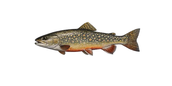 Brook troutSalvelinus fontinalisNative
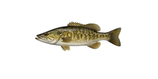 Smallmouth bassMicropterus dolomieuStocked
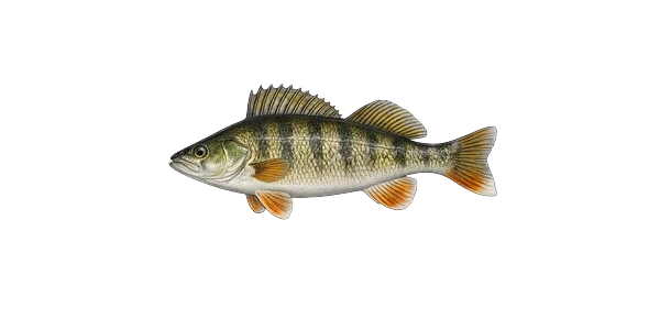 Yellow perchPerca flavescensNative
Source: NYS DEC Stocking Records via data.ny.gov · Annual refresh
From the people who’ve been here, plus what Google has on file.
Free, takes thirty seconds. Yours forever.
Every page on this site gets better when readers contribute. Mark a peak you’ve climbed, drop a photo, file a field note, or flag a correction — every addition makes the next visitor’s page better.
Sunrise on the dock, a cairn at the summit, a bend on the trail. Your camera roll, our archive.
Add a photo →Trail conditions, water level, bug pressure, blowdown. The kind of detail that helps the next person plan.
Write a field note →Wrong elevation, outdated access notes, a coordinate that's drifted. We'd rather hear it than miss it.
Suggest an edit →

What to do, where to stay, and what's reopening across the Park as the snow melts and the calendar fills.

A complete planning guide: difficulty by peak, common combo days, seasonal realities, and a sortable, filterable table of every summit.

Overnight, day, and trip camps in the Park — the camp belt, choosing the right fit, costs and financial aid, ACA accreditation, and the questions every parent should ask before they commit.