

Ladies - East River Link Trail.
This 120-foot connector does one thing: it gets you between the Ladies and East River trails at Cathedral Rocks without backtracking. The ground surface is walkable in any season. Call it a hiker's shortcut, not a destination, but when you need it, you'll be glad someone cut it in.
- Leg-stretcherShort and nearly flat — an hour or less
Seasonal pattern for this trail · tops out ~1,381 ft · live closures appear above
- GroundSurface
- Foot onlyMotor vehicle
- excellentTrail visibility
Read the line before you walk it.
What the trailhead is doing today.
Where the hike begins.
What the route itself carries.
Summits reached, waters touched, and the lean-tos along the way — read it like a cue sheet, mile posts ascending.
Curated trailheads & parking near this route.
Editorial trailhead listings within roughly 3 miles — permit info, parking capacity, and access-road conditions.
Guides, outfitters & shuttles.
If you’re already out here.
Keene.
The corner of the Park this trail calls home — its hamlets, waters, lodging, and the rest of its field record.
Read the Region→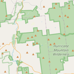
Make a weekend of it.
Closest editorial picks for a meal, a scoop, a pint, a bed, and a sight worth your time.
Eat.
4- Noon Mark Diner2.9 mi
A traditional diner experience, offering hearty meals for travelers and locals in the Adirondack Park.
- Ausable Inn3.1 mi
Comfortable Keene Valley restaurant, bar, liquor store, and small inn. American comfort menu — wings, fish and chips, Montreal brisket, steak au poivre, plus the locally famous Hungarian mushroom soup.
- Forty Six7.1 mi
A small fine-dining room on Route 9N in Keene at the Dartbrook Lodge campus, with a seasonal menu that rotates regularly and elegant plating. Reservations recommended.
- The Deer's Head Inn Restaurant10.7 mi
The Deer's Head Inn is a historic Elizabethtown tavern and restaurant — among the oldest inns in the Adirondacks — serving pub fare and regional dishes.
Sip.
4- Old Mountain Coffee Company2.9 mi
Great Coffee, Great Food, Great Baked Goods & Great People. Stop in to enjoy our house roasted coffee, browse our menu for a bite to eat or grab a delicious treat from our bakery. Order Online for pickup or stop in.
- Counter Space10.8 mi
A casual cafe in Elizabethtown serving coffee, espresso, and light bites — a local gathering spot in the Essex County seat.
- Pleasant Valley Cafe10.8 mi
A local cafe in Elizabethtown serving breakfast, lunch, coffee, and comfort food in the heart of the Boquet Valley.
- Life Church Cafe10.9 mi
Life Church Elizabethtown is a local church dedicated to connecting lives and building community.
Sweet.
4- Black Rooster Maple7.2 mi
Pure Adirondack Maple Syrup, Maple Cream, Bourbon Barrel Maple Syrup
- Cedar Run Bakery & Market7.7 mi
Cedar Run Bakery & Market offers scratch-made baked goods, deli items, fresh menu options, and take & bake meals, alongside a selection of wine and spirits. They are open Friday through Monday from 8 AM to 6 PM.
- Adirondack Corner Store12.1 mi
A longtime deli and general store at the corner of Route 73 in Lake Placid with an ice cream counter and subs — a locals' spot off the Main Street tourist row.
- Ben & Jerry's13.3 mi
The Ben & Jerry's scoop shop on Lake Placid's Main Street above Mirror Lake — the Vermont brand's pints and cones in the heart of the village.
Drink.
4- Lake Placid Pub & Brewery13.4 mi
A brewpub on Mirror Lake Drive in Lake Placid since 1996, with 12 house beers on tap including the original Ubu Ale, a downstairs Irish pub, and a deck over Mirror Lake.
- Top of the Park14.0 mi
A Lake Placid bar on Main Street offering a curated selection of wine, scotch, bourbon, craft beer, and top-shelf liquors, complemented by small plates and signature cocktails. Enjoy 'Spirits with a View' from its large deck overlooking Mi…
- Paradox Brewery14.2 mi
Paradox Brewery offers a diverse tap selection, a full menu with pizza, burgers, and BBQ, and an expansive mountain landscape.
- The Old Mine15.0 mi
The Old Miners Tavern is a historic Adirondack tavern in Moriah, NY, offering classic bar food like juicy burgers and chicken wings, a full bar with rotating craft beers, and a welcoming atmosphere for friends to gather.
Stay.
4- Rooster Comb Inn3.0 mi
Rooster Comb Inn is a dog-friendly inn located in the heart of Keene Valley, NY, offering comfortable, rustic lodging within walking distance to Adirondack trailheads and local eateries. It features shared amenities like a full kitchen and…
- Keene Valley Lodge3.2 mi
A seven-room lodge and three-bedroom cottage at the center of Keene Valley, with breakfast and direct walk access to the Great Range trailheads and village restaurants.
- Dartbrook Lodge7.1 mi
A small lodge on Route 9N in Keene offering individually furnished cottages and suites in the Great Camp tradition, many with kitchens and private porches. The High Peaks trailheads start a few miles up the road.
- The Mountain House7.9 mi
Your private escape in the lush Adirondack mountains. Situated above the town of Keene Valley, the large Mountain House property boasts three beautifully appointed, rustic guest houses with updated amenities. Book for family vacations, c…
See.
4- Hurricane Mountain Fire Tower7.3 mi
Perched atop Hurricane Mountain, this historic fire tower provides hikers with unparalleled 360-degree views of the Adirondacks, Lake Champlain, and Vermont's Green Mountains.
- Keene Arts7.4 mi
Keene Arts is a venue in Keene, NY, hosting diverse events including art exhibits, concerts, film screenings, and a winter farmers market.
- Lake Placid Bobsled Experience8.3 mi
Mt Van Hoevenberg, a Lake Placid Legacy Site, offers the thrilling Skeleton Experience for visitors and youth bobsled and skeleton programs, continuing its Olympic legacy as a venue for winter sports.
- Cliffside Coaster8.3 mi
The Cliffside Coaster in Lake Placid, NY, is the longest coaster in North America. It follows the path of Olympic history at Mt Van Hoevenberg.
Add to the record.
Free, takes thirty seconds. Yours forever.
Every page on this site gets better when readers contribute. Mark a peak you’ve climbed, drop a photo, file a field note, or flag a correction — every addition makes the next visitor’s page better.
Add a shot.
Sunrise on the dock, a cairn at the summit, a bend on the trail. Your camera roll, our archive.
Add a photo →File a report.
Trail conditions, water level, bug pressure, blowdown. The kind of detail that helps the next person plan.
Write a field note →Spot something off?
Wrong elevation, outdated access notes, a coordinate that's drifted. We'd rather hear it than miss it.
Suggest an edit →


Frequently asked.
- How long is the Ladies - East River Link Trail?The Ladies - East River Link Trail is approximately 0.02 miles (0.0 kilometers) — a short out-and-back suitable for most fitness levels.
- How difficult is the Ladies - East River Link Trail?The Ladies - East River Link Trail is rated easy hiking (SAC T1) — broad, well-marked path suitable for most fitness levels in sturdy shoes. Check current DEC advisories for closures, washouts, or seasonal restrictions before heading out.