

Van Hoevenberg Ski Trail.
This half-mile connector runs within the extensive trail network at the Mount Van Hoevenberg recreation area near Lake Placid, a venue developed for the 1980 Winter Olympics. The route links cross-country ski trails in a system that sees year-round use for hiking, mountain biking, and Nordic skiing depending on season. At 0.5 miles, it's brief enough to serve mainly as access between longer loops or facilities.
- Peak foliage window — color starts up high and works down the valleys through mid-October.
Seasonal pattern for this trail · tops out ~3,576 ft · live closures appear above
- GroundSurface
- designatedSki
Read the line before you walk it.
What the trailhead is doing today.
Where the hike begins.
Guides, outfitters & shuttles.
If you’re already out here.
Lake Placid.
The corner of the Park this trail calls home — its hamlets, waters, lodging, and the rest of its field record.
Read the Region→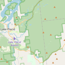
Make a weekend of it.
Closest editorial picks for a meal, a scoop, a pint, a bed, and a sight worth your time.
Eat.
4- Noon Mark Diner7.6 mi
A traditional diner experience, offering hearty meals for travelers and locals in the Adirondack Park.
- Ausable Inn7.7 mi
Comfortable Keene Valley restaurant, bar, liquor store, and small inn. American comfort menu — wings, fish and chips, Montreal brisket, steak au poivre, plus the locally famous Hungarian mushroom soup.
- Salt of the Earth Bistro8.9 mi
A small reservation-required bistro on Sentinel Road in Lake Placid, serving twisted takes on traditional dishes including a signature peanut stew. Parties of six or fewer.
- Lisa G's9.3 mi
Creative American fare with global twists in a welcoming space with vivid murals & waterside patio.
Sip.
4- Old Mountain Coffee Company7.6 mi
Great Coffee, Great Food, Great Baked Goods & Great People. Stop in to enjoy our house roasted coffee, browse our menu for a bite to eat or grab a delicious treat from our bakery. Order Online for pickup or stop in.
- Origin Coffee9.6 mi
Origin Coffee Co. is a specialty coffee shop with locations in Lake Placid and Saranac Lake, offering a chef-driven breakfast and lunch menu served all day. It serves as a community gathering spot for locals and Adirondack travelers.
- The Coffee Bar9.9 mi
A small coffee bar on Main Street in Lake Placid with Mirror Lake and Whiteface Mountain views, pulling shots from Tug Hill Artisan Roasters beans.
- Simply Gourmet10.7 mi
Simply Gourmet in Lake Placid offers daily breakfast and lunch with a focus on clean food, using fresh, local, and sustainable ingredients free of additives or preservatives. They also provide comprehensive catering services for various ev…
Sweet.
4- Adirondack Corner Store8.4 mi
A longtime deli and general store at the corner of Route 73 in Lake Placid with an ice cream counter and subs — a locals' spot off the Main Street tourist row.
- Ben & Jerry's9.4 mi
The Ben & Jerry's scoop shop on Lake Placid's Main Street above Mirror Lake — the Vermont brand's pints and cones in the heart of the village.
- Emma's Lake Placid Creamery9.4 mi
A 1950s-themed creamery in the heart of walkable Lake Placid, famous for its Maple Creme soft serve alongside 16 hard flavors, gelato, sorbet, and old-fashioned malts. The reliable apres-hike treat.
- Cedar Run Bakery & Market10.1 mi
Cedar Run Bakery & Market offers scratch-made baked goods, deli items, fresh menu options, and take & bake meals, alongside a selection of wine and spirits. They are open Friday through Monday from 8 AM to 6 PM.
Drink.
4- Lake Placid Pub & Brewery9.6 mi
A brewpub on Mirror Lake Drive in Lake Placid since 1996, with 12 house beers on tap including the original Ubu Ale, a downstairs Irish pub, and a deck over Mirror Lake.
- Top of the Park10.2 mi
A Lake Placid bar on Main Street offering a curated selection of wine, scotch, bourbon, craft beer, and top-shelf liquors, complemented by small plates and signature cocktails. Enjoy 'Spirits with a View' from its large deck overlooking Mi…
- Ray Brook Brewhouse12.7 mi
Ray Brook Brewhouse is a unique brewery in Ray Brook, NY, offering wild and traditional brews paired with adventurous dishes made from local and exotic ingredients.
- R.F. McDougall's Pub15.5 mi
The casual sibling of the Hungry Trout Restaurant, sharing the same Adirondack riverside property next to Whiteface. Pub food, regional beers, and the same view of the West Branch Ausable at a more relaxed price point.
Stay.
4- Adirondack Loj3.0 mi
Adirondak Loj is a lodging and camping facility operated by the Adirondack Mountain Club (ADK) in Lake Placid, New York. It serves as a hub for outdoor programs and access to the High Peaks region, offering accommodations and information f…
- Van Hoevenberg Cabins5.5 mi
Eight pet-friendly cabins on Cascade Road outside Lake Placid, each named for a High Peaks summit, with kitchenettes and queen, king, or twin configurations. Year-round operation.
- Cascade Inn and Restaurant6.5 mi
A roadside motel and restaurant on Cascade Road between Lake Placid and Keene, with Whiteface views, Italian classics, and ski-out cross-country access from the door.
- TMax-n-Topo's Hostel6.5 mi
A budget hostel on Cascade Road outside Lake Placid with shared bunkrooms, private motel-style rooms, and a seasonal pop-up camper. Full kitchen, communal dining, fire pit, outdoor deck.
See.
4- Cliffside Coaster4.8 mi
The Cliffside Coaster in Lake Placid, NY, is the longest coaster in North America. It follows the path of Olympic history at Mt Van Hoevenberg.
- Lake Placid Bobsled Experience4.9 mi
Mt Van Hoevenberg, a Lake Placid Legacy Site, offers the thrilling Skeleton Experience for visitors and youth bobsled and skeleton programs, continuing its Olympic legacy as a venue for winter sports.
- John Brown Farm State Historic Site7.3 mi
Simple, furnished farmhouse home & grave of abolitionist John Brown, set in parkland with trails.
- Olympic Ski Jump Tower7.6 mi
Experience the thrill of Olympic ski jumping history and world-class training at this iconic Lake Placid venue, offering stunning Adirondack vistas from its towering structures.
Add to the record.
Free, takes thirty seconds. Yours forever.
Every page on this site gets better when readers contribute. Mark a peak you’ve climbed, drop a photo, file a field note, or flag a correction — every addition makes the next visitor’s page better.
File a report.
Trail conditions, water level, bug pressure, blowdown. The kind of detail that helps the next person plan.
Write a field note →Spot something off?
Wrong elevation, outdated access notes, a coordinate that's drifted. We'd rather hear it than miss it.
Suggest an edit →


Frequently asked.
- How long is the Van Hoevenberg Ski Trail?The Van Hoevenberg Ski Trail is approximately 0.52 miles (0.8 kilometers) — a short out-and-back suitable for most fitness levels.
- How long does it take to hike the Van Hoevenberg Ski Trail?Most hikers complete the Van Hoevenberg Ski Trail in about 30 minutes at a steady pace with roughly 535 feet of elevation gain. Allow extra time for rest stops, photos, weather, and trail conditions.
- How difficult is the Van Hoevenberg Ski Trail?Based on its length and elevation gain, the Van Hoevenberg Ski Trail is a demanding hike (535 ft of climbing over the route) — sustained climbing best suited to fit, experienced hikers. This is an estimate from route data, not an official trail rating — check current DEC advisories before heading out.