

Unnamed trail.
This unnamed connector spans just two-tenths of a mile, likely linking two named routes or serving as a spur to a feature too minor to warrant its own designation. Such short segments often appear in networks where trails branch frequently or where old logging roads intersect maintained paths. Check current maps or local trail registers to confirm where it leads before relying on it for navigation.
- Leg-stretcherShort and nearly flat — an hour or less
- Family-friendlyShort, easy, and gentle enough for young legs
- Good for snowshoeingNon-technical grade that carries a snowshoe track
- Peak foliage window — color starts up high and works down the valleys through mid-October.
Seasonal pattern for this trail · tops out ~1,545 ft · live closures appear above
Read the line before you walk it.
What the trailhead is doing today.
Where the hike begins.
Guides, outfitters & shuttles.
If you’re already out here.
Lake Placid.
The corner of the Park this trail calls home — its hamlets, waters, lodging, and the rest of its field record.
Read the Region→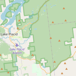
Make a weekend of it.
Closest editorial picks for a meal, a scoop, a pint, a bed, and a sight worth your time.
Eat.
4- The Hungry Trout10.4 mi
Situated on the West Branch of the Ausable River, the Hungry Trout offers two distinct dining experiences, from an upscale restaurant to a lively tavern.
- Monday Tuesday Grill14.1 mi
Monday Tuesday Grill in Upper Jay offers fresh, friendly, and affordable comfort meals for indoor, outdoor, and takeout dining, including grilled cheese sandwiches, soups, and Swedish meatballs.
- Artisans at the Lake Placid Lodge17.1 mi
The restaurant at the Lake Placid Lodge, a Relais and Chateaux property, serving a seasonal farm-to-fork menu in a fire-lit dining room with a three-season terrace over the lake. Breakfast and dinner daily.
- The Cottage at Mirror Lake Inn17.5 mi
The Cottage Restaurant and Cafe is located directly on the shore of Mirror Lake, offering spectacular views of the Adirondack High Peaks. It features food and drink options sourced from the Lake Placid region and operates on a first-come,…
Sip.
4- Adirondack Mountain Coffee Cafe12.3 mi
Adirondack Mountain Coffee Cafe is a coffee shop in Upper Jay, NY, serving fresh, slow-roasted coffee, breakfast, and lunch daily. Located near Whiteface Mountain and the Adirondack State Park, it also offers local beer and cocktails, with…
- Saranac Juice15.7 mi
Cold-pressed juices, cleanses, protein elixirs, and nut mylks from Saranac River Ranch in Bloomingdale, made from organic produce grown on the farm or sourced from local Adirondack growers.
- Simply Gourmet17.7 mi
Simply Gourmet in Lake Placid offers daily breakfast and lunch with a focus on clean food, using fresh, local, and sustainable ingredients free of additives or preservatives. They also provide comprehensive catering services for various ev…
- The Coffee Bar17.9 mi
A small coffee bar on Main Street in Lake Placid with Mirror Lake and Whiteface Mountain views, pulling shots from Tug Hill Artisan Roasters beans.
Sweet.
4- Whitebrook Dairy Bar8.3 mi
A classic roadside drive-in on Route 86 in Wilmington, five minutes from Whiteface — creamy soft serve (try the peanut-butter dip) plus footlongs and the Wilmington burger. Opening day is a local rite of spring.
- Sugar House Creamery12.0 mi
Sugar House Creamery is a farmstead creamery located in the Adirondacks, producing artisanal cheeses from the milk of their own cows. They offer a variety of cheeses, showcasing the quality of their local dairy.
- Cedar Run Bakery & Market17.7 mi
Cedar Run Bakery & Market offers scratch-made baked goods, deli items, fresh menu options, and take & bake meals, alongside a selection of wine and spirits. They are open Friday through Monday from 8 AM to 6 PM.
- Black Rooster Maple18.1 mi
Pure Adirondack Maple Syrup, Maple Cream, Bourbon Barrel Maple Syrup
Drink.
4- R.F. McDougall's Pub10.4 mi
The casual sibling of the Hungry Trout Restaurant, sharing the same Adirondack riverside property next to Whiteface. Pub food, regional beers, and the same view of the West Branch Ausable at a more relaxed price point.
- Hex and Hop Brewing15.5 mi
Hex and Hop Brewing is a craft brewery and meadery in Bloomingdale, New York, making full-flavored, locally sourced beer and mead. They prioritize community and craft, using fresh, local ingredients.
- Top of the Park17.7 mi
A Lake Placid bar on Main Street offering a curated selection of wine, scotch, bourbon, craft beer, and top-shelf liquors, complemented by small plates and signature cocktails. Enjoy 'Spirits with a View' from its large deck overlooking Mi…
- Lake Placid Pub & Brewery18.1 mi
A brewpub on Mirror Lake Drive in Lake Placid since 1996, with 12 house beers on tap including the original Ubu Ale, a downstairs Irish pub, and a deck over Mirror Lake.
Stay.
4- Cadence Lodge at Whiteface8.6 mi
Cadence Lodge in Wilmington, NY, offers an ideal base camp for outdoor adventurers. The property features recently updated guest rooms with amenities to enhance your stay, including a restaurant onsite, weekend breakfast options, and…
- Adirondack Spruce Lodge8.6 mi
Twenty-seven-room independent lodge in Wilmington village, minutes from Whiteface Mountain and walking distance from the Ausable River. Complimentary breakfast, fire pit, and Adirondack-character rooms.
- Mountain Brook Lodge8.6 mi
Welcome to your home away from home! Mountain Brook Lodge offers a unique blend of comfort and convenience, ensuring your stay is memorable. We pride ourselves on offering a variety of amenities to make your stay as comfortable as…
- Wolfjaw Lodge8.7 mi
Welcome to the totally transformed Wolfjaw Lodge, located at the base of Whiteface Mountain, just a 2-minute drive from both Whiteface and Wilmington beach. Each of our 2 private houses and 11 lodge rooms and suites has been recently…
See.
4- Summit Weather Observatory11.2 mi
The Summit Weather Observatory, part of the University at Albany's Atmospheric Sciences Research Center (ASRC), provides real-time weather conditions and data from its observatory at the summit of Whiteface Mountain and a field station at…
- High Falls Gorge11.9 mi
A 22-acre privately owned nature park on Route 86 in Wilmington with rim trails, glass-floor walkways over Ausable River waterfalls, a cafe, and gift shop. Open year-round, weather permitting.
- Upper Jay Art Center and Recovery Lounge12.3 mi
The Upper Jay Art Center and Recovery Lounge is a vibrant venue dedicated to presenting music, theater, and visual arts in Upper Jay, NY. It serves as a community hub for various cultural events.
- Ausable Chasm17.0 mi
A sandstone gorge attraction on US 9 in Ausable Chasm, with rim trails, walkways through the gorge floor, and add-on tubing and rafting on the Ausable River. Open seasonally, roughly mid-May through Columbus Day.
Add to the record.
Free, takes thirty seconds. Yours forever.
Every page on this site gets better when readers contribute. Mark a peak you’ve climbed, drop a photo, file a field note, or flag a correction — every addition makes the next visitor’s page better.
File a report.
Trail conditions, water level, bug pressure, blowdown. The kind of detail that helps the next person plan.
Write a field note →Spot something off?
Wrong elevation, outdated access notes, a coordinate that's drifted. We'd rather hear it than miss it.
Suggest an edit →


Frequently asked.
- How long is the this trail?The this trail is approximately 0.17 miles (0.3 kilometers) — a short out-and-back suitable for most fitness levels.
- How long does it take to hike the this trail?Most hikers complete the this trail in about 10 minutes at a steady pace with roughly 200 feet of elevation gain. Allow extra time for rest stops, photos, weather, and trail conditions.
- How difficult is the this trail?Based on its length and elevation gain, the this trail is an easy hike (200 ft of climbing over the route) — gentle grades suitable for most fitness levels and families. This is an estimate from route data, not an official trail rating — check current DEC advisories before heading out.