
Hunters path.
This 0.3-mile ground path is barely long enough to call a hike, but that's the point. Use it as a connector, a quick stretch between longer trails, or an easy introduction to walking Adirondack dirt when you've got kids or guests who aren't ready for the real stuff. The natural surface keeps it honest, but don't expect much beyond a brief walk in the woods.
- Leg-stretcherShort and nearly flat — an hour or less
- Stick season — bare woods, long views, and icy patches on shaded stretches. Microspikes are cheap insurance.
Seasonal pattern for this trail · live closures appear above
- GroundSurface
- badTrail visibility
- User-createdStatus
Read the line before you walk it.
What the trailhead is doing today.
Where the hike begins.
Guides, outfitters & shuttles.
If you’re already out here.
Great Sacandaga Lake.
The corner of the Park this trail calls home — its hamlets, waters, lodging, and the rest of its field record.
Read the Region→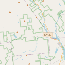
Make a weekend of it.
Closest editorial picks for a meal, a scoop, a pint, a bed, and a sight worth your time.
Eat.
4- Alpine Grille12.1 mi
A long-running roadside steak-and-seafood house on the Sacandaga, between Northville and Wells. Generous portions, a lively bar, and the kind of dining room where the staff knows the regulars by name. Reservations recommended on weekends.
- Nettle Meadow at The Hitching Post12.7 mi
A tavern and dining spot tied to Nettle Meadow Farm, the noted goat-and-sheep creamery, serving farm-to-table fare in the Lake Luzerne area.
- Canepa’s Pizza Shop14.2 mi
Canepa's Pizza Shop, formerly The Pizza Shop of Warrensburg, has been serving award-winning pizza since 2014. Featured on Rachael Ray and PMQ Magazine, they offer authentic Italian hospitality with family recipes and fine ingredients.
- Oscar's Smokehouse14.3 mi
Oscar's Smokehouse has been making fine smoked meats and cheeses for over 70 years in Warrensburg, NY.
Sip.
4- Uncle Carl's Coffee12.2 mi
Uncle Carl's Coffee serves expertly crafted coffees, artisan teas, pastries, and light savory bites. They also offer daily quiche and bagels, along with homemade soups, frozen meals, local meats, and cheeses.
- ADK Blend15.0 mi
Northville smoothie & açaí-bowl spot in the Great Sacandaga Lake corridor.
- Caffe Vero16.4 mi
Breakfast, baked goods, sandwiches & house-roasted coffee in a comfy, earth-toned cafe.
- The PERKS of Speculator17.1 mi
Speculator coffee shop and bakery at 2855 NY-30. Specialty coffee, espresso, fresh-baked bagels and pastries, plus breakfast and lunch sandwiches. Gluten-free options across the bakery case.
Sweet.
4- Cree-Mee Freeze15.0 mi
A summer soft-serve stand near Northville on the Great Sacandaga Lake shore, with twists and specialty sundaes.
- The Village Scoop15.1 mi
A walk-up ice cream shop on Northville's Main Street at the north tip of Great Sacandaga Lake — hard ice cream and soft serve with a wide flavor selection.
- Lake George Baking Company16.4 mi
A bakery with two locations in Queensbury and Lake George, offering custom cakes, breads, rolls, and the original Fudge Fancy. Off-season hours are Wednesday through Sunday, 8 a.m. to 3 p.m.
- Scoop's Ice Cream Parlor16.4 mi
Scoop's Ice Cream Parlor in Lake George offers ice cream and frozen yogurt at inexpensive prices. Located at 327 Canada St, it provides take-out service and accepts credit cards.
— 15.0 mi to the nearest scoop; save it for the ride home.
Drink.
4- The Long Horn Restaurant & Pub13.0 mi
The Long Horn Restaurant Pub Lake Luzerne, The Long Horn Restaurant Pub Lake Luzerne Online ordering, online order accepting credit card, The Long Horn Restaurant Pub Fast, Relaxed, Healthy and stylish dining experience., Catering and Gi…
- Bandstand Brew Works14.2 mi
Bandstand Brew Works is a family-friendly brewpub in Warrensburg, NY, offering handcrafted beers, cocktails, and a diverse menu made with local ingredients. It's a community gathering spot known for live music, weekly events, and a vibrant…
- George Henry's14.6 mi
A family-owned bar and grill on Main Street in Warrensburg doing made-to-order American grill plates, hearty steak and chicken specialties, local craft beer, and fresh-baked breads from area bakeries. No fast food.
- South Shore Dive15.3 mi
South Shore Dive: Casual dining on Great Sacandaga Lake. Made-to-order meals, craft cocktails, lake views. Book now in upstate NY!
Stay.
4- The Lodge at Harrisburg Lake1.9 mi
A 12-bedroom group lodge in Stony Creek sleeping up to 42 across 20 beds and 11 full baths, with Alpine-style architecture, lakefront, pool, multiple sport courts, and a historic tavern.
- 1000 Acres Ranch Resort8.6 mi
Rustic, all-inclusive ranch-style resort set on a river offering horseback riding, dining & pools.
- Ponderosa Pines Campgrounds and Bar10.6 mi
Ponderosa Pines Campgrounds offers waterfront cabin rentals and RV site lots on Great Sacandaga Lake. Amenities include a private beach, dock rentals, on-site bar, and various recreational activities.
- Luzerne State Campground11.3 mi
Located on Fourth Lake in Lake Luzerne, this state campground provides 173 tent and trailer sites, along with dedicated facilities for campers traveling with horses.
See.
4- The Promise Gardens Estate of the Adirondacks10.9 mi
The Promise Gardens is the perfect wedding venue with gorgeous gardens, rustic barns and mountain views near Lake George and the Adirondacks.
- Revolution Rail Co. Thurman11.7 mi
A pedal-powered rail biking operation in Warrensburg on Route 418, with family-friendly tours rolling on disused railroad tracks through Adirondack forest and river corridors. Suitable for all ages and ability levels.
- Tubby Tubes River Co.12.7 mi
An outfitter for lazy-river tubing on the Lower Hudson in Lake Luzerne, with guided trips, tubes, life jackets, and shuttle included. Ages 2 and up. Memorial Day Weekend through Labor Day.
- Historic Copeland Covered Bridge13.9 mi
The Historic Copeland Covered Bridge is a 35-foot Queenpost truss bridge built in 1879 by Arad Copeland in Edinburg, Saratoga County. Listed on the National Register of Historic Places, it is the only covered bridge remaining in Saratoga C…
Add to the record.
Free, takes thirty seconds. Yours forever.
Every page on this site gets better when readers contribute. Mark a peak you’ve climbed, drop a photo, file a field note, or flag a correction — every addition makes the next visitor’s page better.
File a report.
Trail conditions, water level, bug pressure, blowdown. The kind of detail that helps the next person plan.
Write a field note →Spot something off?
Wrong elevation, outdated access notes, a coordinate that's drifted. We'd rather hear it than miss it.
Suggest an edit →
Frequently asked.
- How long is the Hunters path?The Hunters path is approximately 0.30 miles (0.5 kilometers) — a short out-and-back suitable for most fitness levels.