

Hickok Brook Trail (Orange).
This 0.2-mile ground trail near Bullhead Pond is over before you've warmed up. At 56 feet of elevation gain and 7 minutes of walking, it's a connector or leg-stretcher, not a destination. Come here to link to something longer or to get small kids moving between the car and water.
- Leg-stretcherShort and nearly flat — an hour or less
- Family-friendlyShort, easy, and gentle enough for young legs
- Good for snowshoeingNon-technical grade that carries a snowshoe track
- Peak foliage window — color starts up high and works down the valleys through mid-October.
Seasonal pattern for this trail · tops out ~1,194 ft · live closures appear above
- GroundSurface
Read the line before you walk it.
What the trailhead is doing today.
Where the hike begins.
Guides, outfitters & shuttles.
If you’re already out here.
Lake George.
The corner of the Park this trail calls home — its hamlets, waters, lodging, and the rest of its field record.
Read the Region→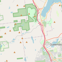
Make a weekend of it.
Closest editorial picks for a meal, a scoop, a pint, a bed, and a sight worth your time.
Eat.
4- Nettle Meadow at The Hitching Post9.1 mi
A tavern and dining spot tied to Nettle Meadow Farm, the noted goat-and-sheep creamery, serving farm-to-table fare in the Lake Luzerne area.
- The Log Jam Restaurant12.1 mi
The Log Jam Restaurant is an authentic log cabin restaurant in Lake George, NY, offering comfortable, casual Adirondack-style dining. It features stone fireplaces and serves American fare, including steaks and a large salad bar.
- Lighthouse Grill14.6 mi
The Lighthouse Grill is a renovated waterfront restaurant in Lake George, offering American, seafood, and plant-based cuisine with artisan drinks and freshest ingredients. It serves breakfast at the marina and is open Friday, Saturday, and…
- Lake George Olive Oil Co.14.7 mi
Lake George Olive Oil Co. is a family-owned business offering a wide selection of fresh extra virgin olive oils, aged balsamic vinegars, and gourmet foods. Visitors can sample from over 50 varieties at their Lake George and Glens Falls loc…
Sip.
3- Caffe Vero14.6 mi
Breakfast, baked goods, sandwiches & house-roasted coffee in a comfy, earth-toned cafe.
- ADK Blend15.1 mi
Northville smoothie & açaí-bowl spot in the Great Sacandaga Lake corridor.
- Uncle Carl's Coffee23.5 mi
Uncle Carl's Coffee serves expertly crafted coffees, artisan teas, pastries, and light savory bites. They also offer daily quiche and bagels, along with homemade soups, frozen meals, local meats, and cheeses.
Sweet.
4- Martha's Dandee Creme11.5 mi
The definitive gateway ice cream stand into the Adirondacks, marked by its towering rooster sign on Route 9 in Queensbury. Towering swirls of soft serve in dozens of handmade flavors plus a grill menu, spring through early fall.
- Cree-Mee Freeze13.2 mi
A summer soft-serve stand near Northville on the Great Sacandaga Lake shore, with twists and specialty sundaes.
- Lake George Baking Company14.7 mi
A bakery with two locations in Queensbury and Lake George, offering custom cakes, breads, rolls, and the original Fudge Fancy. Off-season hours are Wednesday through Sunday, 8 a.m. to 3 p.m.
- Scoop's Ice Cream Parlor14.8 mi
Scoop's Ice Cream Parlor in Lake George offers ice cream and frozen yogurt at inexpensive prices. Located at 327 Canada St, it provides take-out service and accepts credit cards.
Drink.
4- The Long Horn Restaurant & Pub9.5 mi
The Long Horn Restaurant Pub Lake Luzerne, The Long Horn Restaurant Pub Lake Luzerne Online ordering, online order accepting credit card, The Long Horn Restaurant Pub Fast, Relaxed, Healthy and stylish dining experience., Catering and Gi…
- South Shore Dive11.4 mi
South Shore Dive: Casual dining on Great Sacandaga Lake. Made-to-order meals, craft cocktails, lake views. Book now in upstate NY!
- Adirondack Pub & Brewery14.3 mi
Comfortable brewpub offering craft beers & American comfort food amid rustic, lodge-style surrounds.
- Lake George Beach Club14.6 mi
Lively 2-story haunt on the water featuring classic American dishes, live music & TVs for sports.
Stay.
4- Rockwell Falls Inn and Wine Bar5.3 mi
A Victorian-era inn in Lake Luzerne, south of Lake George, with 12 rooms (all with private baths, gas fireplaces, and jacuzzi tubs) and a wine bar open to the public Thursday through Saturday evenings.
- Luzerne Court Motel6.5 mi
A renovated roadside motel on Lake Avenue in Lake Luzerne, 7.5 miles south of Lake George and 25 miles north of Saratoga, with a seasonal pool, nightly campfires, and pet-friendly rooms.
- Saratoga Escape Lodges & RV Resort7.5 mi
Casual resort offering basic wood cabins with kitchens, plus mini-golf, a water park & a lake.
- Luzerne State Campground8.2 mi
Located on Fourth Lake in Lake Luzerne, this state campground provides 173 tent and trailer sites, along with dedicated facilities for campers traveling with horses.
See.
4- Tubby Tubes River Co.9.3 mi
An outfitter for lazy-river tubing on the Lower Hudson in Lake Luzerne, with guided trips, tubes, life jackets, and shuttle included. Ages 2 and up. Memorial Day Weekend through Labor Day.
- Historic Copeland Covered Bridge11.6 mi
The Historic Copeland Covered Bridge is a 35-foot Queenpost truss bridge built in 1879 by Arad Copeland in Edinburg, Saratoga County. Listed on the National Register of Historic Places, it is the only covered bridge remaining in Saratoga C…
- Lake George Expedition Park13.4 mi
Lake George Expedition Park is a place of adventure, discovery, and excitement for attendees of all ages. Located in Lake George, NY. Open Memorial Day - Labor Day.
- Lake George Battlefield Park14.4 mi
Visitors to the Lake George Battlefield can see the sites of the Battle of Lake George (1755), which was part of the siege of Fort William Henry (1757) and a major military camp throughout the French and Indian War (1754-1763).
Add to the record.
Free, takes thirty seconds. Yours forever.
Every page on this site gets better when readers contribute. Mark a peak you’ve climbed, drop a photo, file a field note, or flag a correction — every addition makes the next visitor’s page better.
File a report.
Trail conditions, water level, bug pressure, blowdown. The kind of detail that helps the next person plan.
Write a field note →Spot something off?
Wrong elevation, outdated access notes, a coordinate that's drifted. We'd rather hear it than miss it.
Suggest an edit →


Frequently asked.
- How long is the Hickok Brook Trail (Orange)?The Hickok Brook Trail (Orange) is approximately 0.17 miles (0.3 kilometers) — a short out-and-back suitable for most fitness levels.
- How long does it take to hike the Hickok Brook Trail (Orange)?Most hikers complete the Hickok Brook Trail (Orange) in about 5 minutes at a steady pace with roughly 56 feet of elevation gain. Allow extra time for rest stops, photos, weather, and trail conditions.
- How difficult is the Hickok Brook Trail (Orange)?Based on its length and elevation gain, the Hickok Brook Trail (Orange) is an easy hike (56 ft of climbing over the route) — gentle grades suitable for most fitness levels and families. This is an estimate from route data, not an official trail rating — check current DEC advisories before heading out.