

Wolf Pond.
Wolf Pond appears in the Adirondack trail network without recorded mileage, suggesting either a destination point accessed by other named trails or a very short spur. The pond itself likely serves as a waypoint or turnaround for hikers exploring the surrounding area. Check connecting routes and local maps for access details before planning a trip.
- Leg-stretcherShort and nearly flat — an hour or less
- Peak foliage window — color starts up high and works down the valleys through mid-October.
Seasonal pattern for this trail · tops out ~2,119 ft · live closures appear above
- Has bridgesCrossings
DEC advisories on this trail.
Read the line before you walk it.
What the trailhead is doing today.
Where the hike begins.
Guides, outfitters & shuttles.
If you’re already out here.
Blue Mountain Lake.
The corner of the Park this trail calls home — its hamlets, waters, lodging, and the rest of its field record.
Read the Region→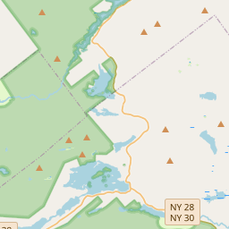
Make a weekend of it.
Closest editorial picks for a meal, a scoop, a pint, a bed, and a sight worth your time.
Eat.
4- Chef Darrell’s Mountain Diner4.6 mi
Chef Darrell’s Mountain Diner: the best Diner in Indian Lake, NY. Order directly online today for takeout or delivery. Save money, support local business!
- Long View Lodge Restaurant7.2 mi
Long View Lodge Restaurant on Long Lake offers a full-service dining experience with an award-winning chef. Known for its quality ingredients and an ever-changing menu in a warm, inviting Adirondack setting, no reservations are necessary.
- Long Lake Diner & Owl’s Head Pub7.3 mi
Long Lake Diner & Owl's Head Pub has been proudly serving food, beverages, and memories since 2004.
- Northern Borne7.6 mi
Family-owned grocery and outdoor-supply store on Long Lake's Main Street, with organic, gluten-free, and vegan options plus a made-to-order deli counter. Camping and outdoor gear stocked alongside the grocery.
Sip.
4- Schoolhouse Grounds Coffee Shop4.8 mi
Seasonal coffee shop inside the 1895 schoolhouse that houses Blue Mountain Designs. Espresso, locally roasted coffee, loose-leaf tea, baked goods, avocado toast, sandwiches, and soups. May through October.
- Waypoint Cafe7.7 mi
Long Lake cafe at 1265 Main St. La Colombe coffee, homemade quiche, avocado toast, artisan sandwiches, salads, poke bowls, soups, and charcuterie. Closed Mondays; weeknight happy hour 4–6 p.m.
- Tamarack Cafe24.4 mi
Tamarack Cafe in downtown Inlet serves a wide variety of breakfast and lunch options, from traditional favorites and specialty bowls to creative salads, sandwiches, and burgers. The cafe also features an 18-hole mini-golf course.
- Blue Line Coffee House24.4 mi
Blue Line Coffee House offers Adirondack-inspired apparel, handcrafted mugs, and mountain-themed gifts, along with pre-packaged coffee and coffee accessories. Products are available for nationwide shipping, and local customers can order dr…
Sweet.
4- Custard’s Last Stand7.2 mi
Custard's Last Stand is a historic ice cream shop in Long Lake, established in 1958, serving a variety of soft frozen custard & hard ice cream, sundaes, specialty shakes, floats, and ice cream sodas. They also offer merchandise and gift cards.
- The Park7.2 mi
Trying to find a fast food restaurant in Long Lake? Pay a visit to The Park. We offer a range of burgers, sides, ice cream, drinks and coffee options.
- The Hungry Crow Market & Café21.7 mi
A downtown North Creek market and cafe serving soft serve alongside scratch-made desserts, next to Hudson River Trading Co. — the cone stop in the Gore and Upper Hudson area.
- Northern Lights Creamery Inc.24.1 mi
An Inlet institution for 40-plus years, a short walk from Arrowhead Park on Fourth Lake — soft serve, homemade gelato, floats, flurries, and specialty sundaes.
Drink.
4- Hex and Hop Tasting Room - Blue Mountain Lake4.9 mi
Hex and Hop is a craft brewery and meadery located in Bloomingdale, New York. They offer full-flavored, high-quality craft beer and mead, made with fresh, locally sourced ingredients, emphasizing community and craft.
- Brookside Hops & Hoagies7.2 mi
Brookside Hops & Hoagies is a casual, family-friendly shop in Long Lake, founded in 2023, offering craft beers and hoagies made with fresh ingredients and Boars Head deli meats. It operates Wednesday through Sunday from 11 AM to 7 PM.
- Indian Lake Restaurant, Tavern and Liquor Store7.8 mi
Indian Lake Restaurant, Tavern and Liquor Store offers a full bar with an extensive bottle selection and local drafts, alongside a menu featuring appetizers, sandwiches, and entrees. The restaurant is currently closed for mud season and wi…
- Lakeview Lanes & The Foul Line Sports Bar23.5 mi
Lakeview Lanes & The Foul Line Sports Bar in Tupper Lake offers 8 lanes of bowling, an arcade, a sports bar, and outdoor seating with food and drinks for family fun.
Stay.
4- Steamboat Landing on Blue Mountain Lake4.8 mi
Steamboat Landing is a comfortable lakeside lodge in Blue Mountain Lake, Adirondack Park, offering renovated accommodations with scenic views and peaceful stays from June to October.
- Blue Mountain Lake Inn5.2 mi
Blue Mountain Lake Inn is a historic 1880s Victorian boarding house offering bed and breakfast lodging and whole house rentals in Blue Mountain Lake, NY, providing hospitality for guests exploring the Adirondack Park.
- Hemlock Hall5.5 mi
A historic family-owned resort on Blue Mountain Lake's north shore, open mid-June through mid-October, with eight lodge rooms, four motel units, nine cottages, and breakfast and dinner included.
- Minnowbrook Conference Center5.6 mi
A 28-acre conference and retreat center on Blue Mountain Lake operated by Syracuse University, with meeting rooms, lakeside patio, and full-service catering for academic and private groups.
See.
4- Blue Mountain Fire Observation Station3.1 mi
Blue Mountain offers a rewarding fire tower hike in the Central Adirondacks, featuring sweeping views and historical significance, with a world-class museum located at its base.
- Adirondack Lakes Center for the Arts4.9 mi
Adirondack Lakes Center for the Arts is a vibrant hub for creativity in the Adirondacks, offering inspiring performances, gallery exhibits, workshops, and community events for all ages.
- Adirondack Experience — Museum on Blue Mountain Lake5.1 mi
More than 20 buildings across 121 acres hold interactive exhibitions on Adirondack life, from boat collections and photography archives to outdoor activities and a research library.
- BLUE MOUNTAIN CENTER7.3 mi
Blue Mountain Center is a working community of writers, artists, and activists set in the heart of the Adirondacks, the largest state park in the continental U.S.
Add to the record.
Free, takes thirty seconds. Yours forever.
Every page on this site gets better when readers contribute. Mark a peak you’ve climbed, drop a photo, file a field note, or flag a correction — every addition makes the next visitor’s page better.
File a report.
Trail conditions, water level, bug pressure, blowdown. The kind of detail that helps the next person plan.
Write a field note →Spot something off?
Wrong elevation, outdated access notes, a coordinate that's drifted. We'd rather hear it than miss it.
Suggest an edit →


Frequently asked.
- How long is the Wolf Pond?The Wolf Pond is approximately 0.01 miles (0.0 kilometers) — a short out-and-back suitable for most fitness levels.