
Sucker Brook Trail.
A 3.3-mile ground trail that gives you enough distance to settle into a rhythm without burning the whole day. The natural surface keeps your footing honest—roots, rocks, and the kind of dirt that shows you've been somewhere when you get back to the car. It's the sort of middle-distance route that works when you want real mileage but need to be somewhere by afternoon.
- Half-day hikeA few hours round trip
- Stick season — bare woods, long views, and icy patches on shaded stretches. Microspikes are cheap insurance.
Seasonal pattern for this trail · live closures appear above
- GroundSurface
Read the line before you walk it.
What the trailhead is doing today.
Where the hike begins.
Guides, outfitters & shuttles.
If you’re already out here.
Speculator.
The corner of the Park this trail calls home — its hamlets, waters, lodging, and the rest of its field record.
Read the Region→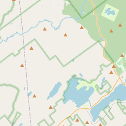
Make a weekend of it.
Closest editorial picks for a meal, a scoop, a pint, a bed, and a sight worth your time.
Eat.
4- Charlie Johns Store10.4 mi
Opened in 1939, Charlie Johns Store is Speculator's anchor general store — 12,000 square feet of full grocery selection, produce, fresh meats, a full deli, bakery, and hardware. Purchased from Charlie Johns in 1971 by Dean Lane, the Lane family has owned and operated it since.
- Firetower Pizza10.5 mi
Hand-tossed pizzeria in Speculator with specialty pies named after Adirondack peaks (Mt Marcy, Snowy Mountain, Whiteface). Wings, baked ziti, white clam pie. Cozy waiting area with retro jukebox and arcade.
- McSweeney's Irish Pub10.9 mi
An Irish-style pub on Route 30 in Indian Lake serving comfort-food classics (shepherd's pie, fish and chips) seven days a week, year-round. The dependable dinner spot in town.
- Chef Darrell’s Mountain Diner14.0 mi
Chef Darrell’s Mountain Diner: the best Diner in Indian Lake, NY. Order directly online today for takeout or delivery. Save money, support local business!
Sip.
4- The PERKS of Speculator10.8 mi
Speculator coffee shop and bakery at 2855 NY-30. Specialty coffee, espresso, fresh-baked bagels and pastries, plus breakfast and lunch sandwiches. Gluten-free options across the bakery case.
- Schoolhouse Grounds Coffee Shop14.5 mi
Seasonal coffee shop inside the 1895 schoolhouse that houses Blue Mountain Designs. Espresso, locally roasted coffee, loose-leaf tea, baked goods, avocado toast, sandwiches, and soups. May through October.
- Uncle Carl's Coffee17.7 mi
Uncle Carl's Coffee serves expertly crafted coffees, artisan teas, pastries, and light savory bites. They also offer daily quiche and bagels, along with homemade soups, frozen meals, local meats, and cheeses.
- Tamarack Cafe21.3 mi
Tamarack Cafe in downtown Inlet serves a wide variety of breakfast and lunch options, from traditional favorites and specialty bowls to creative salads, sandwiches, and burgers. The cafe also features an 18-hole mini-golf course.
Sweet.
4- Speculator Creamery10.8 mi
A family-run village creamery anchoring Speculator's tiny downtown near Lake Pleasant — a genuine community summer hub. Wide-ranging soft-serve flavors, the 16oz Nor'Easter blend, and hand-dipped hard ice cream. Roughly May through September.
- The Hungry Crow Market & Café20.3 mi
A downtown North Creek market and cafe serving soft serve alongside scratch-made desserts, next to Hudson River Trading Co. — the cone stop in the Gore and Upper Hudson area.
- Northern Lights Creamery Inc.20.8 mi
An Inlet institution for 40-plus years, a short walk from Arrowhead Park on Fourth Lake — soft serve, homemade gelato, floats, flurries, and specialty sundaes.
- Custard’s Last Stand21.9 mi
Custard's Last Stand is a historic ice cream shop in Long Lake, established in 1958, serving a variety of soft frozen custard & hard ice cream, sundaes, specialty shakes, floats, and ice cream sodas. They also offer merchandise and gift cards.
Drink.
4- Acorn Pub & Eatery at Oak Mountain9.7 mi
Acorn Pub & Eatery is a dining option at Oak Mountain, offering a place to eat and drink.
- Lemon Tree Brewery10.8 mi
Lemon Tree Brewery is a brewery and taproom located in Speculator, NY, steps from Lake Pleasant. It offers house brews like SASQUATCH HAZY IPA and Blueberry Wheat, along with other local NY State micro-brewed beers and wines in a relaxed s…
- Indian Lake Restaurant, Tavern and Liquor Store10.9 mi
Indian Lake Restaurant, Tavern and Liquor Store offers a full bar with an extensive bottle selection and local drafts, alongside a menu featuring appetizers, sandwiches, and entrees. The restaurant is currently closed for mud season and wi…
- Hex and Hop Tasting Room - Blue Mountain Lake14.3 mi
Hex and Hop is a craft brewery and meadery located in Bloomingdale, New York. They offer full-flavored, high-quality craft beer and mead, made with fresh, locally sourced ingredients, emphasizing community and craft.
Stay.
4- Timberlock2.3 mi
Since 1899, Timberlock has been a family camp offering rustic cabins, lakeside activities, and unforgettable summers in upstate New York.
- Snowy Mountain Inn5.3 mi
Snowy Mountain Inn offers Bed & Breakfast lodging and secluded cottages with lake and mountain views, plus a "guests only" dining room featuring Real Pit Southern BBQ.
- The Lorca Adirondacks6.3 mi
A classic Adirondack drive-in lodge rebuilt as a self-check-in contemporary boutique. Eight rooms walled in natural pine, with fire pits, grills, lawn games, a seasonal pool, and a short walk to Indian Lake.
- Camp Driftwood8.1 mi
Camp Driftwood offers 10 unique and comfortable rental cabins on the shores of Indian Lake in the Adirondack Park, providing a serene escape since 1919.
See.
4- Ampersand Christine Falls10.5 mi
Ampersand Energy LLC.
- Speculator Historical Museum10.6 mi
A small local-history museum on Route 8 in Speculator inside the original Lake Pleasant Town Hall and Library. Open weekends Memorial Day through August, plus weekday hours in summer.
- Great Camp Sagamore14.2 mi
Great Camp Sagamore is a historic Adirondack Great Camp offering multi-day programs, overnight stays, and daily activities focused on history, arts, outdoor recreation, and wellness.
- Adirondack Lakes Center for the Arts14.3 mi
Adirondack Lakes Center for the Arts is a vibrant hub for creativity in the Adirondacks, offering inspiring performances, gallery exhibits, workshops, and community events for all ages.
Add to the record.
Free, takes thirty seconds. Yours forever.
Every page on this site gets better when readers contribute. Mark a peak you’ve climbed, drop a photo, file a field note, or flag a correction — every addition makes the next visitor’s page better.
File a report.
Trail conditions, water level, bug pressure, blowdown. The kind of detail that helps the next person plan.
Write a field note →Spot something off?
Wrong elevation, outdated access notes, a coordinate that's drifted. We'd rather hear it than miss it.
Suggest an edit →
Frequently asked.
- How long is the Sucker Brook Trail?The Sucker Brook Trail is approximately 3.26 miles (5.2 kilometers) — a typical day-hike length.