

Grace Peak Trail.
Unmarked and extending just under a mile and a half, this route to Grace Peak demands careful navigation and rewards those comfortable traveling without blazes. The trail climbs through typical Adirondack forest, offering a quieter experience than more heavily signed paths in the region.
- Family-friendlyShort, easy, and gentle enough for young legs
- Good for snowshoeingNon-technical grade that carries a snowshoe track
Seasonal pattern for this trail · tops out ~4,055 ft · live closures appear above
- lwnNetwork
Read the line before you walk it.
What the trailhead is doing today.
Where the hike begins.
Guides, outfitters & shuttles.
If you’re already out here.
Keene.
The corner of the Park this trail calls home — its hamlets, waters, lodging, and the rest of its field record.
Read the Region→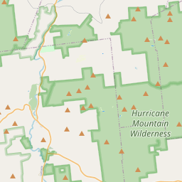
Make a weekend of it.
Closest editorial picks for a meal, a scoop, a pint, a bed, and a sight worth your time.
Eat.
4- Noon Mark Diner8.9 mi
A traditional diner experience, offering hearty meals for travelers and locals in the Adirondack Park.
- Ausable Inn9.1 mi
Comfortable Keene Valley restaurant, bar, liquor store, and small inn. American comfort menu — wings, fish and chips, Montreal brisket, steak au poivre, plus the locally famous Hungarian mushroom soup.
- Forty Six13.0 mi
A small fine-dining room on Route 9N in Keene at the Dartbrook Lodge campus, with a seasonal menu that rotates regularly and elegant plating. Reservations recommended.
- The Deer's Head Inn Restaurant13.9 mi
The Deer's Head Inn is a historic Elizabethtown tavern and restaurant — among the oldest inns in the Adirondacks — serving pub fare and regional dishes.
Sip.
4- Old Mountain Coffee Company8.9 mi
Great Coffee, Great Food, Great Baked Goods & Great People. Stop in to enjoy our house roasted coffee, browse our menu for a bite to eat or grab a delicious treat from our bakery. Order Online for pickup or stop in.
- Counter Space14.0 mi
A casual cafe in Elizabethtown serving coffee, espresso, and light bites — a local gathering spot in the Essex County seat.
- Pleasant Valley Cafe14.0 mi
A local cafe in Elizabethtown serving breakfast, lunch, coffee, and comfort food in the heart of the Boquet Valley.
- Life Church Cafe14.1 mi
Life Church Elizabethtown is a local church dedicated to connecting lives and building community.
Sweet.
4- Black Rooster Maple13.2 mi
Pure Adirondack Maple Syrup, Maple Cream, Bourbon Barrel Maple Syrup
- Cedar Run Bakery & Market13.7 mi
Cedar Run Bakery & Market offers scratch-made baked goods, deli items, fresh menu options, and take & bake meals, alongside a selection of wine and spirits. They are open Friday through Monday from 8 AM to 6 PM.
- Adirondack Corner Store17.2 mi
A longtime deli and general store at the corner of Route 73 in Lake Placid with an ice cream counter and subs — a locals' spot off the Main Street tourist row.
- Ben & Jerry's18.3 mi
The Ben & Jerry's scoop shop on Lake Placid's Main Street above Mirror Lake — the Vermont brand's pints and cones in the heart of the village.
Drink.
4- Paradox Brewery8.2 mi
Paradox Brewery offers a diverse tap selection, a full menu with pizza, burgers, and BBQ, and an expansive mountain landscape.
- The Old Mine13.2 mi
The Old Miners Tavern is a historic Adirondack tavern in Moriah, NY, offering classic bar food like juicy burgers and chicken wings, a full bar with rotating craft beers, and a welcoming atmosphere for friends to gather.
- Flanagan's Pub & Grill15.5 mi
Long-standing, log cabin–style haunt offering traditional pub grub, draft beer & cocktails.
- The Brown Swan and Tavern15.5 mi
The Brown Swan and Tavern in Schroon Lake, NY, offers Adirondacks-inspired cuisine with locally sourced ingredients in a family-friendly setting.
Stay.
4- Blue Ridge Falls Campsites7.1 mi
Blue Ridge Falls Campsites is a campground in North Hudson, NY, offering RV, pop-up, and tent camping near Schroon Lake and I-87. Guests can enjoy Wi-Fi, a swimming pool, tennis courts, and a camp store, with easy access to area attraction…
- Rooster Comb Inn9.0 mi
Rooster Comb Inn is a dog-friendly inn located in the heart of Keene Valley, NY, offering comfortable, rustic lodging within walking distance to Adirondack trailheads and local eateries. It features shared amenities like a full kitchen and…
- Keene Valley Lodge9.2 mi
A seven-room lodge and three-bedroom cottage at the center of Keene Valley, with breakfast and direct walk access to the Great Range trailheads and village restaurants.
- Blue Ridge Motel9.5 mi
A renovated roadside motel on Route 9 between Schroon Lake and North Hudson, with private baths, AC, wifi, a pet-friendly room, and a continental breakfast in the lobby.
See.
4- Hurricane Mountain Fire Tower12.5 mi
Perched atop Hurricane Mountain, this historic fire tower provides hikers with unparalleled 360-degree views of the Adirondacks, Lake Champlain, and Vermont's Green Mountains.
- Lake Placid Bobsled Experience13.2 mi
Mt Van Hoevenberg, a Lake Placid Legacy Site, offers the thrilling Skeleton Experience for visitors and youth bobsled and skeleton programs, continuing its Olympic legacy as a venue for winter sports.
- Cliffside Coaster13.2 mi
The Cliffside Coaster in Lake Placid, NY, is the longest coaster in North America. It follows the path of Olympic history at Mt Van Hoevenberg.
- Keene Arts13.4 mi
Keene Arts is a venue in Keene, NY, hosting diverse events including art exhibits, concerts, film screenings, and a winter farmers market.
Add to the record.
Free, takes thirty seconds. Yours forever.
Every page on this site gets better when readers contribute. Mark a peak you’ve climbed, drop a photo, file a field note, or flag a correction — every addition makes the next visitor’s page better.
Add a shot.
Sunrise on the dock, a cairn at the summit, a bend on the trail. Your camera roll, our archive.
Add a photo →File a report.
Trail conditions, water level, bug pressure, blowdown. The kind of detail that helps the next person plan.
Write a field note →Spot something off?
Wrong elevation, outdated access notes, a coordinate that's drifted. We'd rather hear it than miss it.
Suggest an edit →


Frequently asked.
- How long is the Grace Peak Trail?The Grace Peak Trail is approximately 0.99 miles (1.6 kilometers) — a short out-and-back suitable for most fitness levels.
- How long does it take to hike the Grace Peak Trail?Most hikers complete the Grace Peak Trail in about 35 minutes at a steady pace with roughly 259 feet of elevation gain. Allow extra time for rest stops, photos, weather, and trail conditions.
- How difficult is the Grace Peak Trail?Based on its length and elevation gain, the Grace Peak Trail is an easy hike (259 ft of climbing over the route) — gentle grades suitable for most fitness levels and families. This is an estimate from route data, not an official trail rating — check current DEC advisories before heading out.