

Dudley Brook Trail.
Dudley Brook Trail covers just over half a mile through the Adirondacks, making it one of the shorter named routes in the region. At 0.6 miles, it's brief enough for a quick out-and-back or as a connector between longer segments. Expect minimal elevation change and a walk that can be completed in well under an hour.
- Leg-stretcherShort and nearly flat — an hour or less
- Family-friendlyShort, easy, and gentle enough for young legs
- Good for snowshoeingNon-technical grade that carries a snowshoe track
- Peak foliage window — color starts up high and works down the valleys through mid-October.
Seasonal pattern for this trail · tops out ~1,972 ft · live closures appear above
- GroundSurface
Read the line before you walk it.
What the trailhead is doing today.
Where the hike begins.
Guides, outfitters & shuttles.
If you’re already out here.
Lake Placid.
The corner of the Park this trail calls home — its hamlets, waters, lodging, and the rest of its field record.
Read the Region→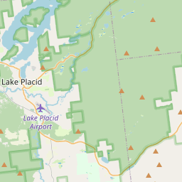
Make a weekend of it.
Closest editorial picks for a meal, a scoop, a pint, a bed, and a sight worth your time.
Eat.
4- Noon Mark Diner14.1 mi
A traditional diner experience, offering hearty meals for travelers and locals in the Adirondack Park.
- Ausable Inn14.2 mi
Comfortable Keene Valley restaurant, bar, liquor store, and small inn. American comfort menu — wings, fish and chips, Montreal brisket, steak au poivre, plus the locally famous Hungarian mushroom soup.
- Salt of the Earth Bistro14.4 mi
A small reservation-required bistro on Sentinel Road in Lake Placid, serving twisted takes on traditional dishes including a signature peanut stew. Parties of six or fewer.
- Lisa G's14.8 mi
Creative American fare with global twists in a welcoming space with vivid murals & waterside patio.
Sip.
4- Old Mountain Coffee Company14.1 mi
Great Coffee, Great Food, Great Baked Goods & Great People. Stop in to enjoy our house roasted coffee, browse our menu for a bite to eat or grab a delicious treat from our bakery. Order Online for pickup or stop in.
- Origin Coffee15.1 mi
Origin Coffee Co. is a specialty coffee shop with locations in Lake Placid and Saranac Lake, offering a chef-driven breakfast and lunch menu served all day. It serves as a community gathering spot for locals and Adirondack travelers.
- The Coffee Bar15.4 mi
A small coffee bar on Main Street in Lake Placid with Mirror Lake and Whiteface Mountain views, pulling shots from Tug Hill Artisan Roasters beans.
- Simply Gourmet16.0 mi
Simply Gourmet in Lake Placid offers daily breakfast and lunch with a focus on clean food, using fresh, local, and sustainable ingredients free of additives or preservatives. They also provide comprehensive catering services for various ev…
Sweet.
4- Adirondack Corner Store14.1 mi
A longtime deli and general store at the corner of Route 73 in Lake Placid with an ice cream counter and subs — a locals' spot off the Main Street tourist row.
- Emma's Lake Placid Creamery14.8 mi
A 1950s-themed creamery in the heart of walkable Lake Placid, famous for its Maple Creme soft serve alongside 16 hard flavors, gelato, sorbet, and old-fashioned malts. The reliable apres-hike treat.
- Ben & Jerry's14.9 mi
The Ben & Jerry's scoop shop on Lake Placid's Main Street above Mirror Lake — the Vermont brand's pints and cones in the heart of the village.
- Donnelly's Soft Ice Cream16.7 mi
A fourth-generation Saranac Lake institution on a former dairy farm, serving exactly one rotating soft-serve flavor each day — twisted with vanilla on the same 1953 machine. Cash only; check the daily flavor. Memorial Day to Labor Day.
Drink.
4- Lake Placid Pub & Brewery15.1 mi
A brewpub on Mirror Lake Drive in Lake Placid since 1996, with 12 house beers on tap including the original Ubu Ale, a downstairs Irish pub, and a deck over Mirror Lake.
- Top of the Park15.7 mi
A Lake Placid bar on Main Street offering a curated selection of wine, scotch, bourbon, craft beer, and top-shelf liquors, complemented by small plates and signature cocktails. Enjoy 'Spirits with a View' from its large deck overlooking Mi…
- Paradox Brewery16.2 mi
Paradox Brewery offers a diverse tap selection, a full menu with pizza, burgers, and BBQ, and an expansive mountain landscape.
- Ray Brook Brewhouse16.5 mi
Ray Brook Brewhouse is a unique brewery in Ray Brook, NY, offering wild and traditional brews paired with adventurous dishes made from local and exotic ingredients.
— 15.1 mi to the nearest pint; appoint a driver.
Stay.
4- Adirondack Loj8.4 mi
Adirondak Loj is a lodging and camping facility operated by the Adirondack Mountain Club (ADK) in Lake Placid, New York. It serves as a hub for outdoor programs and access to the High Peaks region, offering accommodations and information f…
- The Pilot's House9.0 mi
The Pilot's House sits above the Outfitter's storefront, with a wonderful view of Vanderwhacker Mt. and the Hudson River, and Santanoni Mt as a backdrop.
- Van Hoevenberg Cabins12.3 mi
Eight pet-friendly cabins on Cascade Road outside Lake Placid, each named for a High Peaks summit, with kitchenettes and queen, king, or twin configurations. Year-round operation.
- Cascade Inn and Restaurant12.7 mi
A roadside motel and restaurant on Cascade Road between Lake Placid and Keene, with Whiteface views, Italian classics, and ski-out cross-country access from the door.
See.
4- Camp Santanoni6.9 mi
Built by the wealthy Pruyn family, Camp Santanoni is a publicly-owned National Historic Landmark, offering visitors a glimpse into the early Adirondack Great Camp era and opportunities for outdoor recreation.
- Newcomb Ski Slope10.9 mi
2 slope municipal ski slope free to the public.
- Cliffside Coaster11.5 mi
The Cliffside Coaster in Lake Placid, NY, is the longest coaster in North America. It follows the path of Olympic history at Mt Van Hoevenberg.
- Lake Placid Bobsled Experience11.5 mi
Mt Van Hoevenberg, a Lake Placid Legacy Site, offers the thrilling Skeleton Experience for visitors and youth bobsled and skeleton programs, continuing its Olympic legacy as a venue for winter sports.
Add to the record.
Free, takes thirty seconds. Yours forever.
Every page on this site gets better when readers contribute. Mark a peak you’ve climbed, drop a photo, file a field note, or flag a correction — every addition makes the next visitor’s page better.
File a report.
Trail conditions, water level, bug pressure, blowdown. The kind of detail that helps the next person plan.
Write a field note →Spot something off?
Wrong elevation, outdated access notes, a coordinate that's drifted. We'd rather hear it than miss it.
Suggest an edit →


Frequently asked.
- How long is the Dudley Brook Trail?The Dudley Brook Trail is approximately 0.58 miles (0.9 kilometers) — a short out-and-back suitable for most fitness levels.
- How long does it take to hike the Dudley Brook Trail?Most hikers complete the Dudley Brook Trail in about 20 minutes at a steady pace with roughly 145 feet of elevation gain. Allow extra time for rest stops, photos, weather, and trail conditions.
- How difficult is the Dudley Brook Trail?Based on its length and elevation gain, the Dudley Brook Trail is an easy hike (145 ft of climbing over the route) — gentle grades suitable for most fitness levels and families. This is an estimate from route data, not an official trail rating — check current DEC advisories before heading out.