

Columbian Road.
A 0.9-mile trail that gets you in and out fast when you need a walk but not an expedition. The distance works for an early-morning loop before work or a late-afternoon shake-out after driving all day. It won't give you views or a destination, but it will give you woods and movement, which is sometimes exactly what you want.
- Leg-stretcherShort and nearly flat — an hour or less
- Peak foliage window — color starts up high and works down the valleys through mid-October.
Seasonal pattern for this trail · live closures appear above
Read the line before you walk it.
What the trailhead is doing today.
Where the hike begins.
Guides, outfitters & shuttles.
If you’re already out here.
Tupper Lake.
The corner of the Park this trail calls home — its hamlets, waters, lodging, and the rest of its field record.
Read the Region→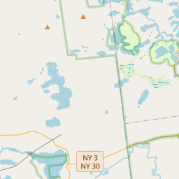
Make a weekend of it.
Closest editorial picks for a meal, a scoop, a pint, a bed, and a sight worth your time.
Eat.
4- The Clubhouse at Tupper Lake Country Club18.1 mi
The Clubhouse Restaurant & Bar at Tupper Lake Golf Club offers a full bar, weekly specials, and hosts events and weddings. Open to the public, enjoy meals with a view of the golf course.
- PorkBusters BBQ18.2 mi
PorkBusters BBQ is a Tupper Lake restaurant serving barbecue dishes seven days a week from 11 AM to 9 PM. They offer a menu for dine-in or takeout, plus catering for parties and events.
- Amado19.0 mi
A small restaurant on Cliff Avenue in Tupper Lake serving Brazilian dishes (moqueca, feijoada) alongside lamb pot pie, fish fry, and a clearly marked vegan section. Homemade desserts.
- Guido's Pizzeria19.1 mi
Guido's Pizzeria in Tupper Lake has been serving hand-thrown pizzas, subs, calzones, dinners, and wings since 1988. They offer free delivery within the Town of Tupper Lake on any size order and make fresh dough daily.
— 18.1 mi to the nearest table out here; plan the drive to dinner.
Sweet.
1— 19.3 mi to the nearest scoop; save it for the ride home.
Drink.
2- Raquette River Brewing18.4 mi
A family- and dog-friendly taproom pouring year-round craft beer alongside four permanent food trucks, from wood-fired pizza to Carolina barbecue.
- Lakeview Lanes & The Foul Line Sports Bar18.8 mi
Lakeview Lanes & The Foul Line Sports Bar in Tupper Lake offers 8 lanes of bowling, an arcade, a sports bar, and outdoor seating with food and drinks for family fun.
— 18.4 mi to the nearest pint; appoint a driver.
Stay.
4- The Lodge at Seveys11.8 mi
The Lodge @ Seveys is a spacious and recently remodeled facility that serves as the perfect family getaway in the heart of the Adirondacks. With seven bedrooms accommodating up to fourteen people, the lodge features a fully equipped…
- Red Top Inn LLC17.7 mi
No-frills lodgings by Tupper Lake with boat rentals and nightly bonfires by the lake.
- Pine Terrace Motel & Resort17.9 mi
Waterfront motel offers basic cabins with kitchens & WiFi plus pool & tennis courts.
- Norridgewock Lodge19.6 mi
NORRIDGEWOCK LODGE, an oasis in the Adirondack Mountains. Our lakeside resort is the perfect remote vacation in the wilderness of the Beaver River. Book online!
See.
4- Adirondack Railroad18.6 mi
Adirondack Railroad offers scenic train experiences through the beautiful outdoor scenery of New York, departing from stations in Utica, Thendara, and Tupper Lake. They provide various themed rides, including special events and multi-hour…
- The Adirondack Sky Center & Observatory19.2 mi
Free 2-Day Space Camp at the Adirondack Sky Center Calling all future space explorers— get ready for an out-of-this-world adventure! Join us to explore some of the most fascinating topics in outer space! We’ll cover black holes, space tra…
- The Wild Center20.3 mi
Live animals, hands-on exhibits & forest trails connect guests with the Adirondacks.
- John Dillon Park21.5 mi
John Dillon Park, run by Paul Smith's College, is an accessible outdoor recreation area in Long Lake featuring a 3.5-mile accessible trail system, lean-tos, and fishing access. It is closed for the summer 2026 season for water system impro…
— 18.6 mi to the nearest sight on file; fold it into the drive.
Add to the record.
Free, takes thirty seconds. Yours forever.
Every page on this site gets better when readers contribute. Mark a peak you’ve climbed, drop a photo, file a field note, or flag a correction — every addition makes the next visitor’s page better.
File a report.
Trail conditions, water level, bug pressure, blowdown. The kind of detail that helps the next person plan.
Write a field note →Spot something off?
Wrong elevation, outdated access notes, a coordinate that's drifted. We'd rather hear it than miss it.
Suggest an edit →


Frequently asked.
- How long is the Columbian Road?The Columbian Road is approximately 0.85 miles (1.4 kilometers) — a short out-and-back suitable for most fitness levels.