

West Old Farm Road Leg.
West Old Farm Road Leg is a half-mile connector in the Adirondack trail network, short enough to link other routes or serve as a quick out-and-back. The "Old Farm Road" designation suggests historic agricultural use, typical of trails that follow former settlement corridors through the park. At under a kilometer, it's the sort of segment that matters more for navigation than destination.
- Good for snowshoeingNon-technical grade that carries a snowshoe track
- Peak foliage window — color starts up high and works down the valleys through mid-October.
Seasonal pattern for this trail · tops out ~1,342 ft · live closures appear above
- GroundSurface
Read the line before you walk it.
What the trailhead is doing today.
Where the hike begins.
Guides, outfitters & shuttles.
If you’re already out here.
Lake George.
The corner of the Park this trail calls home — its hamlets, waters, lodging, and the rest of its field record.
Read the Region→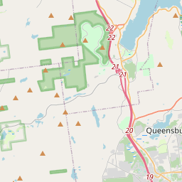
Make a weekend of it.
Closest editorial picks for a meal, a scoop, a pint, a bed, and a sight worth your time.
Eat.
4- Beyond the Sea4.0 mi
An upscale fine dining establishment offering a sophisticated menu of meticulously prepared dishes in the Lake George region.
- Lone Bull Pancake & Steak House7.6 mi
Hearty plates of traditional daytime fare round out the menu at this seasonal, rustic establishment.
- Antonio's Bayside Bistro7.8 mi
Discover a unique dining experience at Antonio's Bayside Bistro, where tradition meets innovation on the serene shores of Lake George. Enjoy exquisite Italian cuisine, breathtaking views, and warm hospitality.
- The Olde Log Inn10.1 mi
American classics served in a log cabin with a stone fireplace & stuffed grizzly bear, plus a patio.
Sip.
3- Caffe Vero10.6 mi
Breakfast, baked goods, sandwiches & house-roasted coffee in a comfy, earth-toned cafe.
- 9 Mile Coffee Co22.3 mi
9 Mile Coffee Co. is a coffee shop in downtown Schroon Lake, NY, serving a variety of coffees, teas, smoothies, sandwiches, and soups. They also sell their custom coffee blends and gift cards online.
- Cupola Crepes22.4 mi
Family-run creperie at 1095 Main Street in Schroon Lake. Sweet and savory crepes (gluten-free batter available), scones, coffee, and soft serve. Wednesday through Sunday.
Sweet.
4- Cate's Creamery3.7 mi
The main ice cream spot in the heart of Bolton Landing village on Lake George's quieter west shore — soft serve, hand-dipped hard ice cream, and slushies, a short stroll from the lakefront.
- Scoop's Ice Cream Parlor10.4 mi
Scoop's Ice Cream Parlor in Lake George offers ice cream and frozen yogurt at inexpensive prices. Located at 327 Canada St, it provides take-out service and accepts credit cards.
- Lake George Baking Company10.5 mi
A bakery with two locations in Queensbury and Lake George, offering custom cakes, breads, rolls, and the original Fudge Fancy. Off-season hours are Wednesday through Sunday, 8 a.m. to 3 p.m.
- Main Street Ice Cream Parlor13.5 mi
Create a free link in bio with Bio Sites by Squarespace. Showcase your links, earn money, and grow your brand online, all with one link.
Drink.
4- Diamond Point Grille6.9 mi
Diamond Point Grille is a casual family restaurant located in Diamond Point, NY, on Lake George. It specializes as a fish and burger joint, serving simple comfort food made with local, affordable ingredients in a relaxed setting.
- Ridge Terrace Restaurant-Cocktail Lounge7.3 mi
The Ridge Terrace is a chef-owned and operated restaurant in Lake George, NY, celebrating its 60th season. They offer a diverse menu, including a children's menu, and can accommodate special dietary requests.
- Springbrook Hollow Farm Distillery9.9 mi
Springbrook Hollow Farm Distillery, located in the Adirondack Mountains, crafts a variety of spirits including vodka, gin, moonshine, and whiskeys. Visitors can enjoy a beautiful tasting room offering specialty cocktails, local beer, wine,…
- George Henry's10.1 mi
A family-owned bar and grill on Main Street in Warrensburg doing made-to-order American grill plates, hearty steak and chicken specialties, local craft beer, and fresh-baked breads from area bakeries. No fast food.
Stay.
4- Boathouse Waterfront Lodging3.8 mi
Boathouse Waterfront Lodging is a historic, adults-only bed and breakfast located directly on the shores of Lake George in Bolton Landing, NY. It is the only lodging of its kind situated right on the water, offering a unique setting for ro…
- The Sagamore Resort4.1 mi
Iconic Bolton Landing resort on Lake George with Donald Ross-designed golf, lakeside dining, spa, and classic summer-resort amenities.
- Blue Water Manor4.9 mi
Rustic mountain lodge offers log cabins, cottages & rooms plus lake views & a picnic area.
- The Lodges at Bolton Landing4.9 mi
A collection of lodges on Lake George's Northwest Bay, providing direct water access with complimentary boats and a renovated pool area.
See.
4- Bolton Historical Museum4.0 mi
The Bolton Historical Museum, located on the shores of Lake George in Bolton Landing, educates visitors about the history of Bolton, Lake George, and the surrounding region.
- Schumann Preserve at Pilot Knob5.4 mi
Schumann Preserve at Pilot Knob offers a moderately steep, 0.7-mile hike to a gazebo with expansive views of Lake George and the Adirondacks. An additional blue trail leads to a seasonal waterfall.
- Tour Boat Lake George at Blue Lagoon Resort7.0 mi
Tour Boat Lake George at Blue Lagoon Resort offers private guided boat tours of Lake George on a 24-foot bowrider motorboat. Guests enjoy sightseeing, swimming, tubing, and cliff jumping with an experienced captain.
- Godwin Preserve7.5 mi
Godwin Preserve in the Town of Bolton offers two hiking trails totaling 112 acres, with moderate difficulty. The Yellow Trail provides views of Amy's Park wetlands and High Nopit, while the Red Trail connects to Pole Hill Pond Preserve.
Add to the record.
Free, takes thirty seconds. Yours forever.
Every page on this site gets better when readers contribute. Mark a peak you’ve climbed, drop a photo, file a field note, or flag a correction — every addition makes the next visitor’s page better.
File a report.
Trail conditions, water level, bug pressure, blowdown. The kind of detail that helps the next person plan.
Write a field note →Spot something off?
Wrong elevation, outdated access notes, a coordinate that's drifted. We'd rather hear it than miss it.
Suggest an edit →


Frequently asked.
- How long is the West Old Farm Road Leg?The West Old Farm Road Leg is approximately 0.58 miles (0.9 kilometers) — a short out-and-back suitable for most fitness levels.
- How long does it take to hike the West Old Farm Road Leg?Most hikers complete the West Old Farm Road Leg in about 25 minutes at a steady pace with roughly 322 feet of elevation gain. Allow extra time for rest stops, photos, weather, and trail conditions.
- How difficult is the West Old Farm Road Leg?Based on its length and elevation gain, the West Old Farm Road Leg is a moderate hike (322 ft of climbing over the route) — steady climbing that rewards a reasonable base of fitness. This is an estimate from route data, not an official trail rating — check current DEC advisories before heading out.