

Ski Trail (Red).
A 0.2-mile leg-stretcher that climbs 105 feet in about 9 minutes, this ground trail near Warner Pond delivers the quickest hit of elevation in the region. The grade is easy but consistent enough to get your heart rate up without committing to a real hike. Use it as a warm-up before paddling Warner Pond or as a turnaround point if you're testing gear or breaking in boots.
- Leg-stretcherShort and nearly flat — an hour or less
- Family-friendlyShort, easy, and gentle enough for young legs
- Good for snowshoeingNon-technical grade that carries a snowshoe track
- Peak foliage window — color starts up high and works down the valleys through mid-October.
Seasonal pattern for this trail · tops out ~1,522 ft · live closures appear above
- GroundSurface
Read the line before you walk it.
What the trailhead is doing today.
Where the hike begins.
Guides, outfitters & shuttles.
If you’re already out here.
Great Sacandaga Lake.
The corner of the Park this trail calls home — its hamlets, waters, lodging, and the rest of its field record.
Read the Region→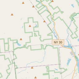
Make a weekend of it.
Closest editorial picks for a meal, a scoop, a pint, a bed, and a sight worth your time.
Eat.
4- Lanzi's on the Lake1.6 mi
An Italian restaurant and wedding venue on Route 30 in Mayfield on the Great Sacandaga shore, with floor-to-ceiling windows, a large deck, and event capacity up to 200.
- The Local6.4 mi
Fine-dining restaurant in the Great Sacandaga Lake region.
- Klippel's Kozy Korner Cafe6.4 mi
India’s largest Food Delivery, Dining and Restaurant Discovery Service. Better food for more people.
- Alpine Grille13.6 mi
A long-running roadside steak-and-seafood house on the Sacandaga, between Northville and Wells. Generous portions, a lively bar, and the kind of dining room where the staff knows the regulars by name. Reservations recommended on weekends.
Sip.
3- ADK Blend6.4 mi
Northville smoothie & açaí-bowl spot in the Great Sacandaga Lake corridor.
- Uncle Carl's Coffee17.8 mi
Uncle Carl's Coffee serves expertly crafted coffees, artisan teas, pastries, and light savory bites. They also offer daily quiche and bagels, along with homemade soups, frozen meals, local meats, and cheeses.
- The PERKS of Speculator24.4 mi
Speculator coffee shop and bakery at 2855 NY-30. Specialty coffee, espresso, fresh-baked bagels and pastries, plus breakfast and lunch sandwiches. Gluten-free options across the bakery case.
Sweet.
4- Zippy's Ice Cream3.3 mi
A roadside soft-serve stand on Route 30 in Mayfield near the Park's southern gateway and Great Sacandaga Lake, known for dense, cold soft serve with weekly flavors like maple and coffee.
- The Village Scoop6.3 mi
A walk-up ice cream shop on Northville's Main Street at the north tip of Great Sacandaga Lake — hard ice cream and soft serve with a wide flavor selection.
- Cree-Mee Freeze7.4 mi
A summer soft-serve stand near Northville on the Great Sacandaga Lake shore, with twists and specialty sundaes.
- Speculator Creamery24.4 mi
A family-run village creamery anchoring Speculator's tiny downtown near Lake Pleasant — a genuine community summer hub. Wide-ranging soft-serve flavors, the 16oz Nor'Easter blend, and hand-dipped hard ice cream. Roughly May through September.
Drink.
4- Sacandaga Spirits3.1 mi
Located in Mayfield, Sacandaga Spirits offers a selection of handcrafted wines, liquors, and ciders. Visitors are invited to experience their local Adirondack offerings.
- Sport Island Pub5.7 mi
Sport Island Pub offers great food, refreshing drinks, and friendly entertainment on the Great Sacandaga Lake. This family-run restaurant, with three generations of service, invites you to enjoy exquisite dishes for dine-in or take-out.
- South Shore Dive8.9 mi
South Shore Dive: Casual dining on Great Sacandaga Lake. Made-to-order meals, craft cocktails, lake views. Book now in upstate NY!
- Nick Stoner Inn Seafood & Steakhouse11.7 mi
Caroga Lake restaurant at 1810 NY-10 doing hand-cut, in-house steaks, fresh seafood, and a tight made-to-order menu. 19 craft beers on tap, NY Finger Lakes wines. Open Thursday through Sunday; Sunday 11–5.
Stay.
4- Sunset Bay Vacation Resort— RV Park & Marina1.9 mi
Sunset Bay Vacation Resort is an all-seasonal RV Park and Marina on the southwestern shore of Great Sacandaga Lake. This gated community offers full RV hookups, a private beach, marina, and boat launch, along with amenities like a cafe, pl…
- Inn on Great Sacandaga Lake2.0 mi
The Inn on Great Sacandaga Lake, also known as Maguire's Great Sacandaga B&B, is a lakefront bed and breakfast featuring comfortable rooms, complimentary breakfast, and amenities like a pool, game room, and 300 feet of sandy lakefront.
- Northampton Beach Campground4.7 mi
Northampton Beach Campground is situated on the northwest corner of 29-mile long Great Sacandaga Lake. It offers a variety of large, level camping sites, ranging from secluded spots among white pines to open areas along the sandy shoreline.
- The Great Sacandaga Motel5.7 mi
This classic roadside motel offers comfortable, practical rooms for year-round stays in Northville, just steps from the Great Sacandaga Lake.
See.
3- Grandview Mini Golf3.4 mi
An 18-hole lakeside mini golf course on Great Sacandaga Lake in Mayfield, with an arcade, ice cream novelties, snacks, and party hosting — reachable by boat or car. Open seven days, noon to 8pm; $8 unlimited all-day play.
- Historic Copeland Covered Bridge9.1 mi
The Historic Copeland Covered Bridge is a 35-foot Queenpost truss bridge built in 1879 by Arad Copeland in Edinburg, Saratoga County. Listed on the National Register of Historic Places, it is the only covered bridge remaining in Saratoga C…
- Speculator Historical Museum24.6 mi
A small local-history museum on Route 8 in Speculator inside the original Lake Pleasant Town Hall and Library. Open weekends Memorial Day through August, plus weekday hours in summer.
Add to the record.
Free, takes thirty seconds. Yours forever.
Every page on this site gets better when readers contribute. Mark a peak you’ve climbed, drop a photo, file a field note, or flag a correction — every addition makes the next visitor’s page better.
File a report.
Trail conditions, water level, bug pressure, blowdown. The kind of detail that helps the next person plan.
Write a field note →Spot something off?
Wrong elevation, outdated access notes, a coordinate that's drifted. We'd rather hear it than miss it.
Suggest an edit →


Frequently asked.
- How long is the Ski Trail (Red)?The Ski Trail (Red) is approximately 0.19 miles (0.3 kilometers) — a short out-and-back suitable for most fitness levels.
- How long does it take to hike the Ski Trail (Red)?Most hikers complete the Ski Trail (Red) in about 10 minutes at a steady pace with roughly 105 feet of elevation gain. Allow extra time for rest stops, photos, weather, and trail conditions.
- How difficult is the Ski Trail (Red)?Based on its length and elevation gain, the Ski Trail (Red) is an easy hike (105 ft of climbing over the route) — gentle grades suitable for most fitness levels and families. This is an estimate from route data, not an official trail rating — check current DEC advisories before heading out.