

Nature Trail.
A short, accessible loop or out-and-back path just under a mile, suitable for families or a quick stretch of the legs. The name suggests interpretive features or gentle terrain, though specifics vary by location. At 0.6 miles, expect 20–30 minutes round trip at an easy pace.
- Leg-stretcherShort and nearly flat — an hour or less
- Family-friendlyShort, easy, and gentle enough for young legs
- Good for snowshoeingNon-technical grade that carries a snowshoe track
- Peak foliage window — color starts up high and works down the valleys through mid-October.
Seasonal pattern for this trail · tops out ~840 ft · live closures appear above
Read the line before you walk it.
What the trailhead is doing today.
Where the hike begins.
Guides, outfitters & shuttles.
If you’re already out here.
Lake George.
The corner of the Park this trail calls home — its hamlets, waters, lodging, and the rest of its field record.
Read the Region→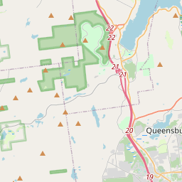
Make a weekend of it.
Closest editorial picks for a meal, a scoop, a pint, a bed, and a sight worth your time.
Eat.
4- Oscar's Smokehouse3.5 mi
Oscar's Smokehouse has been making fine smoked meats and cheeses for over 70 years in Warrensburg, NY.
- Canepa’s Pizza Shop3.7 mi
Canepa's Pizza Shop, formerly The Pizza Shop of Warrensburg, has been serving award-winning pizza since 2014. Featured on Rachael Ray and PMQ Magazine, they offer authentic Italian hospitality with family recipes and fine ingredients.
- Deli & Meat Store of the North3.8 mi
Deli & Meat Store of the North is a long-standing deli, meat market, and grocery store in Warrensburg, NY, known for its fresh meats, famous 18-inch subs, daily hot items, all-day breakfast, pizza, and catering services.
- Tommy Guns Pizzeria4.3 mi
Tommy Guns Pizzeria & Bar in Warrensburg, NY, serves delicious pizza, wings, and a variety of other dishes crafted from top-notch ingredients. It offers a cozy and inviting atmosphere, perfect for meals with family and friends or for hosti…
Sip.
3- Caffe Vero9.7 mi
Breakfast, baked goods, sandwiches & house-roasted coffee in a comfy, earth-toned cafe.
- 9 Mile Coffee Co20.0 mi
9 Mile Coffee Co. is a coffee shop in downtown Schroon Lake, NY, serving a variety of coffees, teas, smoothies, sandwiches, and soups. They also sell their custom coffee blends and gift cards online.
- Cupola Crepes20.1 mi
Family-run creperie at 1095 Main Street in Schroon Lake. Sweet and savory crepes (gluten-free batter available), scones, coffee, and soft serve. Wednesday through Sunday.
Sweet.
4- Main Street Ice Cream Parlor7.1 mi
Create a free link in bio with Bio Sites by Squarespace. Showcase your links, earn money, and grow your brand online, all with one link.
- Crossroads Ice Cream7.7 mi
The ice cream counter at The Crossroads, a country and outdoors store off I-87 Exit 25 in Chestertown between Schroon and Brant Lake — hard and soft ice cream on the road north.
- Cate's Creamery7.8 mi
The main ice cream spot in the heart of Bolton Landing village on Lake George's quieter west shore — soft serve, hand-dipped hard ice cream, and slushies, a short stroll from the lakefront.
- Scoop's Ice Cream Parlor9.6 mi
Scoop's Ice Cream Parlor in Lake George offers ice cream and frozen yogurt at inexpensive prices. Located at 327 Canada St, it provides take-out service and accepts credit cards.
Drink.
4- Bandstand Brew Works3.6 mi
Bandstand Brew Works is a family-friendly brewpub in Warrensburg, NY, offering handcrafted beers, cocktails, and a diverse menu made with local ingredients. It's a community gathering spot known for live music, weekly events, and a vibrant…
- George Henry's4.4 mi
A family-owned bar and grill on Main Street in Warrensburg doing made-to-order American grill plates, hearty steak and chicken specialties, local craft beer, and fresh-baked breads from area bakeries. No fast food.
- Crazy Loon Distillery6.5 mi
At the Crazy Loon Distillery, we produce high quality Adirondack inspired craft spirits that reflect the innovative nature and peaceful mindset of the North Country of New York. We offer a lineup of flavorful craft spirits inspired by the…
- Diamond Point Grille7.5 mi
Diamond Point Grille is a casual family restaurant located in Diamond Point, NY, on Lake George. It specializes as a fish and burger joint, serving simple comfort food made with local, affordable ingredients in a relaxed setting.
Stay.
4- Cornerstone Victorian B & B3.7 mi
Cornerstone Victorian Bed & Breakfast is a historic Queen Anne home in Warrensburg, New York, offering elegant rooms and an award-winning four-course gourmet breakfast. It is minutes from Lake George, Gore Mountain, and Saratoga Springs.
- Glen Lodge & Market3.7 mi
Come stay at our cabin... you may never want to go back home! We are currently taking group bookings for the entire lodge only. Pull up an Adirondack chair and take in the beauty and nature of the Adirondack Mountains of Upstate New York,…
- Lake George Escape Campground4.3 mi
Basic log cabins & trailers in a 178-acre riverfront resort with 2 outdoor pools, dining & a beach.
- Lake George Riverview Campground4.6 mi
Lake George Riverview Campground offers 170 campsites along the Schroon River with amenities like a beach, pool, and water recreation, located 4 miles north of Lake George Village.
See.
4- Revolution Rail Co. Thurman4.7 mi
A pedal-powered rail biking operation in Warrensburg on Route 418, with family-friendly tours rolling on disused railroad tracks through Adirondack forest and river corridors. Suitable for all ages and ability levels.
- The Promise Gardens Estate of the Adirondacks4.9 mi
The Promise Gardens is the perfect wedding venue with gorgeous gardens, rustic barns and mountain views near Lake George and the Adirondacks.
- Bolton Historical Museum7.5 mi
The Bolton Historical Museum, located on the shores of Lake George in Bolton Landing, educates visitors about the history of Bolton, Lake George, and the surrounding region.
- Tour Boat Lake George at Blue Lagoon Resort7.7 mi
Tour Boat Lake George at Blue Lagoon Resort offers private guided boat tours of Lake George on a 24-foot bowrider motorboat. Guests enjoy sightseeing, swimming, tubing, and cliff jumping with an experienced captain.
Add to the record.
Free, takes thirty seconds. Yours forever.
Every page on this site gets better when readers contribute. Mark a peak you’ve climbed, drop a photo, file a field note, or flag a correction — every addition makes the next visitor’s page better.
File a report.
Trail conditions, water level, bug pressure, blowdown. The kind of detail that helps the next person plan.
Write a field note →Spot something off?
Wrong elevation, outdated access notes, a coordinate that's drifted. We'd rather hear it than miss it.
Suggest an edit →


Frequently asked.
- How long is the Nature Trail?The Nature Trail is approximately 0.64 miles (1.0 kilometers) — a short out-and-back suitable for most fitness levels.
- How long does it take to hike the Nature Trail?Most hikers complete the Nature Trail in about 20 minutes at a steady pace with roughly 59 feet of elevation gain. Allow extra time for rest stops, photos, weather, and trail conditions.
- How difficult is the Nature Trail?Based on its length and elevation gain, the Nature Trail is an easy hike (59 ft of climbing over the route) — gentle grades suitable for most fitness levels and families. This is an estimate from route data, not an official trail rating — check current DEC advisories before heading out.