

Eddy Road.
A 1.8-mile ground trail on Cheney Hill that gets you out and back without drama. The surface is dirt, the grade is manageable, and you won't need to block out your afternoon. Good for a quick leg-stretch when the bigger peaks feel like too much commitment.
- Peak foliage window — color starts up high and works down the valleys through mid-October.
Seasonal pattern for this trail · live closures appear above
- GroundSurface
- privateMotor vehicle
Read the line before you walk it.
What the trailhead is doing today.
Where the hike begins.
What the route itself carries.
Summits reached, waters touched, and the lean-tos along the way — read it like a cue sheet, mile posts ascending.
If you’re already out here.
Saranac Lake.
The corner of the Park this trail calls home — its hamlets, waters, lodging, and the rest of its field record.
Read the Region→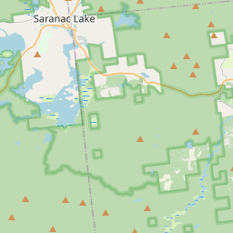
Make a weekend of it.
Closest editorial picks for a meal, a scoop, a pint, a bed, and a sight worth your time.
Eat.
1— 24.5 mi to the nearest table out here; plan the drive to dinner.
Drink.
1— 24.6 mi to the nearest pint; appoint a driver.
Stay.
2- The St. Regis Suites21.2 mi
Five well-appointed suites of various sizes, between Saranac Lake and Paul Smith's College in Gabriels, NY. Renovated by Cedar Circle LLC with green building techniques. Stays from three days to three months.
- Hohmeyer's Lake Clear Lodge & Resort24.6 mi
Wooded lakefront resort featuring homey rooms & cabins, local dining, a pub & outdoor recreation.
— 21.2 mi to the nearest bed on the register; book before you go.
See.
3- White Pine Camp19.2 mi
The 1907 Great Camp on Osgood Pond that served as Calvin Coolidge's Summer White House in the summer of 1926. Seasonal guided tours, and several cottages rent by the week.
- Topridge20.0 mi
The sprawling Gilded Age estate Marjorie Merriweather Post built on Upper St. Regis Lake — later New York State's, now privately held. Best seen from the St. Regis lakes.
- THE GREAT ADIRONDACK CORN MAZE22.9 mi
The Great Adirondack Corn Maze at Tucker Farms in Gabriels offers a new maze design each year, providing a fun experience of getting lost in the cornfield.
— 19.2 mi to the nearest sight on file; fold it into the drive.
Add to the record.
Free, takes thirty seconds. Yours forever.
Every page on this site gets better when readers contribute. Mark a peak you’ve climbed, drop a photo, file a field note, or flag a correction — every addition makes the next visitor’s page better.
File a report.
Trail conditions, water level, bug pressure, blowdown. The kind of detail that helps the next person plan.
Write a field note →Spot something off?
Wrong elevation, outdated access notes, a coordinate that's drifted. We'd rather hear it than miss it.
Suggest an edit →


Frequently asked.
- How long is the Eddy Road?The Eddy Road is approximately 1.84 miles (3.0 kilometers) — a short out-and-back suitable for most fitness levels.