

East Path.
East Path runs just under a mile through terrain that's manageable for most hikers. At 0.8 miles, it's short enough for a quick out-and-back or as a connector segment in a longer loop. The modest distance makes it a reasonable option when time or daylight is limited.
- Peak foliage window — color starts up high and works down the valleys through mid-October.
Seasonal pattern for this trail · tops out ~2,841 ft · live closures appear above
- GroundSurface
Read the line before you walk it.
What the trailhead is doing today.
Where the hike begins.
Guides, outfitters & shuttles.
If you’re already out here.
Lake George.
The corner of the Park this trail calls home — its hamlets, waters, lodging, and the rest of its field record.
Read the Region→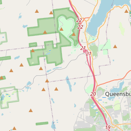
Make a weekend of it.
Closest editorial picks for a meal, a scoop, a pint, a bed, and a sight worth your time.
Eat.
4- Oscar's Smokehouse9.8 mi
Oscar's Smokehouse has been making fine smoked meats and cheeses for over 70 years in Warrensburg, NY.
- Canepa’s Pizza Shop9.8 mi
Canepa's Pizza Shop, formerly The Pizza Shop of Warrensburg, has been serving award-winning pizza since 2014. Featured on Rachael Ray and PMQ Magazine, they offer authentic Italian hospitality with family recipes and fine ingredients.
- Deli & Meat Store of the North10.0 mi
Deli & Meat Store of the North is a long-standing deli, meat market, and grocery store in Warrensburg, NY, known for its fresh meats, famous 18-inch subs, daily hot items, all-day breakfast, pizza, and catering services.
- becks TAVERN10.3 mi
A tavern on Peaceful Valley Road in North Creek serving German-inspired dishes alongside burgers, wings, and bar standards. The Yurts out back are the conversation piece.
Sip.
4- Caffe Vero14.9 mi
Breakfast, baked goods, sandwiches & house-roasted coffee in a comfy, earth-toned cafe.
- Uncle Carl's Coffee18.1 mi
Uncle Carl's Coffee serves expertly crafted coffees, artisan teas, pastries, and light savory bites. They also offer daily quiche and bagels, along with homemade soups, frozen meals, local meats, and cheeses.
- The PERKS of Speculator19.9 mi
Speculator coffee shop and bakery at 2855 NY-30. Specialty coffee, espresso, fresh-baked bagels and pastries, plus breakfast and lunch sandwiches. Gluten-free options across the bakery case.
- 9 Mile Coffee Co23.0 mi
9 Mile Coffee Co. is a coffee shop in downtown Schroon Lake, NY, serving a variety of coffees, teas, smoothies, sandwiches, and soups. They also sell their custom coffee blends and gift cards online.
Sweet.
4- The Hungry Crow Market & Café11.0 mi
A downtown North Creek market and cafe serving soft serve alongside scratch-made desserts, next to Hudson River Trading Co. — the cone stop in the Gore and Upper Hudson area.
- Main Street Ice Cream Parlor11.5 mi
Create a free link in bio with Bio Sites by Squarespace. Showcase your links, earn money, and grow your brand online, all with one link.
- Crossroads Ice Cream11.9 mi
The ice cream counter at The Crossroads, a country and outdoors store off I-87 Exit 25 in Chestertown between Schroon and Brant Lake — hard and soft ice cream on the road north.
- Scoop's Ice Cream Parlor14.9 mi
Scoop's Ice Cream Parlor in Lake George offers ice cream and frozen yogurt at inexpensive prices. Located at 327 Canada St, it provides take-out service and accepts credit cards.
Drink.
4- Bandstand Brew Works9.8 mi
Bandstand Brew Works is a family-friendly brewpub in Warrensburg, NY, offering handcrafted beers, cocktails, and a diverse menu made with local ingredients. It's a community gathering spot known for live music, weekly events, and a vibrant…
- George Henry's10.6 mi
A family-owned bar and grill on Main Street in Warrensburg doing made-to-order American grill plates, hearty steak and chicken specialties, local craft beer, and fresh-baked breads from area bakeries. No fast food.
- Crazy Loon Distillery12.8 mi
At the Crazy Loon Distillery, we produce high quality Adirondack inspired craft spirits that reflect the innovative nature and peaceful mindset of the North Country of New York. We offer a lineup of flavorful craft spirits inspired by the…
- The Hub14.5 mi
The Hub is a cafe, restaurant, lounge, bar, and bike repair shop located in Brant Lake, also serving the Lake George, Loon Lake, Friends Lake, and Schroon Lake areas.
Stay.
4- Glen Lodge & Market6.2 mi
Come stay at our cabin... you may never want to go back home! We are currently taking group bookings for the entire lodge only. Pull up an Adirondack chair and take in the beauty and nature of the Adirondack Mountains of Upstate New York,…
- Black Mountain Lodge6.7 mi
A cabin resort on State Highway 8 in Johnsburg, between Brant Lake and Garnet Lake in the southern Adirondacks. Year-round.
- 1000 Acres Ranch Resort8.8 mi
Rustic, all-inclusive ranch-style resort set on a river offering horseback riding, dining & pools.
- Friends Lake Inn9.2 mi
Plush rooms, some with whirlpool tubs, in a rustic-chic inn offering fine dining & a bright bistro.
See.
4- The Promise Gardens Estate of the Adirondacks7.4 mi
The Promise Gardens is the perfect wedding venue with gorgeous gardens, rustic barns and mountain views near Lake George and the Adirondacks.
- Revolution Rail Co. Thurman8.2 mi
A pedal-powered rail biking operation in Warrensburg on Route 418, with family-friendly tours rolling on disused railroad tracks through Adirondack forest and river corridors. Suitable for all ages and ability levels.
- North Creek Depot Museum11.5 mi
Saved from demolition, this 1872 landmark station is now a museum, heritage center, and cultural hub in historic North Creek, featuring a fabulous diorama and exhibits on the Adirondack Railroad, Theodore Roosevelt, and local history.
- Revolution Rail Co. - Thurman Station11.5 mi
A pedal-powered rail biking operation at Thurman Station on the Adirondack Railroad bed near North Creek, with family-friendly seasonal tours rolling alongside the Hudson River corridor through forest and open river-bank country.
Add to the record.
Free, takes thirty seconds. Yours forever.
Every page on this site gets better when readers contribute. Mark a peak you’ve climbed, drop a photo, file a field note, or flag a correction — every addition makes the next visitor’s page better.
File a report.
Trail conditions, water level, bug pressure, blowdown. The kind of detail that helps the next person plan.
Write a field note →Spot something off?
Wrong elevation, outdated access notes, a coordinate that's drifted. We'd rather hear it than miss it.
Suggest an edit →


Frequently asked.
- How long is the East Path?The East Path is approximately 0.76 miles (1.2 kilometers) — a short out-and-back suitable for most fitness levels.
- How long does it take to hike the East Path?Most hikers complete the East Path in about 45 minutes at a steady pace with roughly 778 feet of elevation gain. Allow extra time for rest stops, photos, weather, and trail conditions.
- How difficult is the East Path?Based on its length and elevation gain, the East Path is a demanding hike (778 ft of climbing over the route) — sustained climbing best suited to fit, experienced hikers. This is an estimate from route data, not an official trail rating — check current DEC advisories before heading out.