

Boreas Road.
Boreas Road is a 1.9-mile route that serves as both a connector and access point in the central Adirondacks. The road grade makes for easy walking, and it sees use from hikers heading deeper into the backcountry as well as those simply looking for a short leg-stretch. Expect a broad, gentle path suitable for anyone in hiking shoes.
- Family-friendlyShort, easy, and gentle enough for young legs
- Good for snowshoeingNon-technical grade that carries a snowshoe track
- Peak foliage window — color starts up high and works down the valleys through mid-October.
Seasonal pattern for this trail · tops out ~2,119 ft · live closures appear above
Read the line before you walk it.
What the trailhead is doing today.
Where the hike begins.
Guides, outfitters & shuttles.
If you’re already out here.
Schroon Lake.
The corner of the Park this trail calls home — its hamlets, waters, lodging, and the rest of its field record.
Read the Region→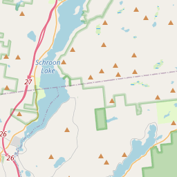
Make a weekend of it.
Closest editorial picks for a meal, a scoop, a pint, a bed, and a sight worth your time.
Eat.
4- Trail Break at Schroon Lake15.0 mi
Trail Break at Schroon Lake offers a restaurant, bar, and lodging in Schroon Lake. Guests can enjoy a menu of food, wine, and beer, live music on select evenings, and overnight stays in their rooms from May through October.
- DeCesare's Pizzeria15.5 mi
DeCesare's Pizzeria in Schroon Lake offers a menu of pizza, Italian dishes, and salads. They provide online ordering for both carryout and delivery.
- Pitkins Restaurant15.5 mi
Pitkin's Restaurant is a family dining landmark in Schroon Lake, offering breakfast, lunch, and dinner with a broad menu in a modern rustic setting. It features a new patio, including pet-friendly outdoor dining, and is conveniently locate…
- Sticks & Stones Wood Fired Bistro & Bar16.1 mi
Sticks and Stones Wood fired Bistro and Bar, Menu, Events, Catering, Location, Adirondack style private parties.
Sip.
4- Cupola Crepes15.5 mi
Family-run creperie at 1095 Main Street in Schroon Lake. Sweet and savory crepes (gluten-free batter available), scones, coffee, and soft serve. Wednesday through Sunday.
- 9 Mile Coffee Co15.5 mi
9 Mile Coffee Co. is a coffee shop in downtown Schroon Lake, NY, serving a variety of coffees, teas, smoothies, sandwiches, and soups. They also sell their custom coffee blends and gift cards online.
- Old Mountain Coffee Company17.2 mi
Great Coffee, Great Food, Great Baked Goods & Great People. Stop in to enjoy our house roasted coffee, browse our menu for a bite to eat or grab a delicious treat from our bakery. Order Online for pickup or stop in.
- Origin Coffee20.4 mi
Origin Coffee Co. is a specialty coffee shop with locations in Lake Placid and Saranac Lake, offering a chef-driven breakfast and lunch menu served all day. It serves as a community gathering spot for locals and Adirondack travelers.
— 15.5 mi to the nearest pour to this spot; pack a thermos.
Sweet.
4- Adirondack Corner Store19.4 mi
A longtime deli and general store at the corner of Route 73 in Lake Placid with an ice cream counter and subs — a locals' spot off the Main Street tourist row.
- Stone Bridge Ice Cream19.6 mi
Stone Bridge Ice Cream is a seasonal stand located 2.5 miles from the Natural Stone Bridge & Caves, offering over 40 flavors of soft serve, custom ice cream cakes, and signature sundaes. It features outdoor seating and a kids' swing set.
- The Hungry Crow Market & Café20.1 mi
A downtown North Creek market and cafe serving soft serve alongside scratch-made desserts, next to Hudson River Trading Co. — the cone stop in the Gore and Upper Hudson area.
- Emma's Lake Placid Creamery20.2 mi
A 1950s-themed creamery in the heart of walkable Lake Placid, famous for its Maple Creme soft serve alongside 16 hard flavors, gelato, sorbet, and old-fashioned malts. The reliable apres-hike treat.
— 19.4 mi to the nearest scoop; save it for the ride home.
Drink.
4- Paradox Brewery13.3 mi
Paradox Brewery offers a diverse tap selection, a full menu with pizza, burgers, and BBQ, and an expansive mountain landscape.
- The Brown Swan and Tavern15.4 mi
The Brown Swan and Tavern in Schroon Lake, NY, offers Adirondacks-inspired cuisine with locally sourced ingredients in a family-friendly setting.
- Flanagan's Pub & Grill15.5 mi
Long-standing, log cabin–style haunt offering traditional pub grub, draft beer & cocktails.
- Indian Lake Restaurant, Tavern and Liquor Store19.6 mi
Indian Lake Restaurant, Tavern and Liquor Store offers a full bar with an extensive bottle selection and local drafts, alongside a menu featuring appetizers, sandwiches, and entrees. The restaurant is currently closed for mud season and wi…
Stay.
4- The Pilot's House7.0 mi
The Pilot's House sits above the Outfitter's storefront, with a wonderful view of Vanderwhacker Mt. and the Hudson River, and Santanoni Mt as a backdrop.
- Blue Ridge Falls Campsites10.7 mi
Blue Ridge Falls Campsites is a campground in North Hudson, NY, offering RV, pop-up, and tent camping near Schroon Lake and I-87. Guests can enjoy Wi-Fi, a swimming pool, tennis courts, and a camp store, with easy access to area attraction…
- Blue Ridge Motel13.1 mi
A renovated roadside motel on Route 9 between Schroon Lake and North Hudson, with private baths, AC, wifi, a pet-friendly room, and a continental breakfast in the lobby.
- Adirondack Loj13.6 mi
Adirondak Loj is a lodging and camping facility operated by the Adirondack Mountain Club (ADK) in Lake Placid, New York. It serves as a hub for outdoor programs and access to the High Peaks region, offering accommodations and information f…
See.
4- Camp Santanoni7.0 mi
Built by the wealthy Pruyn family, Camp Santanoni is a publicly-owned National Historic Landmark, offering visitors a glimpse into the early Adirondack Great Camp era and opportunities for outdoor recreation.
- Newcomb Ski Slope9.3 mi
2 slope municipal ski slope free to the public.
- Cliffside Coaster16.3 mi
The Cliffside Coaster in Lake Placid, NY, is the longest coaster in North America. It follows the path of Olympic history at Mt Van Hoevenberg.
- Lake Placid Bobsled Experience16.4 mi
Mt Van Hoevenberg, a Lake Placid Legacy Site, offers the thrilling Skeleton Experience for visitors and youth bobsled and skeleton programs, continuing its Olympic legacy as a venue for winter sports.
Add to the record.
Free, takes thirty seconds. Yours forever.
Every page on this site gets better when readers contribute. Mark a peak you’ve climbed, drop a photo, file a field note, or flag a correction — every addition makes the next visitor’s page better.
File a report.
Trail conditions, water level, bug pressure, blowdown. The kind of detail that helps the next person plan.
Write a field note →Spot something off?
Wrong elevation, outdated access notes, a coordinate that's drifted. We'd rather hear it than miss it.
Suggest an edit →


Frequently asked.
- How long is the Boreas Road?The Boreas Road is approximately 1.90 miles (3.1 kilometers) — a short out-and-back suitable for most fitness levels.
- How long does it take to hike the Boreas Road?Most hikers complete the Boreas Road in about 1 hour at a steady pace with roughly 235 feet of elevation gain. Allow extra time for rest stops, photos, weather, and trail conditions.
- How difficult is the Boreas Road?Based on its length and elevation gain, the Boreas Road is an easy hike (235 ft of climbing over the route) — gentle grades suitable for most fitness levels and families. This is an estimate from route data, not an official trail rating — check current DEC advisories before heading out.