

Lily Pond Trail.
This short out-and-back covers 1.4 miles through terrain that's accessible enough for families but still delivers a taste of Adirondack forest walking. The destination is a small pond typical of the region's glacial landscape—quiet water, shoreline vegetation, and often good chances to spot frogs or dragonflies in season. It's a manageable introduction to trail hiking without the commitment of a full-day route.
- Leg-stretcherShort and nearly flat — an hour or less
- Family-friendlyShort, easy, and gentle enough for young legs
- Good for snowshoeingNon-technical grade that carries a snowshoe track
- Peak foliage window — color starts up high and works down the valleys through mid-October.
Seasonal pattern for this trail · tops out ~1,342 ft · live closures appear above
- DirtSurface
Read the line before you walk it.
What the trailhead is doing today.
Where the hike begins.
What the route itself carries.
Summits reached, waters touched, and the lean-tos along the way — read it like a cue sheet, mile posts ascending.
Guides, outfitters & shuttles.
If you’re already out here.
Brant Lake.
The corner of the Park this trail calls home — its hamlets, waters, lodging, and the rest of its field record.
Read the Region→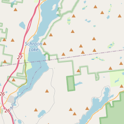
Make a weekend of it.
Closest editorial picks for a meal, a scoop, a pint, a bed, and a sight worth your time.
Eat.
4- Jimbo's Club at the Point2.5 mi
A fine-dining room and private event venue on a 25-acre peninsula on Brant Lake, off Route 8. Weekly-changing menu, an award-winning wine list, and wedding bookings for the full property.
- Cafe Adirondack Restaurant & Wine Room8.1 mi
Please call 518-494-5800 for reservations, or to check for takeout and walk in availability.
- Sticks & Stones Wood Fired Bistro & Bar9.4 mi
Sticks and Stones Wood fired Bistro and Bar, Menu, Events, Catering, Location, Adirondack style private parties.
- Beyond the Sea10.1 mi
An upscale fine dining establishment offering a sophisticated menu of meticulously prepared dishes in the Lake George region.
Sip.
3- 9 Mile Coffee Co10.3 mi
9 Mile Coffee Co. is a coffee shop in downtown Schroon Lake, NY, serving a variety of coffees, teas, smoothies, sandwiches, and soups. They also sell their custom coffee blends and gift cards online.
- Cupola Crepes10.4 mi
Family-run creperie at 1095 Main Street in Schroon Lake. Sweet and savory crepes (gluten-free batter available), scones, coffee, and soft serve. Wednesday through Sunday.
- Caffe Vero19.4 mi
Breakfast, baked goods, sandwiches & house-roasted coffee in a comfy, earth-toned cafe.
Sweet.
4- Crossroads Ice Cream7.3 mi
The ice cream counter at The Crossroads, a country and outdoors store off I-87 Exit 25 in Chestertown between Schroon and Brant Lake — hard and soft ice cream on the road north.
- Main Street Ice Cream Parlor7.6 mi
Create a free link in bio with Bio Sites by Squarespace. Showcase your links, earn money, and grow your brand online, all with one link.
- Stone Bridge Ice Cream7.8 mi
Stone Bridge Ice Cream is a seasonal stand located 2.5 miles from the Natural Stone Bridge & Caves, offering over 40 flavors of soft serve, custom ice cream cakes, and signature sundaes. It features outdoor seating and a kids' swing set.
- Cate's Creamery10.2 mi
The main ice cream spot in the heart of Bolton Landing village on Lake George's quieter west shore — soft serve, hand-dipped hard ice cream, and slushies, a short stroll from the lakefront.
Drink.
4- The Hub4.6 mi
The Hub is a cafe, restaurant, lounge, bar, and bike repair shop located in Brant Lake, also serving the Lake George, Loon Lake, Friends Lake, and Schroon Lake areas.
- Crazy Loon Distillery6.4 mi
At the Crazy Loon Distillery, we produce high quality Adirondack inspired craft spirits that reflect the innovative nature and peaceful mindset of the North Country of New York. We offer a lineup of flavorful craft spirits inspired by the…
- Black Bear Restaurant & Bar8.1 mi
Black Bear Restaurant & Bar is an American eatery in Pottersville, NY, offering comfort food, sandwiches, and breakfast. Known for its welcoming atmosphere, quick service, and popular dishes like meatloaf and gravy fries.
- Flanagan's Pub & Grill10.3 mi
Long-standing, log cabin–style haunt offering traditional pub grub, draft beer & cocktails.
Stay.
4- Hidden Pond Campsite1.6 mi
Family-run seasonal campground in Brant Lake on 75 acres of woodland, built around a 6-acre spring-fed pond with a sandy swimming beach. Founded 1967. Fishing yes; boats no.
- Hillcrest Cottages4.3 mi
Hillcrest Cottages, Brant Lake, New York, Cottages in the Adirondacks, Warren County
- Park Mountain Campground5.5 mi
Park Mountain Campground is a family-owned RV and tent campground with 15 spacious sites in the Adirondack Mountains, less than a mile from Schroon Lake and near the Pharaoh Lake Wilderness area.
- Adirondack Pines Bed & Breakfast5.6 mi
Adirondack Pines offers lodging in an 1837 country farmhouse B&B and a renovated 3-bedroom vacation rental house, located minutes from Schroon Lake and area attractions.
See.
4- Town of Horicon Museum4.2 mi
The Brant Lake Museum is housed in an 1890s farmhouse, featuring period furniture, clothing, tools, and photographs from the 19th and 20th centuries. It also includes a Carriage House with military and local hotel exhibits.
- Godwin Preserve4.8 mi
Godwin Preserve in the Town of Bolton offers two hiking trails totaling 112 acres, with moderate difficulty. The Yellow Trail provides views of Amy's Park wetlands and High Nopit, while the Red Trail connects to Pole Hill Pond Preserve.
- Natural Stone Bridge & Caves9.8 mi
Explore the largest marble cave entrance in the eastern U.S., carved by Trout Brook. Offers self-guided trails, adventure tours, and winter snowshoeing with ice formations.
- Bolton Historical Museum10.3 mi
The Bolton Historical Museum, located on the shores of Lake George in Bolton Landing, educates visitors about the history of Bolton, Lake George, and the surrounding region.
Add to the record.
Free, takes thirty seconds. Yours forever.
Every page on this site gets better when readers contribute. Mark a peak you’ve climbed, drop a photo, file a field note, or flag a correction — every addition makes the next visitor’s page better.
File a report.
Trail conditions, water level, bug pressure, blowdown. The kind of detail that helps the next person plan.
Write a field note →Spot something off?
Wrong elevation, outdated access notes, a coordinate that's drifted. We'd rather hear it than miss it.
Suggest an edit →


Frequently asked.
- How long is the Lily Pond Trail?The Lily Pond Trail is approximately 1.44 miles (2.3 kilometers) — a short out-and-back suitable for most fitness levels.
- How long does it take to hike the Lily Pond Trail?Most hikers complete the Lily Pond Trail in about 50 minutes at a steady pace with roughly 184 feet of elevation gain. Allow extra time for rest stops, photos, weather, and trail conditions.
- How difficult is the Lily Pond Trail?Based on its length and elevation gain, the Lily Pond Trail is an easy hike (184 ft of climbing over the route) — gentle grades suitable for most fitness levels and families. This is an estimate from route data, not an official trail rating — check current DEC advisories before heading out.