

Jerseyfield Railbed Trail.
A former railroad grade with only 156 feet of elevation gain over 2.8 miles, this is one of the flattest walks in the Park. The railbed surface makes for easy footing, and you can cover the whole thing in 90 minutes without breaking a sweat. Come here when you want woods and quiet without the climb.
- Family-friendlyShort, easy, and gentle enough for young legs
- Good for snowshoeingNon-technical grade that carries a snowshoe track
- Peak foliage window — color starts up high and works down the valleys through mid-October.
Seasonal pattern for this trail · tops out ~1,896 ft · live closures appear above
- GroundSurface
Read the line before you walk it.
What the trailhead is doing today.
Where the hike begins.
If you’re already out here.
Speculator.
The corner of the Park this trail calls home — its hamlets, waters, lodging, and the rest of its field record.
Read the Region→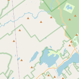
Make a weekend of it.
Closest editorial picks for a meal, a scoop, a pint, a bed, and a sight worth your time.
Eat.
1— 20.5 mi to the nearest table out here; plan the drive to dinner.
Drink.
2- Nick Stoner Inn Seafood & Steakhouse15.1 mi
Caroga Lake restaurant at 1810 NY-10 doing hand-cut, in-house steaks, fresh seafood, and a tight made-to-order menu. 19 craft beers on tap, NY Finger Lakes wines. Open Thursday through Sunday; Sunday 11–5.
- Vrooman's Hotel15.4 mi
On the shore of West Caroga Lake, this family-owned hotel and tavern has been a beloved community fixture for generations, serving exceptional dishes and warm hospitality daily.
— 15.1 mi to the nearest pint; appoint a driver.
Stay.
4- Pine Lake Lodge12.8 mi
Pine Lake Lodge is a spacious eight-bedroom vacation rental near Great Sacandaga Lake, offering ample space and amenities for large groups, family reunions, and celebrations.
- The Balsam Inn & Cafe13.1 mi
Historic inn at 140 NY-10 in Caroga Lake, with newly renovated boutique rooms on the second floor and the Forever Wild Tavern downstairs. A minute from the West Branch of the Sacandaga and adjacent to state park land.
- The Bears Den Vacation Rental Resort13.1 mi
Booked as an exclusive buyout. Sleeps up to 20 across the main log lodge in Caroga Lake. Full kitchen and bar, three fireplaces, hot tub, sand volleyball court, wood-fired pizza oven, and a private sand beach on the West Branch Sacandaga River.
- The Inn on Piseco Lake20.1 mi
Established in 1892 as the Irondequoit Inn, the historic Inn on Piseco Lake is a 600-acre lakefront retreat in the Hamilton County hamlet of Piseco — nine guest rooms, two-bedroom cabins that sleep six, beachfront and wooded campsites, and a restaurant open to the public. The Northville-Placid Trail crosses nearby. A rare survivor of the late-19th-century Adirondack hotel era.
Add to the record.
Free, takes thirty seconds. Yours forever.
Every page on this site gets better when readers contribute. Mark a peak you’ve climbed, drop a photo, file a field note, or flag a correction — every addition makes the next visitor’s page better.
File a report.
Trail conditions, water level, bug pressure, blowdown. The kind of detail that helps the next person plan.
Write a field note →Spot something off?
Wrong elevation, outdated access notes, a coordinate that's drifted. We'd rather hear it than miss it.
Suggest an edit →


Frequently asked.
- How long is the Jerseyfield Railbed Trail?The Jerseyfield Railbed Trail is approximately 2.83 miles (4.6 kilometers) — a short out-and-back suitable for most fitness levels.
- How long does it take to hike the Jerseyfield Railbed Trail?Most hikers complete the Jerseyfield Railbed Trail in about 1 hour 30 minutes at a steady pace with roughly 156 feet of elevation gain. Allow extra time for rest stops, photos, weather, and trail conditions.
- How difficult is the Jerseyfield Railbed Trail?Based on its length and elevation gain, the Jerseyfield Railbed Trail is an easy hike (156 ft of climbing over the route) — gentle grades suitable for most fitness levels and families. This is an estimate from route data, not an official trail rating — check current DEC advisories before heading out.