

44.53°N · 73.46°W · CARTO Voyager
§ The Trails · Keene
Unnamed trail.
this trail runs 0.0 miles (0.0 km) — a short walk. Ausable Chasm maintains the route.
Length0.0 mi
DifficultyNot rated
Book time5mguidebook pace
Field dataOpenStreetMap geometry · elevation sampled ~150 m · maintained by Ausable Chasm
§ Good for
- Leg-stretcherShort and nearly flat — an hour or less
Our read, from the trail’s length, climb & grade.
§ When to go
PrimePrime season — and peak color
- Peak foliage window — color starts up high and works down the valleys through mid-October.
J
F
M
A
M
J
J
A
S
O
N
D
Seasonal pattern for this trail · live closures appear above
§ Before you go
- Ausable ChasmOperator
From OpenStreetMap. Surface + access tags vary by trail.
§ The Route · 0.0 Miles Mapped
Directions to the Trailhead→Read the line before you walk it.
Plate No. 1 — Unnamed trailThe Atlas · CARTO
§ Conditions on the Trail
What the trailhead is doing today.
§ Getting There
Where the hike begins.
Parking nearbynearest 3.6 mi
Port Douglass Boat Launch Parking3.6 mi · directionsPeru Dock Boat Launch Parking6.5 mi · directionsPoke-O-Moonshine Rock Climber Parking8.6 mi · directionsPoke-O-Moonshine Hiker Parking8.7 mi · directionsRed Road Parking Area9.0 mi · directionsWillsboro Bay Boat Launch Parking9.4 mi · directionsRed Road Parking Lot9.7 mi · directionsPoke-O-Moonshne Fire Tower Parking Area9.7 mi · directions§ Local Connections
Guides, outfitters & shuttles.
Guides & instruction3 within 25 mi
Hungry Trout Fly Shop20 miFly Fish the Adirondacks20 miAdirondack Mountain Guides25 miOutfitters & rentals2 within 25 mi
Adirondack Outdoor EnthusiastKeene · 22 miSolace CyclesKeene · 22 miShuttles & transport1 within 25 mi
Town of Keene Hiker Shuttle (Garden Shuttle)25 mi§ Near This Trail
All Trails→If you’re already out here.
Connected & nearby trailswithin ~3 mi
Caves and Falls Hike Trail0.1 mi · 0.0 mi awayUnmarked trail0.0 mi · 0.0 mi awayUnmarked trail0.0 mi · 0.0 mi awayAdventure Trail0.0 mi · 0.0 mi awayAdventure Trail0.0 mi · 0.0 mi awayRiver Walk Trail0.1 mi · 0.0 mi awayUnmarked trail0.0 mi · 0.0 mi awayPeaks nearbywithin ~5 mi
Prospect Mountain906 ft · 2.5 mi awayTrembleau Mountain988 ft · 2.8 mi awaySmith Mountain801 ft · 3.4 mi awayCold Spring Mountain1,079 ft · 4.0 mi awayFordway Mountain1,227 ft · 4.3 mi awayFlagstaff Mountain1,378 ft · 4.5 mi awayLittle Fordway Mountain1,142 ft · 4.9 mi awayLakes & pondswithin ~5 mi
Ausable RiverRiver · 1.6 mi awayMud BrookStream · 1.8 mi awayMud BrookStream · 3.8 mi awayLittle Ausable RiverRiver · 4.3 mi awayAugur LakeLake · 4.9 mi awayLittle Ausable RiverRiver · 5.0 mi awayCampsites & lean-tos7 mapped nearby
Ausable Chasm CampgroundCampsite · 0.4 mi
Port Kent Camp SiteCampsite · 2.9 mi
Ausable Pines Campground & RVCampsite · 3.8 mi
Unmarked campsiteCampsite · 4.5 mi
Campsite 2Campsite · 4.5 mi
Campsite 1Campsite · 4.5 mi
Unmarked campsiteCampsite · 4.5 mi
§ The Region
Keene.
The corner of the Park this trail calls home — its hamlets, waters, lodging, and the rest of its field record.
Read the Region→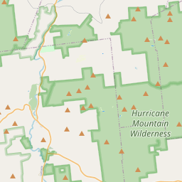
§ The Field Notes
Add to the record.
§ Reader account
Start your Logbook.
Free, takes thirty seconds. Yours forever.
Every page on this site gets better when readers contribute. Mark a peak you’ve climbed, drop a photo, file a field note, or flag a correction — every addition makes the next visitor’s page better.
03Field Note
File a report.
Trail conditions, water level, bug pressure, blowdown. The kind of detail that helps the next person plan.
Write a field note →04Corrections
Spot something off?
Wrong elevation, outdated access notes, a coordinate that's drifted. We'd rather hear it than miss it.
Suggest an edit →Photos, field notes, and corrections are reviewed before they appear publicly. Logbook entries post immediately.§ Maintain or steward this trail? Get in touch →
§ From the field guides
All field guides →


§ Questions
Frequently asked.
- How long is the this trail?The this trail is approximately 0.03 miles (0.0 kilometers) — a short out-and-back suitable for most fitness levels.
- Who maintains the this trail?The this trail is operated or maintained by Ausable Chasm.