

Rim Trail.
The Rim Trail is a 0.1-mile path — a five-minute walk at most. It traces the edge of a gorge or overlook; check the trailhead sign for what it frames.
- Leg-stretcherShort and nearly flat — an hour or less
- Peak foliage window — color starts up high and works down the valleys through mid-October.
Seasonal pattern for this trail · live closures appear above
- GroundSurface
Read the line before you walk it.
What the trailhead is doing today.
Where the hike begins.
Guides, outfitters & shuttles.
If you’re already out here.
Old Forge.
The corner of the Park this trail calls home — its hamlets, waters, lodging, and the rest of its field record.
Read the Region→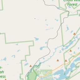
Make a weekend of it.
Closest editorial picks for a meal, a scoop, a pint, a bed, and a sight worth your time.
Eat.
4- The SteakHouse23.6 mi
The Steak House is a family-owned and operated restaurant since 1971, offering a classic Adirondack dining experience with handcrafted steaks, quality meats, seafood, homemade dishes, and a cocktail lounge.
- Frankie's Taste of Italy24.1 mi
Frankie's Taste of Italy is Old Forge's original Italian restaurant — 24 years on Route 28, fresh pasta brought in from Boston's North End, a serious menu of pasta, chicken, veal, and seafood, and one of New York State's largest selections of rare premium Kentucky bourbons. Homemade gelato and bread pudding.
- Walt's Diner24.9 mi
A working diner on Route 28 in Old Forge running for 25-plus years, with breakfast and lunch most days and a Friday fish fry until 8 p.m. Closed Tuesdays.
- Tony Harper's Pizza & Clam Shack25.0 mi
Tony Harper's Pizza & Clam Shack is a family-friendly restaurant offering homemade traditional and thin-crust pizzas, signature Whiskey Wings, steamers, and "Raquette Cheesesteaks". They feature a full bar with microbrews, high-definition…
— 23.6 mi to the nearest table out here; plan the drive to dinner.
Drink.
1— 25.0 mi to the nearest pint; appoint a driver.
Stay.
1— 23.9 mi to the nearest bed on the register; book before you go.
See.
1— 23.4 mi to the nearest sight on file; fold it into the drive.
Add to the record.
Free, takes thirty seconds. Yours forever.
Every page on this site gets better when readers contribute. Mark a peak you’ve climbed, drop a photo, file a field note, or flag a correction — every addition makes the next visitor’s page better.
File a report.
Trail conditions, water level, bug pressure, blowdown. The kind of detail that helps the next person plan.
Write a field note →Spot something off?
Wrong elevation, outdated access notes, a coordinate that's drifted. We'd rather hear it than miss it.
Suggest an edit →


Frequently asked.
- How long is the Rim Trail?The Rim Trail is approximately 0.13 miles (0.2 kilometers) — a short out-and-back suitable for most fitness levels.