

Number 1 Road.
8-mile route in the Adirondacks, likely following an old logging or access road given its naming convention. These former roads often provide relatively flat, wide travel compared to footpaths, though conditions can vary from grassy tracks to eroded corridors depending on maintenance and use.
- Family-friendlyShort, easy, and gentle enough for young legs
- Good for snowshoeingNon-technical grade that carries a snowshoe track
- Peak foliage window — color starts up high and works down the valleys through mid-October.
Seasonal pattern for this trail · tops out ~1,585 ft · live closures appear above
Read the line before you walk it.
What the trailhead is doing today.
Where the hike begins.
If you’re already out here.
Old Forge.
The corner of the Park this trail calls home — its hamlets, waters, lodging, and the rest of its field record.
Read the Region→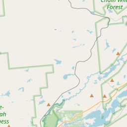
Make a weekend of it.
Closest editorial picks for a meal, a scoop, a pint, a bed, and a sight worth your time.
Eat.
1— 21.0 mi to the nearest table out here; plan the drive to dinner.
Stay.
3- Norridgewock Lodge16.7 mi
NORRIDGEWOCK LODGE, an oasis in the Adirondack Mountains. Our lakeside resort is the perfect remote vacation in the wilderness of the Beaver River. Book online!
- The Waldheim22.1 mi
A rustic resort with log-cottages featuring porches with lake views, plus 3 included meals a day.
- Covewood Lodge23.0 mi
A Great Camp-style lodge on Big Moose Lake in Eagle Bay, with 19 housekeeping cottages and Main Lodge apartments and rooms. Open May through October, with kids' programming and weekly campfires from late June to Labor Day.
— 16.7 mi to the nearest bed on the register; book before you go.
Add to the record.
Free, takes thirty seconds. Yours forever.
Every page on this site gets better when readers contribute. Mark a peak you’ve climbed, drop a photo, file a field note, or flag a correction — every addition makes the next visitor’s page better.
File a report.
Trail conditions, water level, bug pressure, blowdown. The kind of detail that helps the next person plan.
Write a field note →Spot something off?
Wrong elevation, outdated access notes, a coordinate that's drifted. We'd rather hear it than miss it.
Suggest an edit →


Frequently asked.
- How long is the Number 1 Road?The Number 1 Road is approximately 1.82 miles (2.9 kilometers) — a short out-and-back suitable for most fitness levels.
- How long does it take to hike the Number 1 Road?Most hikers complete the Number 1 Road in about 1 hour at a steady pace with roughly 274 feet of elevation gain. Allow extra time for rest stops, photos, weather, and trail conditions.
- How difficult is the Number 1 Road?Based on its length and elevation gain, the Number 1 Road is an easy hike (274 ft of climbing over the route) — gentle grades suitable for most fitness levels and families. This is an estimate from route data, not an official trail rating — check current DEC advisories before heading out.