

Lyon Mountain Trail.
A challenging ascent through the northeastern Adirondacks, this trail climbs steadily over its five-and-a-half-kilometer length to what is reported to be one of the region's more dramatic fire-tower summits. Red disk blazes mark the route, which the Department of Environmental Conservation maintains as part of the state trail system.
- Half-day hikeA few hours round trip
- Good for snowshoeingNon-technical grade that carries a snowshoe track
Seasonal pattern for this trail · tops out ~3,819 ft · live closures appear above
- NYSDECOperator
- lwnNetwork
Read the line before you walk it.
What the trailhead is doing today.
Where the hike begins.
Guides, outfitters & shuttles.
If you’re already out here.
Saranac Lake.
The corner of the Park this trail calls home — its hamlets, waters, lodging, and the rest of its field record.
Read the Region→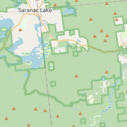
Make a weekend of it.
Closest editorial picks for a meal, a scoop, a pint, a bed, and a sight worth your time.
Eat.
1— 24.8 mi to the nearest table out here; plan the drive to dinner.
Sweet.
1— 22.9 mi to the nearest scoop; save it for the ride home.
Drink.
2- R.F. McDougall's Pub24.8 mi
The casual sibling of the Hungry Trout Restaurant, sharing the same Adirondack riverside property next to Whiteface. Pub food, regional beers, and the same view of the West Branch Ausable at a more relaxed price point.
- Hex and Hop Brewing24.9 mi
Hex and Hop Brewing is a craft brewery and meadery in Bloomingdale, New York, making full-flavored, locally sourced beer and mead. They prioritize community and craft, using fresh, local ingredients.
— 24.8 mi to the nearest pint; appoint a driver.
Stay.
4- Adirondack Spruce Lodge23.1 mi
Twenty-seven-room independent lodge in Wilmington village, minutes from Whiteface Mountain and walking distance from the Ausable River. Complimentary breakfast, fire pit, and Adirondack-character rooms.
- Cadence Lodge at Whiteface23.1 mi
Cadence Lodge in Wilmington, NY, offers an ideal base camp for outdoor adventurers. The property features recently updated guest rooms with amenities to enhance your stay, including a restaurant onsite, weekend breakfast options, and…
- Mountain Brook Lodge23.1 mi
Welcome to your home away from home! Mountain Brook Lodge offers a unique blend of comfort and convenience, ensuring your stay is memorable. We pride ourselves on offering a variety of amenities to make your stay as comfortable as…
- Wolfjaw Lodge23.2 mi
Welcome to the totally transformed Wolfjaw Lodge, located at the base of Whiteface Mountain, just a 2-minute drive from both Whiteface and Wilmington beach. Each of our 2 private houses and 11 lodge rooms and suites has been recently…
— 23.1 mi to the nearest bed on the register; book before you go.
See.
2- Ausable Chasm23.2 mi
A sandstone gorge attraction on US 9 in Ausable Chasm, with rim trails, walkways through the gorge floor, and add-on tubing and rafting on the Ausable River. Open seasonally, roughly mid-May through Columbus Day.
- Summit Weather Observatory24.9 mi
The Summit Weather Observatory, part of the University at Albany's Atmospheric Sciences Research Center (ASRC), provides real-time weather conditions and data from its observatory at the summit of Whiteface Mountain and a field station at…
— 23.2 mi to the nearest sight on file; fold it into the drive.
Add to the record.
Free, takes thirty seconds. Yours forever.
Every page on this site gets better when readers contribute. Mark a peak you’ve climbed, drop a photo, file a field note, or flag a correction — every addition makes the next visitor’s page better.
Add a shot.
Sunrise on the dock, a cairn at the summit, a bend on the trail. Your camera roll, our archive.
Add a photo →File a report.
Trail conditions, water level, bug pressure, blowdown. The kind of detail that helps the next person plan.
Write a field note →Spot something off?
Wrong elevation, outdated access notes, a coordinate that's drifted. We'd rather hear it than miss it.
Suggest an edit →


Frequently asked.
- How long is the Lyon Mountain Trail?The Lyon Mountain Trail is approximately 3.32 miles (5.3 kilometers) — a typical day-hike length.
- How long does it take to hike the Lyon Mountain Trail?Most hikers complete the Lyon Mountain Trail in about 2 hours 45 minutes at a steady pace with roughly 1,975 feet of elevation gain. Allow extra time for rest stops, photos, weather, and trail conditions.
- How difficult is the Lyon Mountain Trail?The Lyon Mountain Trail is rated mountain hiking (SAC T2) — partly steep, with sections that benefit from hiking boots and a confident step. Check current DEC advisories for closures, washouts, or seasonal restrictions before heading out.
- Who maintains the Lyon Mountain Trail?The Lyon Mountain Trail is operated or maintained by NYSDEC (part of the lwn network).