

Beach Mill Trail.
This 0.8-mile trail drops you at Halfmoon Lake in under 30 minutes with only 134 feet of climbing—about as gentle as Adirondack access gets. It's the trail you take when you want water without the work, perfect for an evening paddle launch or a morning walk before the day heats up. Easy enough for kids who complain and adults nursing sore knees from yesterday's real hike.
- Leg-stretcherShort and nearly flat — an hour or less
- Family-friendlyShort, easy, and gentle enough for young legs
- Good for snowshoeingNon-technical grade that carries a snowshoe track
- Peak foliage window — color starts up high and works down the valleys through mid-October.
Seasonal pattern for this trail · tops out ~1,355 ft · live closures appear above
Read the line before you walk it.
What the trailhead is doing today.
Where the hike begins.
Guides, outfitters & shuttles.
If you’re already out here.
Old Forge.
The corner of the Park this trail calls home — its hamlets, waters, lodging, and the rest of its field record.
Read the Region→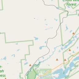
Make a weekend of it.
Closest editorial picks for a meal, a scoop, a pint, a bed, and a sight worth your time.
Eat.
4- The SteakHouse15.6 mi
The Steak House is a family-owned and operated restaurant since 1971, offering a classic Adirondack dining experience with handcrafted steaks, quality meats, seafood, homemade dishes, and a cocktail lounge.
- Frankie's Taste of Italy16.1 mi
Frankie's Taste of Italy is Old Forge's original Italian restaurant — 24 years on Route 28, fresh pasta brought in from Boston's North End, a serious menu of pasta, chicken, veal, and seafood, and one of New York State's largest selections of rare premium Kentucky bourbons. Homemade gelato and bread pudding.
- Walt's Diner16.5 mi
A working diner on Route 28 in Old Forge running for 25-plus years, with breakfast and lunch most days and a Friday fish fry until 8 p.m. Closed Tuesdays.
- Tony Harper's Pizza & Clam Shack16.5 mi
Tony Harper's Pizza & Clam Shack is a family-friendly restaurant offering homemade traditional and thin-crust pizzas, signature Whiskey Wings, steamers, and "Raquette Cheesesteaks". They feature a full bar with microbrews, high-definition…
— 15.6 mi to the nearest table out here; plan the drive to dinner.
Sip.
3- Blue Line Coffee House16.6 mi
A coffee shop on Route 28 in Old Forge selling drinks, Adirondack-themed apparel, handcrafted mugs, and shipped coffee subscriptions. Order drinks for pickup or shop the gift line online.
- Blue Line Coffee House24.3 mi
Blue Line Coffee House offers Adirondack-inspired apparel, handcrafted mugs, and mountain-themed gifts, along with pre-packaged coffee and coffee accessories. Products are available for nationwide shipping, and local customers can order dr…
- Tamarack Cafe24.3 mi
Tamarack Cafe in downtown Inlet serves a wide variety of breakfast and lunch options, from traditional favorites and specialty bowls to creative salads, sandwiches, and burgers. The cafe also features an 18-hole mini-golf course.
— 16.6 mi to the nearest pour to this spot; pack a thermos.
Sweet.
3- Benny’s Ice Cream16.5 mi
A family-run, locally loved scoop shop on Old Forge's Main Street — hand-scooped hard flavors and soft serve.
- Pied Piper16.5 mi
A circa-1950s soft-serve and frozen-custard stand locals treat as a permanent fixture — the walk-up window after a day on the Fulton Chain or at the water park. Three daily soft-serve flavors plus around 20 hard flavors.
- Northern Lights Creamery Inc.24.8 mi
An Inlet institution for 40-plus years, a short walk from Arrowhead Park on Fourth Lake — soft serve, homemade gelato, floats, flurries, and specialty sundaes.
— 16.5 mi to the nearest scoop; save it for the ride home.
Drink.
3- Old Forge Brewing Company16.5 mi
Old Forge Brewing Company, established in 2008, is a brewpub committed to crafting quality beer and food while prioritizing local ingredients and community support. They offer a diverse menu, a range of craft beers, and host regular events.
- Slickers Adirondack Tavern16.6 mi
Slickers Adirondack Tavern, established in 1984, offers a classic tavern experience with a focus on quality ingredients. They are well-known for their signature French Dip Sandwich.
- Daiker's20.2 mi
Daikers is an Adirondack pitstop in Old Forge, NY, offering seasonal and local dining with a deck overlooking Fourth Lake. Their caring and committed staff ensure a fantastic experience for guests.
— 16.5 mi to the nearest pint; appoint a driver.
Stay.
4- Adirondack Lodge Old Forge16.0 mi
Step into Adirondack charm, reimagined. At Adirondack Lodge, rustic knotty-pine details meet modern comfort, creating a year-round base for snowmobile rides, lakeside picnics, and sweeping mountain views just outside your window. Each of…
- Water's Edge Inn16.7 mi
Homey rooms & suites with balconies, plus an indoor pool, free breakfast & a deck with lake views.
- Old Forge Camping Resort17.1 mi
A year-round campground on Route 28 in Old Forge in the Water Safari Resort family, with deluxe cabins, cottages, RV sites, and tent sites. Stay-and-Play packages for Water Safari.
- Norridgewock Lodge19.4 mi
NORRIDGEWOCK LODGE, an oasis in the Adirondack Mountains. Our lakeside resort is the perfect remote vacation in the wilderness of the Beaver River. Book online!
— 16.0 mi to the nearest bed on the register; book before you go.
See.
3- Adirondack Railbike15.5 mi
Adirondack Railbike Adventures offers unique railbike tours in the Adirondack Mountains. Riders can explore scenic routes from Old Forge (Thendara) and Tupper Lake, experiencing natural beauty and spectacular views on railbikes made in New…
- Enchanted Forest Water Safari16.7 mi
Located in Old Forge, Enchanted Forest Water Safari offers a blend of water park experiences and traditional theme park attractions. Visitors can access various slides, pools, and dry rides.
- Calypso's Cove16.7 mi
Calypso's Cove is a family fun park in Old Forge, NY, located next to Enchanted Forest Water Safari. It features attractions like go-karts, mini-golf, arcade games, and a ropes course with a zipline, offering afternoon and evening entertai…
— 15.5 mi to the nearest sight on file; fold it into the drive.
Add to the record.
Free, takes thirty seconds. Yours forever.
Every page on this site gets better when readers contribute. Mark a peak you’ve climbed, drop a photo, file a field note, or flag a correction — every addition makes the next visitor’s page better.
File a report.
Trail conditions, water level, bug pressure, blowdown. The kind of detail that helps the next person plan.
Write a field note →Spot something off?
Wrong elevation, outdated access notes, a coordinate that's drifted. We'd rather hear it than miss it.
Suggest an edit →


Frequently asked.
- How long is the Beach Mill Trail?The Beach Mill Trail is approximately 0.82 miles (1.3 kilometers) — a short out-and-back suitable for most fitness levels.
- How long does it take to hike the Beach Mill Trail?Most hikers complete the Beach Mill Trail in about 30 minutes at a steady pace with roughly 134 feet of elevation gain. Allow extra time for rest stops, photos, weather, and trail conditions.
- How difficult is the Beach Mill Trail?Based on its length and elevation gain, the Beach Mill Trail is an easy hike (134 ft of climbing over the route) — gentle grades suitable for most fitness levels and families. This is an estimate from route data, not an official trail rating — check current DEC advisories before heading out.