
One Park. Two apps in one.
On the drive up it plans the trip — guides, weather ahead, a room for the night. The moment you cross the Blue Line it becomes a field instrument — offline maps, a voice calling the turns, live conditions, the trail under your feet. Same app. It knows where you are.
Requires iPhone · iOS 15 or later · Free
The app is still in beta. Joining installs it free through Apple’s TestFlight app, and new builds arrive on your phone as we ship them.
It knows when you cross the line.
Every trail, peak, lake and lean-to — with the live layer no trail app carries — on the trail with you, working after the signal drops.
What it does that nothing else does.
The signal dies. The map doesn't.
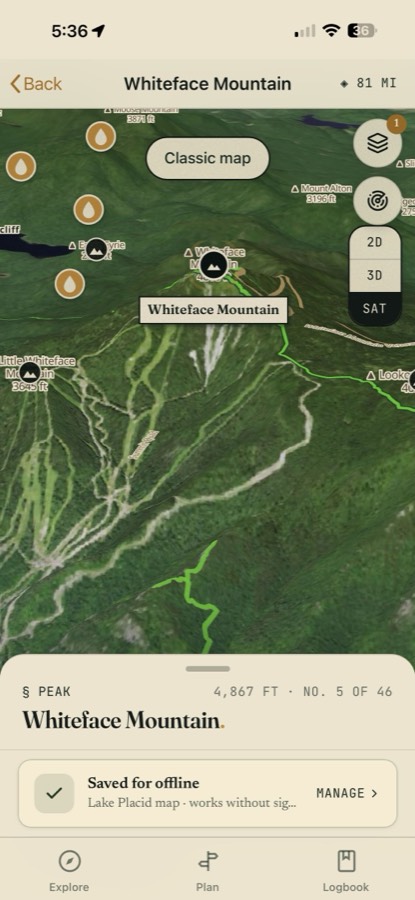
One tap before the bars disappear and the whole catalog stores on the device — every trail line, peak, water, lean-to and parking area, plus downloadable base maps by region. With zero bars the app opens straight to an offline map.
Whiteface in 3D, saved for offline. The Park's dead zones are the point, not an edge case.
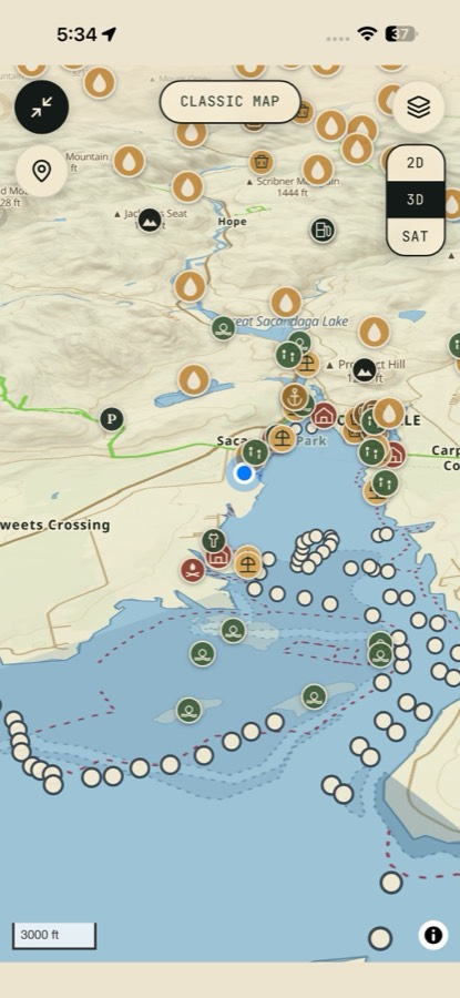
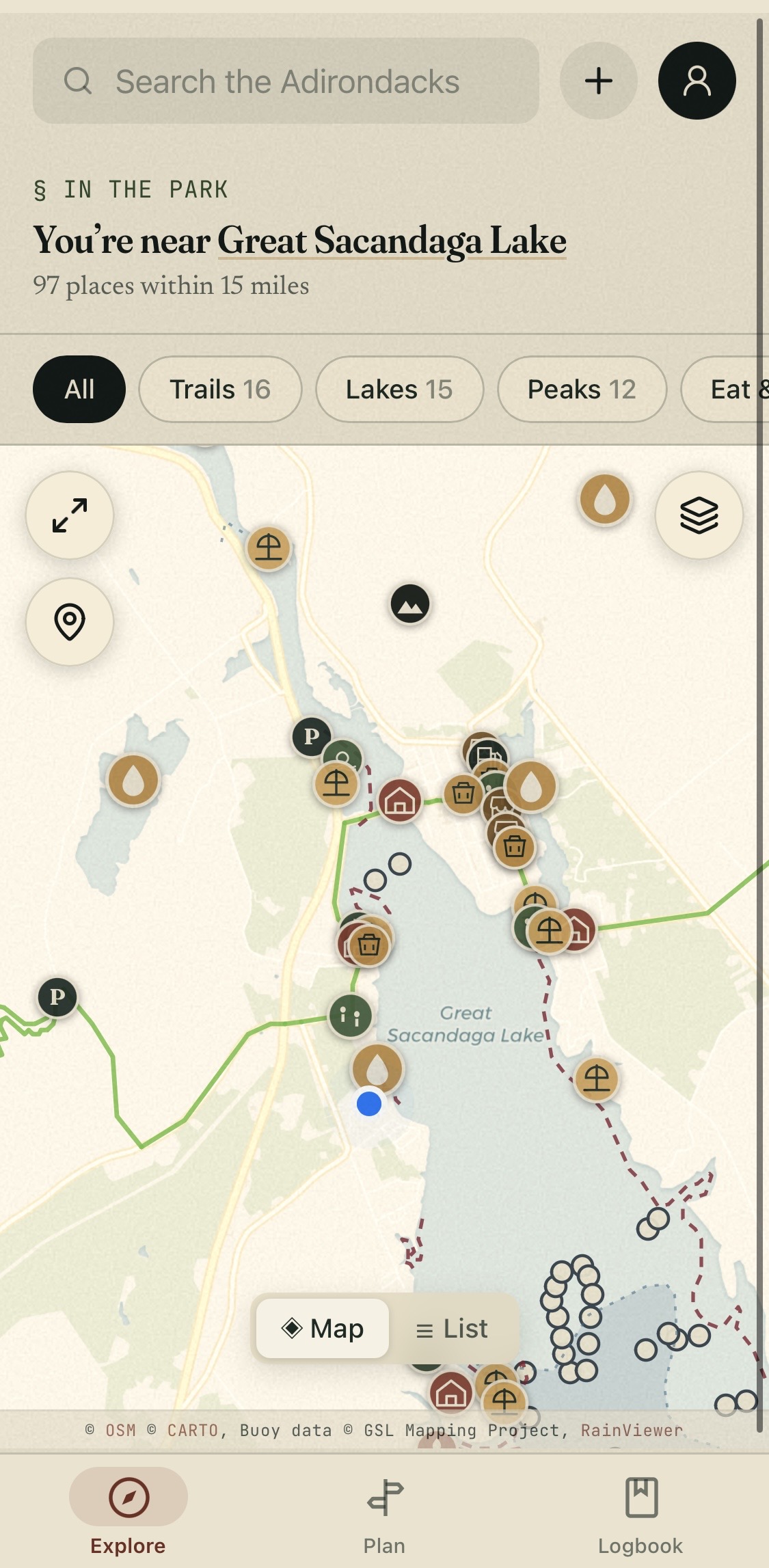
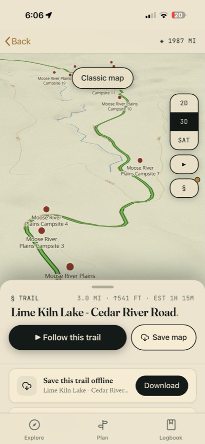
Join the Beta on TestFlight→ExploreWhiteface in 3D — No. 5 of 46, saved offlineExplorethe classic map, pins for everythingA voice that names what's ahead.
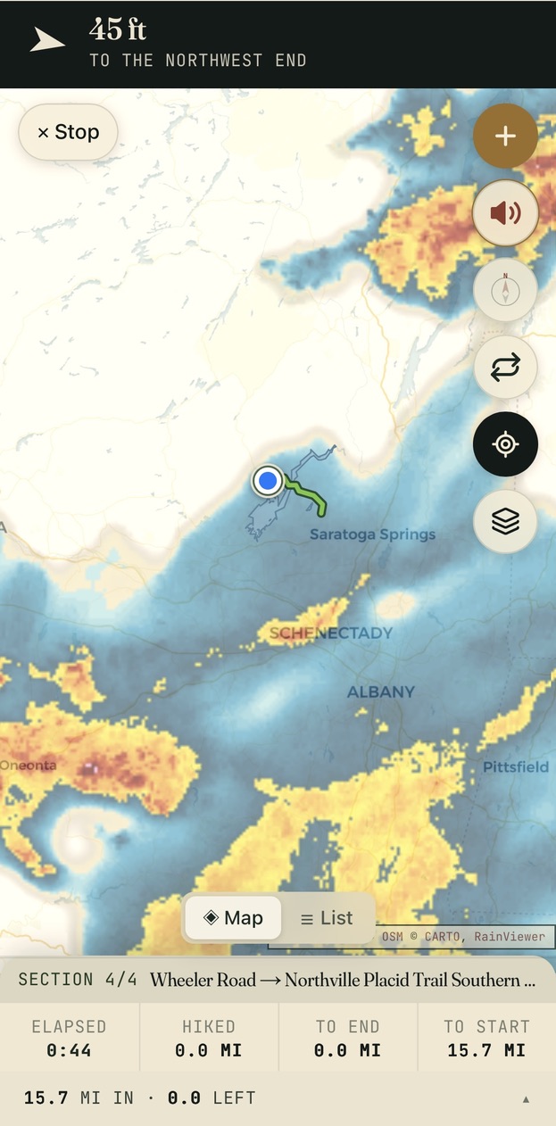
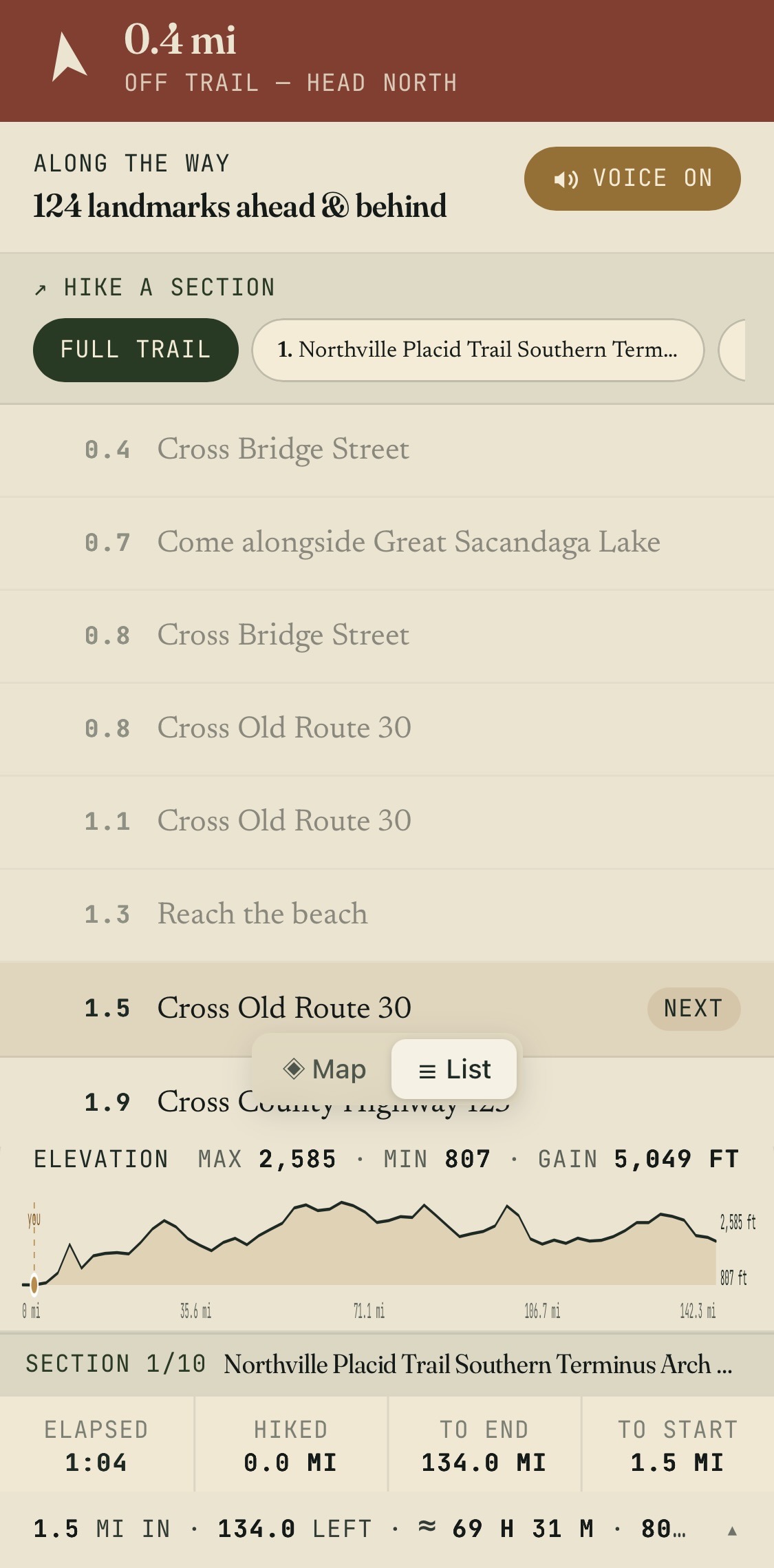
Spoken turn-by-turn through the iPhone's native voice — “Come alongside Great Sacandaga Lake. Reach the beach.” Named landmarks called out ahead and behind, fully offline, speaking even with the ringer silenced.
Split a long trail into day-size sections and the elevation profile, book time and miles-left re-scope to the leg you're actually hiking.
Join the Beta on TestFlight→Followvoice directions, sections, the elevation aheadFollowthe trail sheet — campsites, gain, book timeThe storm, drawn over your trail.
Rain radar drops onto the live map — the system sweeping in from the west, your trail drawn in green underneath it. Summit forecasts read the elevation you're going to, not the valley you parked in, and a daylight margin follows you down.
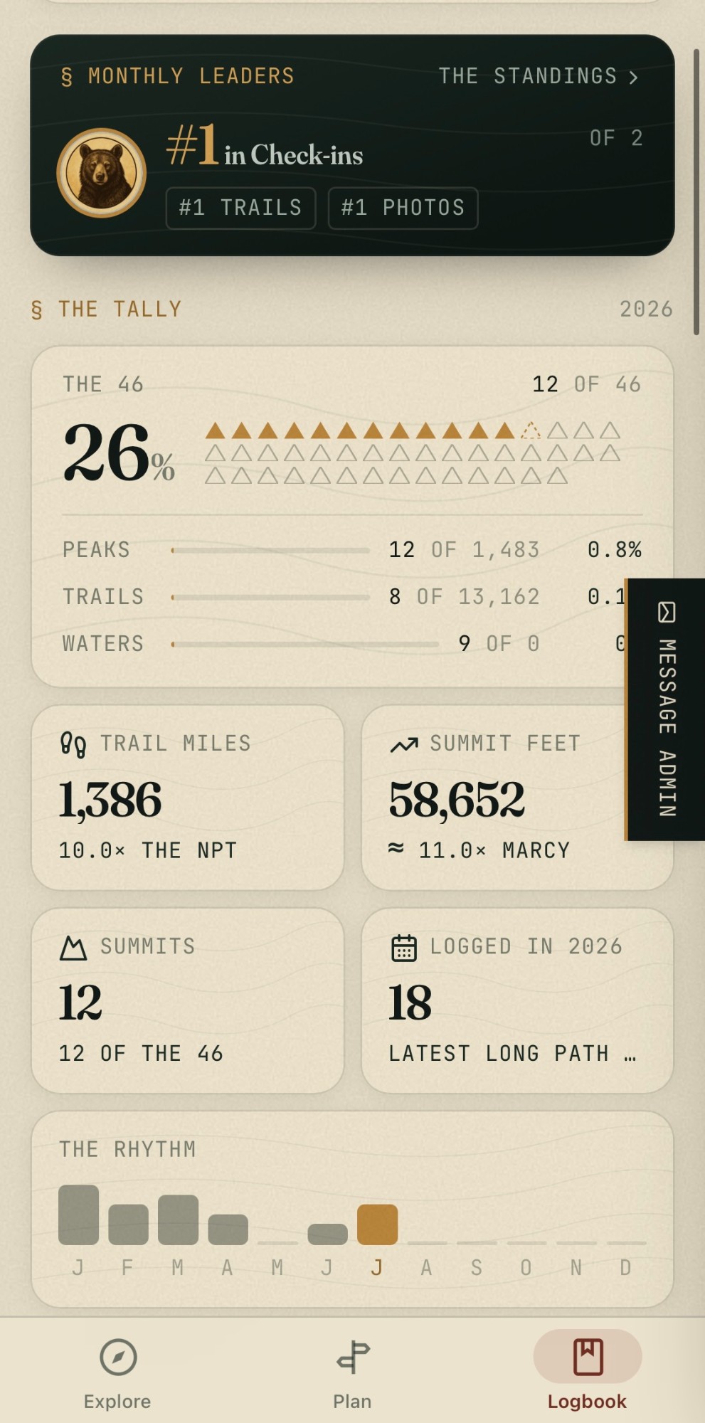
Your tally keeps itself: check-ins, the 46, traveled miles, summit feet — a personal register, free.
Join the Beta on TestFlight→Followrain radar, over the trail you're onLogbookthe tally — your 46, your miles, your rhythmEverything the app carries.
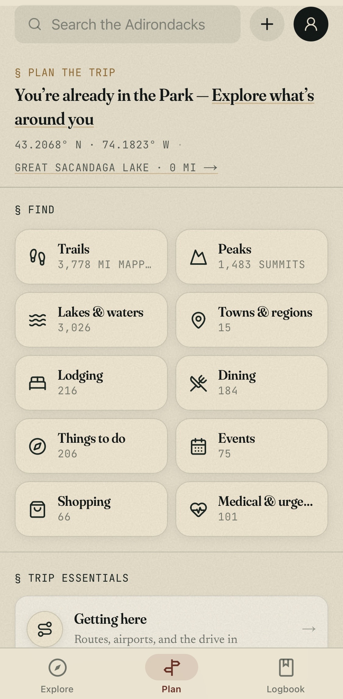
Lodging, dining, retail & outfitters · campsites, lean-tos, parking, beaches & islands · every ER, urgent care & pharmacy in the Park
The Approach, then the Field.
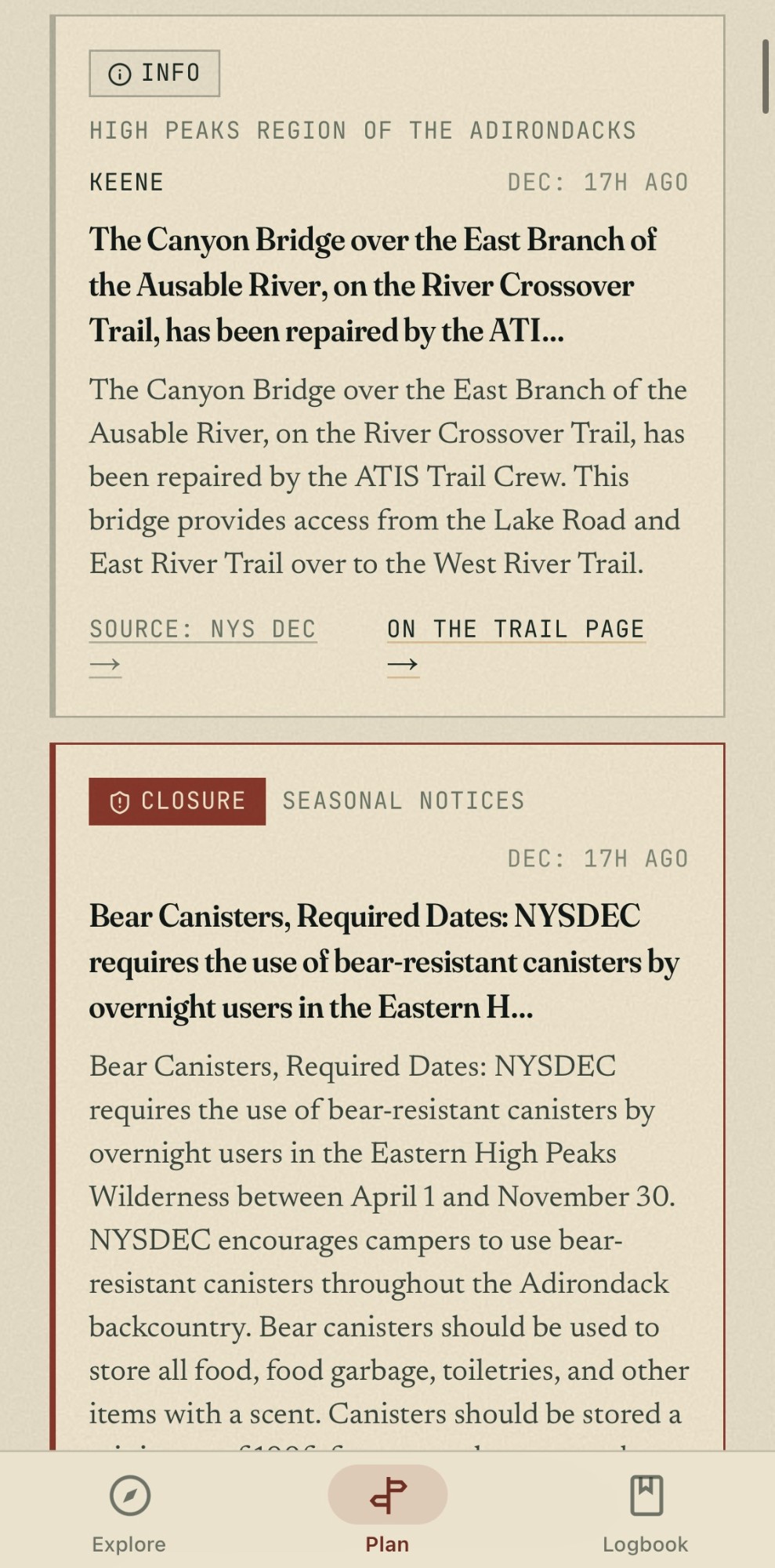
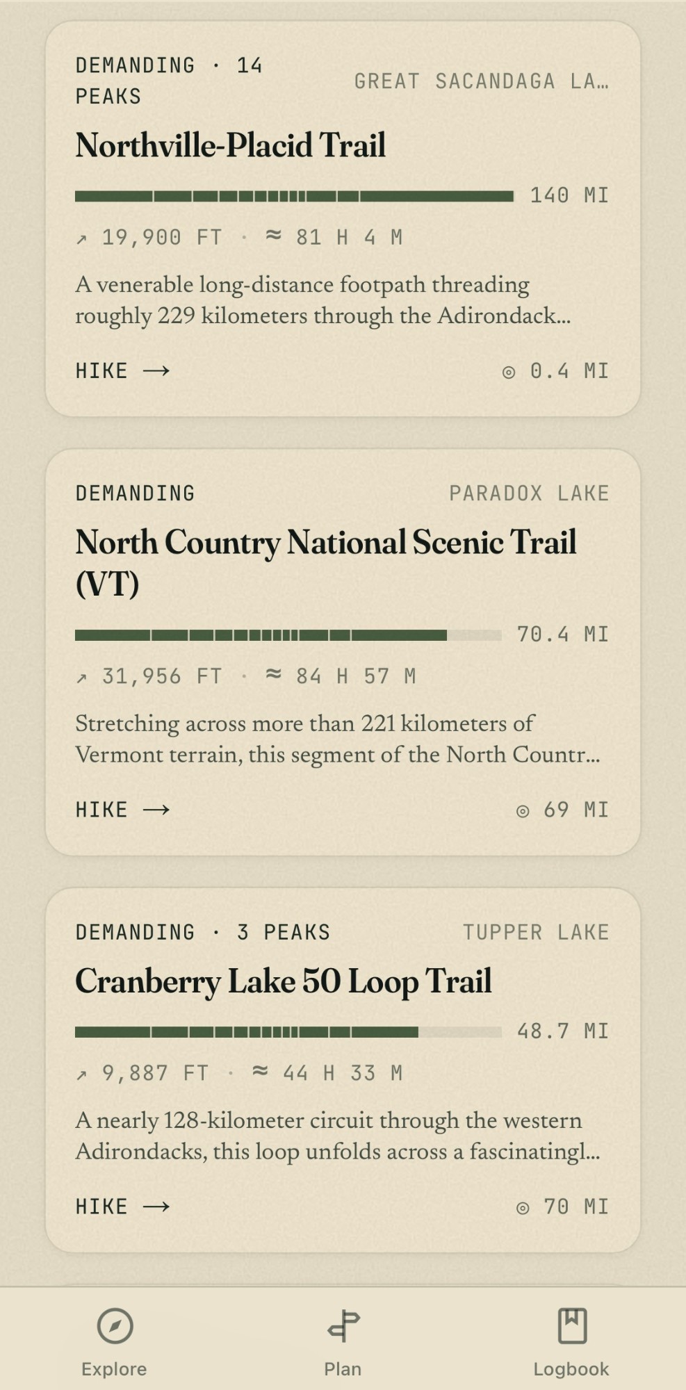
Outside the Blue Line it’s a planner. Inside, an instrument. The plates below are real captures, cycling through each character’s screens.
Every reason it earns the Home Screen.
Against the trail app. Against the tourism sites.
AllTrails is very good at trails, everywhere. ROOST’s sites are very good at marketing the regions that fund them. We’re the only one whose entire job is the Park — every trail and every business, online and offline, planning and field.
| Feature | AdirondackRegionWeb + iPhone · Free | AllTrails®Web + app · Freemium | ROOST sitesWeb only |
|---|---|---|---|
| Coverage | The Adirondack Park — every acre inside the Blue Line | Worldwide trail catalog | Member regions, marketing-first |
| Native iPhone app | Carried | Carried | — |
| Trails mapped | 6,150 miles of centerline — every OSM-mapped trail, not just the famous ones | Popular Adirondack routes within a worldwide catalog | Curated highlights; often links out for trail detail |
| Peaks | 1,483 named summits — the 46 plus every other one | High-traffic summits | Editorial mentions |
| Lakes, ponds & rivers | 3,023 waters with paddling access, acreage, species | — | Editorial mentions |
| Businesses on the map | Lodging, dining, retail and outfitters — every listing curated by editors who live here, not crowd-sourced or pay-to-play | — | Member listings only |
| Medical & essentials | ERs, urgent care and pharmacies — plus a safety layer that never drops the nearest hospital off the map | — | — |
| EV charging & fuel | Chargers and gas stations plotted across the Park | — | — |
| Backcountry furniture | Campsites, lean-tos, parking areas, beaches and islands — the field layer, mapped and searchable | Trailheads + user waypoints | — |
| Offline maps | Free — the Field Pack stores every trail, peak, water and POI, plus downloadable base maps by region. With zero bars the app opens straight to an offline map | AllTrails+ subscription ($35.99/yr) | — |
| Live DEC advisories | 529 tracked advisories surfaced on the exact trail, peak or region they affect — plus a Home Screen widget | Community reports | Occasional news posts |
| Real-time weather | Summit forecasts, sunset clock, rain-radar overlay on the map, and book-time math on every follow | Trail-page forecast; radar behind paid tiers | — |
| GPS trail follow | Live Activity on the Lock Screen + Dynamic Island; miles left, daylight margin, offline waypoints | Recording + navigation | — |
| Voice directions | Spoken turn-by-turn through the native iOS voice — named landmarks ahead and behind, fully offline, free | Wrong-turn alerts with AllTrails+ | — |
| Section hiking | Long trails split into day-size legs — follow section 1 of 10 on the Northville–Placid and every stat re-scopes | Custom routes with Peak ($79.99/yr) | — |
| Apple Health | Your hike's step count, read from Apple Health onto the trail dashboard — read-only, never written | Records to its own activity log | — |
| The Logbook | Check-ins, 46er tally, traveled tracks — a personal register, free | Lists + stats (deeper stats paid) | — |
| Events calendar | Published events with editorial details | — | Carried |
| Lodging booking | Request-to-book with real proprietors | — | Links out to members |
| Siri, widgets, Dynamic Island | Carried | Partial | — |
| Price | Free. No subscription, no signup wall | Free tier + $35.99–$79.99/yr | Free (destination marketing) |
| Who writes it | Editors who live and hike here | Crowd + algorithm | Tourism promotion office |
AdirondackRegion.com is an independent editorial project and is not affiliated with, sponsored by, or endorsed by AllTrails, LLC or the Regional Office of Sustainable Tourism (ROOST). AllTrails® is a registered trademark of AllTrails, LLC. Comparisons reflect publicly visible features of the AllTrails iOS app and free tier, and of ROOST's destination sites (visitadirondacks.com, lakeplacid.com, saranaclake.com and siblings), as of July 2026; features and pricing may change. Scope figures are live production numbers and change as the catalog grows.
“You’ve crossed the Blue Line.”
Turn on the greeting and the app quietly welcomes you the moment you enter the Park — then gets to work. Ask Siri to check you in. Glance at Marcy’s summit weather from the Home Screen. Watch the miles tick down on the Dynamic Island. This is what a field guide built only for the Adirondacks feels like.
The app is built for iPhone today. Leave your email and we’ll tell you the moment an Android version is ready — no spam, just the one note.